
| Memorials | : | 1 |
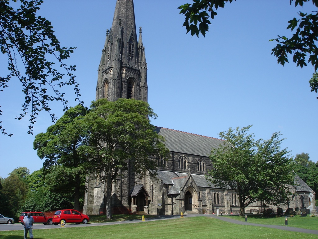
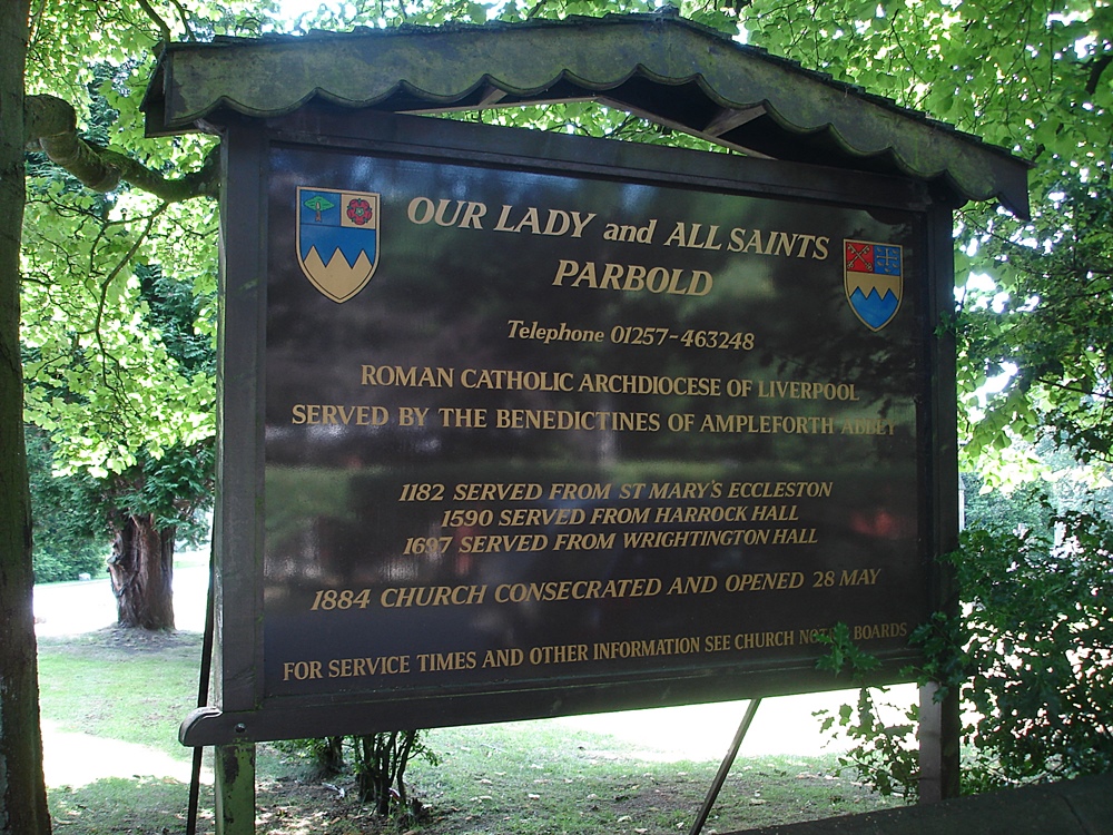
| Location | : | Parbold, West Lancashire District, England |
| Coordinate | : | 53.5911900, -2.7644350 |
frequently asked questions (FAQ):
-
Where is Our Lady and All Saints Roman Catholic?
Our Lady and All Saints Roman Catholic is located at Lancaster Lane Parbold, West Lancashire District ,Lancashire , WN8 7HSEngland.
-
Our Lady and All Saints Roman Catholic cemetery's updated grave count on graveviews.com?
1 memorials
-
Where are the coordinates of the Our Lady and All Saints Roman Catholic?
Latitude: 53.5911900
Longitude: -2.7644350
Nearby Cemetories:
1. Christ Church Churchyard
Parbold, West Lancashire District, England
Coordinate: 53.5908500, -2.7531900
2. Christchurch Churchyard
Newburgh, West Lancashire District, England
Coordinate: 53.5876845, -2.7842440
3. St. Michael's Churchyard
Dalton, West Lancashire District, England
Coordinate: 53.5670360, -2.7640390
4. St. Peter's Churchyard
Mawdesley, Chorley Borough, England
Coordinate: 53.6237600, -2.7734100
5. Lathom Park Chapel
Lathom, West Lancashire District, England
Coordinate: 53.5782510, -2.8216720
6. St. Peter and St. Paul Churchyard
Mawdesley, Chorley Borough, England
Coordinate: 53.6266580, -2.7451420
7. St. Joseph's Roman Catholic Church Cemetery
Wrightington, West Lancashire District, England
Coordinate: 53.5923300, -2.7010200
8. St. James the Great Churchyard
Wrightington, West Lancashire District, England
Coordinate: 53.6168220, -2.7175670
9. St. Joseph's College
Up Holland, West Lancashire District, England
Coordinate: 53.5525740, -2.7307890
10. St. Paul's Churchyard
Skelmersdale, West Lancashire District, England
Coordinate: 53.5502050, -2.7929450
11. St John The Evangelist Roman Catholic Church
Burscough, West Lancashire District, England
Coordinate: 53.5902152, -2.8424163
12. St John the Baptist Churchyard
Burscough, West Lancashire District, England
Coordinate: 53.6042760, -2.8401390
13. St. Mary the Virgin Churchyard
Rufford, West Lancashire District, England
Coordinate: 53.6349960, -2.8126410
14. Skelmersdale Cemetery
Skelmersdale, West Lancashire District, England
Coordinate: 53.5446820, -2.8131570
15. Burscough Priory
Burscough, West Lancashire District, England
Coordinate: 53.5830270, -2.8565030
16. St. Richard's Roman Catholic Cemetery
Skelmersdale, West Lancashire District, England
Coordinate: 53.5442920, -2.8143760
17. St Marie Churchyard
Standish, Metropolitan Borough of Wigan, England
Coordinate: 53.5844610, -2.6704070
18. St Thomas the Martyr Churchyard
Up Holland, West Lancashire District, England
Coordinate: 53.5402980, -2.7195920
19. St Wilfrid Churchyard
Standish, Metropolitan Borough of Wigan, England
Coordinate: 53.5868240, -2.6616530
20. St. James Churchyard
Westhead, West Lancashire District, England
Coordinate: 53.5582324, -2.8527492
21. St Oswald’s Churchyard
Coppull, Chorley Borough, England
Coordinate: 53.6217176, -2.6714738
22. St Mary the Virgin Churchyard
Eccleston, Chorley Borough, England
Coordinate: 53.6528800, -2.7331920
23. Salem Churchyard
Orrell, Metropolitan Borough of Wigan, England
Coordinate: 53.5331572, -2.7107046
24. Croston Cemetery
Croston, Chorley Borough, England
Coordinate: 53.6586700, -2.7733100