
| Memorials | : | 0 |
| Location | : | Lillingstone Lovell, Aylesbury Vale District, England |
| Coordinate | : | 52.0582400, -0.9621460 |
frequently asked questions (FAQ):
-
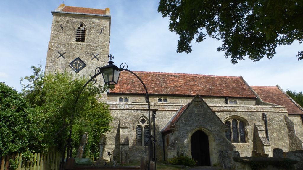
Where is Parish Church of the Assumption?
Parish Church of the Assumption is located at Lillingstone Lovell, Aylesbury Vale District ,Buckinghamshire ,England.
-
Parish Church of the Assumption cemetery's updated grave count on graveviews.com?
0 memorials
-
Where are the coordinates of the Parish Church of the Assumption?
Latitude: 52.0582400
Longitude: -0.9621460
Nearby Cemetories:
1. Lillingstone Lovell Cemetery
Lillingstone Lovell, Aylesbury Vale District, England
Coordinate: 52.0584600, -0.9619000
2. St. Nicholas of Myra Churchyard
Lillingstone Dayrell, Aylesbury Vale District, England
Coordinate: 52.0524510, -0.9728480
3. St. James' Churchyard
Akeley, Aylesbury Vale District, England
Coordinate: 52.0340000, -0.9692000
4. Assumption of the Blessed Virgin Mary Churchyard
Leckhampstead, Aylesbury Vale District, England
Coordinate: 52.0349200, -0.9426000
5. St John the Evangelist Churchyard
Wicken, South Northamptonshire Borough, England
Coordinate: 52.0489000, -0.9149000
6. St Leonard's Churchyard
Foscote, Aylesbury Vale District, England
Coordinate: 52.0154000, -0.9571000
7. Holy Trinity Churchyard
Deanshanger, South Northamptonshire Borough, England
Coordinate: 52.0493600, -0.8907600
8. St James the Great Churchyard
Paulerspury, South Northamptonshire Borough, England
Coordinate: 52.1032000, -0.9565000
9. St. Edmund's Churchyard
Maids Moreton, Aylesbury Vale District, England
Coordinate: 52.0104310, -0.9722660
10. Potterspury Cemetery
Potterspury, South Northamptonshire Borough, England
Coordinate: 52.0803020, -0.8898052
11. United Reformed Church
Potterspury, South Northamptonshire Borough, England
Coordinate: 52.0836703, -0.8887879
12. St. Michael & All Angels Churchyard
Thornton, Aylesbury Vale District, England
Coordinate: 52.0194400, -0.9055200
13. Church of the Assumption of Blessed Virgin Mary
Stowe, Aylesbury Vale District, England
Coordinate: 52.0182720, -1.0174270
14. Friends Meeting House Burial Ground
Buckingham, Aylesbury Vale District, England
Coordinate: 52.0017400, -0.9867000
15. Assumption of the Blessed Virgin Mary Church
Beachampton, Aylesbury Vale District, England
Coordinate: 52.0267000, -0.8784000
16. Buckingham Cemetery
Buckingham, Aylesbury Vale District, England
Coordinate: 52.0011610, -0.9962420
17. St Leonards Church
Yardley Gobion, South Northamptonshire Borough, England
Coordinate: 52.0962081, -0.8844584
18. St. Guthlac's Churchyard
Milton Keynes Borough, England
Coordinate: 52.0483770, -0.8634780
19. St Guthlac's Church Passenham
Old Stratford, South Northamptonshire Borough, England
Coordinate: 52.0481170, -0.8634000
20. Saint Peter and Saint Paul Churchyard
Buckingham, Aylesbury Vale District, England
Coordinate: 51.9981040, -0.9893520
21. Old St Peter and St Paul Churchyard
Buckingham, Aylesbury Vale District, England
Coordinate: 51.9966610, -0.9908980
22. St Mary Magdalen Churchyard
Stony Stratford, Milton Keynes Borough, England
Coordinate: 52.0587470, -0.8550560
23. St. Mary and St. Giles Churchyard
Stony Stratford, Milton Keynes Borough, England
Coordinate: 52.0569580, -0.8535910
24. St. Mary's Churchyard
Thornborough, Aylesbury Vale District, England
Coordinate: 51.9964070, -0.9189690