
| Memorials | : | 0 |
| Location | : | Paulerspury, South Northamptonshire Borough, England |
| Coordinate | : | 52.1032000, -0.9565000 |
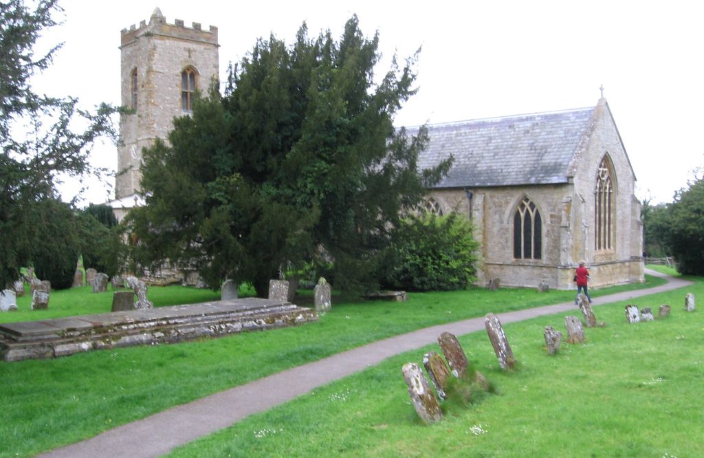
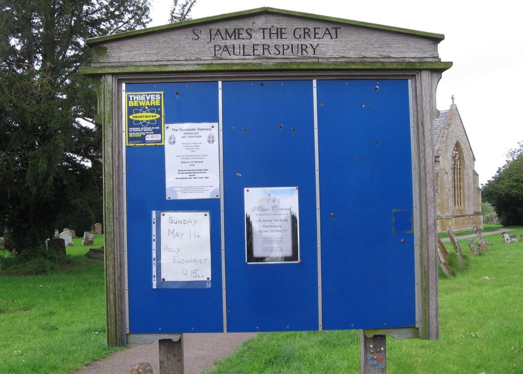
| Description | : | Church of St James the Great is a grade II* listed building in Paulerspury, Northamptonshire, England |
frequently asked questions (FAQ):
-
Where is St James the Great Churchyard?
St James the Great Churchyard is located at 114 High Street Paulerspury, South Northamptonshire Borough ,Northamptonshire , NN12 7NREngland.
-
St James the Great Churchyard cemetery's updated grave count on graveviews.com?
0 memorials
-
Where are the coordinates of the St James the Great Churchyard?
Latitude: 52.1032000
Longitude: -0.9565000
Nearby Cemetories:
1. St. Mary's Churchyard
Easton Neston, South Northamptonshire Borough, England
Coordinate: 52.1363720, -0.9756590
2. Brackley Road Cemetery
Towcester, South Northamptonshire Borough, England
Coordinate: 52.1294010, -0.9997560
3. St Mary's Church
Grafton Regis, South Northamptonshire Borough, England
Coordinate: 52.1154430, -0.8931010
4. St Leonards Church
Yardley Gobion, South Northamptonshire Borough, England
Coordinate: 52.0962081, -0.8844584
5. Lillingstone Lovell Cemetery
Lillingstone Lovell, Aylesbury Vale District, England
Coordinate: 52.0584600, -0.9619000
6. Parish Church of the Assumption
Lillingstone Lovell, Aylesbury Vale District, England
Coordinate: 52.0582400, -0.9621460
7. United Reformed Church
Potterspury, South Northamptonshire Borough, England
Coordinate: 52.0836703, -0.8887879
8. Potterspury Cemetery
Potterspury, South Northamptonshire Borough, England
Coordinate: 52.0803020, -0.8898052
9. St. Nicholas of Myra Churchyard
Lillingstone Dayrell, Aylesbury Vale District, England
Coordinate: 52.0524510, -0.9728480
10. St. John the Baptist Churchyard
Tiffield, South Northamptonshire Borough, England
Coordinate: 52.1586117, -0.9794450
11. St Bartholomew Churchyard
Greens Norton, South Northamptonshire Borough, England
Coordinate: 52.1434200, -1.0234100
12. St John the Evangelist Churchyard
Wicken, South Northamptonshire Borough, England
Coordinate: 52.0489000, -0.9149000
13. St. John the Baptist Churchyard
Abthorpe, South Northamptonshire Borough, England
Coordinate: 52.1131262, -1.0529425
14. Holy Trinity Churchyard
Deanshanger, South Northamptonshire Borough, England
Coordinate: 52.0493600, -0.8907600
15. Assumption of the Blessed Virgin Mary Churchyard
Leckhampstead, Aylesbury Vale District, England
Coordinate: 52.0349200, -0.9426000
16. St. Botolph's Churchyard
Slapton, South Northamptonshire Borough, England
Coordinate: 52.1166000, -1.0666000
17. St. James' Churchyard
Akeley, Aylesbury Vale District, England
Coordinate: 52.0340000, -0.9692000
18. Blisworth
Blisworth, South Northamptonshire Borough, England
Coordinate: 52.1751366, -0.9416729
19. St. Peter & St. Paul's Parish Churchyard
Cosgrove, South Northamptonshire Borough, England
Coordinate: 52.0748600, -0.8474600
20. St. Simon & St. Jude Churchyard
Castlethorpe, Milton Keynes Borough, England
Coordinate: 52.0931117, -0.8349450
21. St Mary Magdalen Churchyard
Stony Stratford, Milton Keynes Borough, England
Coordinate: 52.0587470, -0.8550560
22. St. Mary and St. Giles Churchyard
Stony Stratford, Milton Keynes Borough, England
Coordinate: 52.0569580, -0.8535910
23. St. Guthlac's Churchyard
Milton Keynes Borough, England
Coordinate: 52.0483770, -0.8634780
24. St Guthlac's Church Passenham
Old Stratford, South Northamptonshire Borough, England
Coordinate: 52.0481170, -0.8634000