
| Memorials | : | 0 |
| Location | : | Lillingstone Dayrell, Aylesbury Vale District, England |
| Coordinate | : | 52.0524510, -0.9728480 |
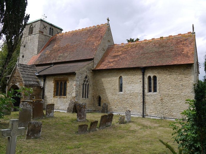
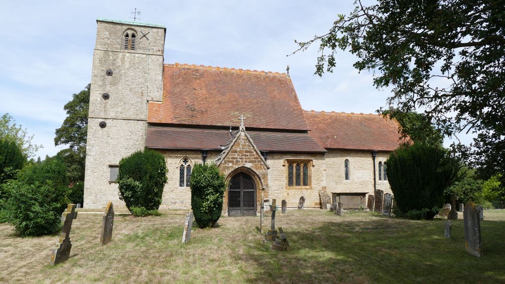
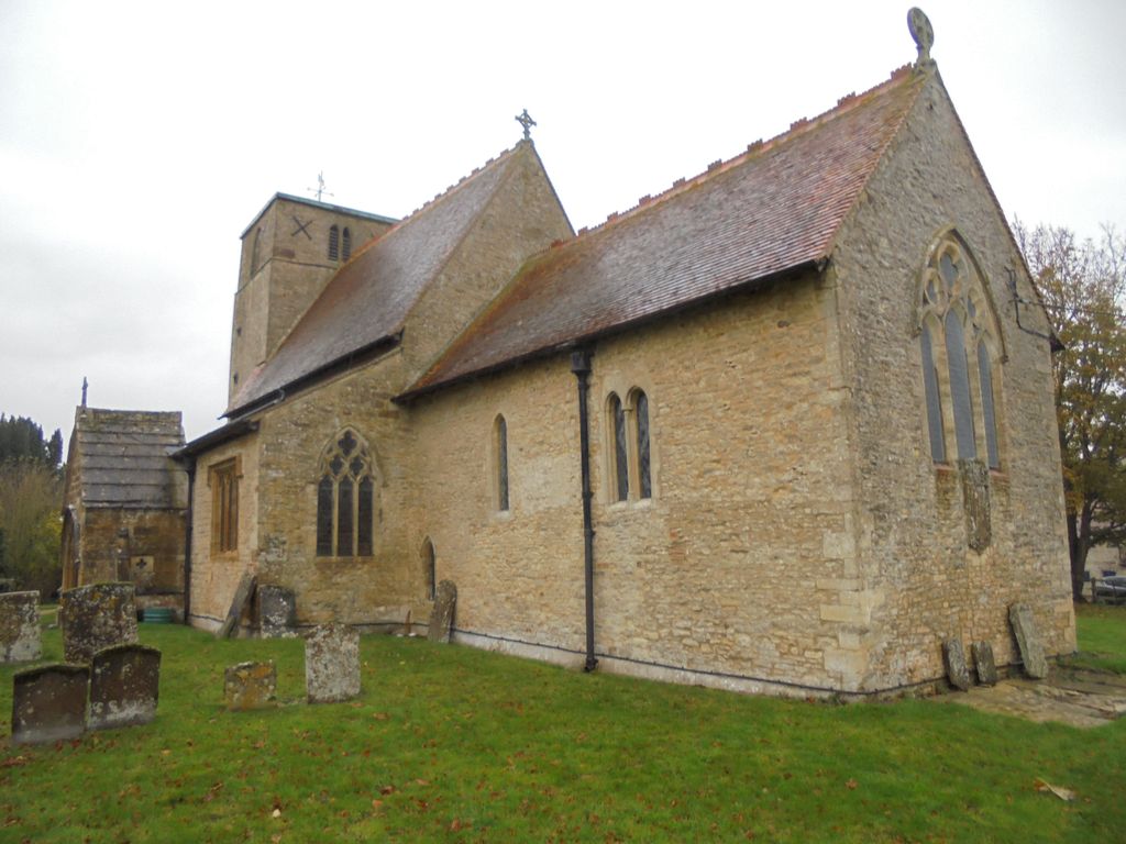
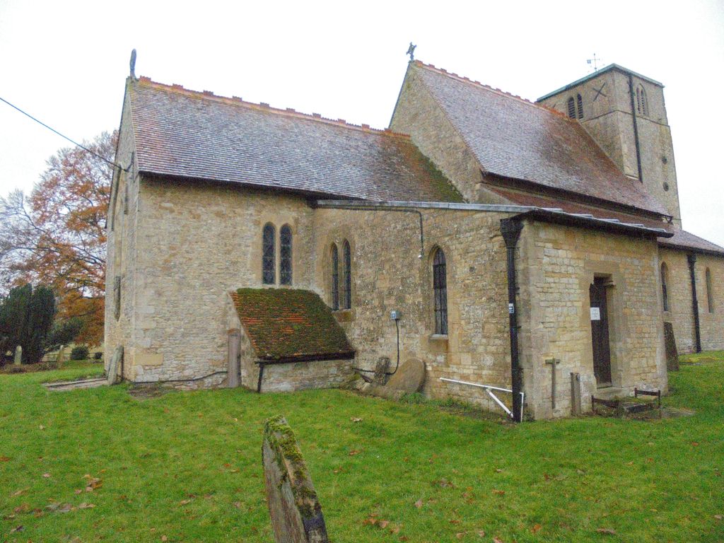
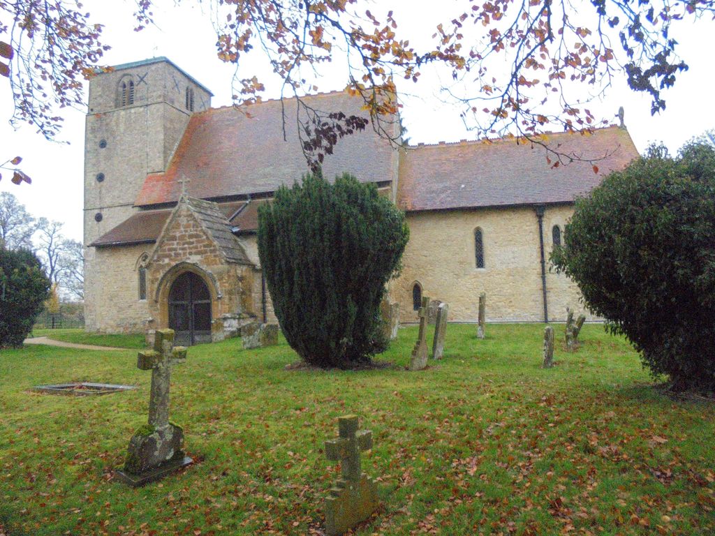
| Description | : | Parish Church of St Nicholas of Bari, Church of England (Anglican). The parish church of Lillingstone Dayrell is dedicated to St Nicholas of Myra. This 11th century Church in the Fields was in Lillingstone Parva until the 14th century when the Dayrells took possession of the estate and the village became Lillingstone Dayrell. |
frequently asked questions (FAQ):
-
Where is St. Nicholas of Myra Churchyard?
St. Nicholas of Myra Churchyard is located at Off Buckingham Rd(A413) Lillingstone Dayrell, Aylesbury Vale District ,Buckinghamshire , MK18 5ATEngland.
-
St. Nicholas of Myra Churchyard cemetery's updated grave count on graveviews.com?
0 memorials
-
Where are the coordinates of the St. Nicholas of Myra Churchyard?
Latitude: 52.0524510
Longitude: -0.9728480


Nearby Cemetories:
1. Parish Church of the Assumption
Lillingstone Lovell, Aylesbury Vale District, England
Coordinate: 52.0582400, -0.9621460
2. Lillingstone Lovell Cemetery
Lillingstone Lovell, Aylesbury Vale District, England
Coordinate: 52.0584600, -0.9619000
3. St. James' Churchyard
Akeley, Aylesbury Vale District, England
Coordinate: 52.0340000, -0.9692000
4. Assumption of the Blessed Virgin Mary Churchyard
Leckhampstead, Aylesbury Vale District, England
Coordinate: 52.0349200, -0.9426000
5. St John the Evangelist Churchyard
Wicken, South Northamptonshire Borough, England
Coordinate: 52.0489000, -0.9149000
6. St Leonard's Churchyard
Foscote, Aylesbury Vale District, England
Coordinate: 52.0154000, -0.9571000
7. St. Edmund's Churchyard
Maids Moreton, Aylesbury Vale District, England
Coordinate: 52.0104310, -0.9722660
8. Church of the Assumption of Blessed Virgin Mary
Stowe, Aylesbury Vale District, England
Coordinate: 52.0182720, -1.0174270
9. Holy Trinity Churchyard
Deanshanger, South Northamptonshire Borough, England
Coordinate: 52.0493600, -0.8907600
10. Friends Meeting House Burial Ground
Buckingham, Aylesbury Vale District, England
Coordinate: 52.0017400, -0.9867000
11. St James the Great Churchyard
Paulerspury, South Northamptonshire Borough, England
Coordinate: 52.1032000, -0.9565000
12. St. Michael & All Angels Churchyard
Thornton, Aylesbury Vale District, England
Coordinate: 52.0194400, -0.9055200
13. Buckingham Cemetery
Buckingham, Aylesbury Vale District, England
Coordinate: 52.0011610, -0.9962420
14. Saint Peter and Saint Paul Churchyard
Buckingham, Aylesbury Vale District, England
Coordinate: 51.9981040, -0.9893520
15. Old St Peter and St Paul Churchyard
Buckingham, Aylesbury Vale District, England
Coordinate: 51.9966610, -0.9908980
16. Potterspury Cemetery
Potterspury, South Northamptonshire Borough, England
Coordinate: 52.0803020, -0.8898052
17. Saint John the Evangelist Churchyard
Buckingham, Aylesbury Vale District, England
Coordinate: 51.9996500, -1.0174090
18. United Reformed Church
Potterspury, South Northamptonshire Borough, England
Coordinate: 52.0836703, -0.8887879
19. St. Giles' Churchyard
Water Stratford, Aylesbury Vale District, England
Coordinate: 52.0136475, -1.0515046
20. Assumption of the Blessed Virgin Mary Church
Beachampton, Aylesbury Vale District, England
Coordinate: 52.0267000, -0.8784000
21. St. Margaret's Churchyard
Biddlesden, Aylesbury Vale District, England
Coordinate: 52.0535450, -1.0782870
22. St. Edward the Confessor Churchyard
Shalstone, Aylesbury Vale District, England
Coordinate: 52.0225079, -1.0666653
23. St. Mary's Churchyard
Thornborough, Aylesbury Vale District, England
Coordinate: 51.9964070, -0.9189690
24. Biddlesden Abbey
Harringworth, East Northamptonshire Borough, England
Coordinate: 52.0539000, -1.0797000