
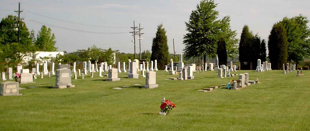
| Memorials | : | 3 |
| Location | : | Friendship, Guilford County, USA |
| Coordinate | : | 36.0958140, -79.9534400 |
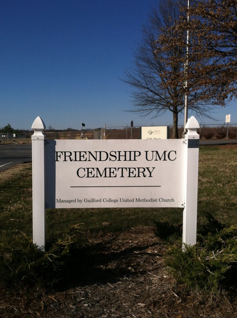
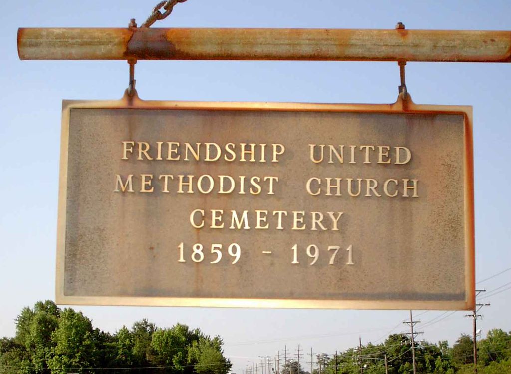
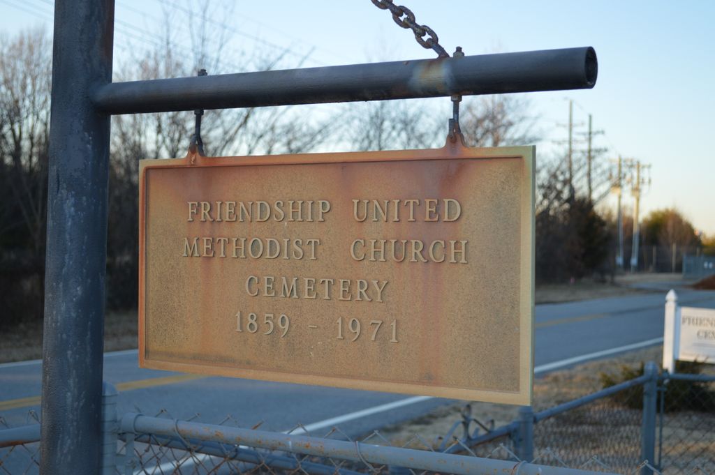
| Description | : | Location: The northern dead end stub of Regional Road South, 1/2 mile north of Market Street. The cemetery is in front of the Aviation Center campus for Guilford Technical Community College. |
frequently asked questions (FAQ):
-
Where is Friendship United Methodist Church Cemetery?
Friendship United Methodist Church Cemetery is located at SR # 1695 Friendship, Guilford County ,North Carolina ,USA.
-
Friendship United Methodist Church Cemetery cemetery's updated grave count on graveviews.com?
2 memorials
-
Where are the coordinates of the Friendship United Methodist Church Cemetery?
Latitude: 36.0958140
Longitude: -79.9534400
Nearby Cemetories:
1. Saint Johns Church Cemetery
Greensboro, Guilford County, USA
Coordinate: 36.0835810, -79.9814340
2. Smith Grove Baptist Church Cemetery
Colfax, Guilford County, USA
Coordinate: 36.0856700, -79.9937170
3. Zion Hill United Methodist Church Cemetery
Colfax, Guilford County, USA
Coordinate: 36.0865610, -79.9945560
4. The Church of Jesus Christ of LDS Cemetery
Colfax, Guilford County, USA
Coordinate: 36.1042100, -79.9958200
5. Persimmon Grove A.M.E. Cemetery
Guilford County, USA
Coordinate: 36.0747190, -79.9153200
6. Sandy Ridge United Methodist Church Cemetery
High Point, Guilford County, USA
Coordinate: 36.0722300, -80.0003740
7. Dover Friends Meeting Cemetery
Colfax, Guilford County, USA
Coordinate: 36.1274810, -79.9971490
8. Reynolds Chapel Baptist Church Cemetery
Greensboro, Guilford County, USA
Coordinate: 36.0642690, -79.9078590
9. Raleighs Crossroads UMC Cemetery
Greensboro, Guilford County, USA
Coordinate: 36.0608420, -79.9095370
10. Northwest Baptist Church Cemetery
Greensboro, Guilford County, USA
Coordinate: 36.1461800, -79.9543460
11. New Garden Friends Cemetery
Greensboro, Guilford County, USA
Coordinate: 36.0912790, -79.8908890
12. Collins Grove United Methodist Cemetery
Greensboro, Guilford County, USA
Coordinate: 36.1285800, -79.9051600
13. Shady Grove Wesleyan Church Cemetery
Colfax, Guilford County, USA
Coordinate: 36.1138115, -80.0147629
14. Hickory Grove United Methodist Church Cemetery
Guilford County, USA
Coordinate: 36.0474970, -79.9265630
15. Pleasant Ridge Christian Church Cemetery
Greensboro, Guilford County, USA
Coordinate: 36.1484860, -79.9391910
16. Shining Light Baptist Church Cemetery
Greensboro, Guilford County, USA
Coordinate: 36.0528500, -79.9115420
17. Pilgrims Rest Cemetery
Guilford County, USA
Coordinate: 36.0609330, -79.8891810
18. Ai Methodist Memorial Cemetery
Oak Ridge, Guilford County, USA
Coordinate: 36.1558990, -79.9756012
19. Saint Paul the Apostle Catholic Church Columbarium
Greensboro, Guilford County, USA
Coordinate: 36.1174220, -79.8776970
20. Deep River Friends Meeting Cemetery
High Point, Guilford County, USA
Coordinate: 36.0307770, -79.9640808
21. Jessup Grove Baptist Church Cemetery
Greensboro, Guilford County, USA
Coordinate: 36.1407800, -79.8927930
22. Muirs Chapel U M C Cemetery
Greensboro, Guilford County, USA
Coordinate: 36.0744820, -79.8711090
23. Midway Baptist Church Cemetery
Jamestown, Guilford County, USA
Coordinate: 36.0303860, -79.9223720
24. Saint Barnabas Episcopal Church Columbarium
Greensboro, Guilford County, USA
Coordinate: 36.1161450, -79.8698010