
| Memorials | : | 0 |
| Location | : | Hybart, Monroe County, USA |
| Coordinate | : | 31.8197980, -87.3825610 |
| Description | : | Hybart is an African-American community of about 540 souls, of which less than 100 are Caucasian. The communities of Hybart and Vredenburgh are often referred to as one and same but there is a separation between them of less than 1/2 mile. The nearest metropolitan areas of any size are in Wilcox County to the north and Clark County to the west. Of course, the most historic is Monroeville, which is about 26 miles south on Hwy-41. Local communities of historical note are Franklin (6 miles) and Bell's Landing Campground (3 miles) and Tunnel Springs/Peterman (15 miles). To... Read More |
frequently asked questions (FAQ):
-
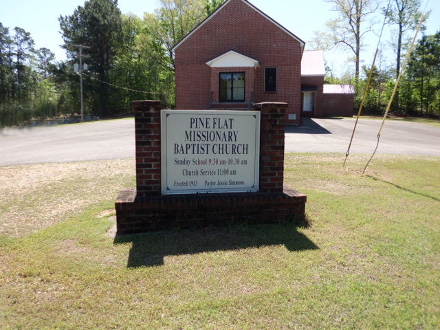
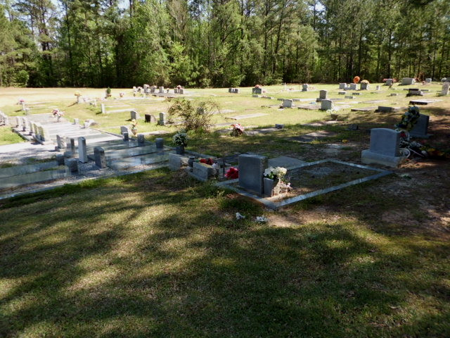
Where is Pine Flat Baptist Church Cemetery?
Pine Flat Baptist Church Cemetery is located at 25592 Highway 41 North Hybart, Monroe County ,Alabama , 36481USA.
-
Pine Flat Baptist Church Cemetery cemetery's updated grave count on graveviews.com?
0 memorials
-
Where are the coordinates of the Pine Flat Baptist Church Cemetery?
Latitude: 31.8197980
Longitude: -87.3825610
Nearby Cemetories:
1. Hybart Cemetery
Monroe County, USA
Coordinate: 31.8132992, -87.3846970
2. Bells Landing Cemetery
Hybart, Monroe County, USA
Coordinate: 31.8079970, -87.3973410
3. Waymon Chapel Cemetery
Hybart, Monroe County, USA
Coordinate: 31.8387394, -87.3645450
4. Crosby Cemetery
Wilcox County, USA
Coordinate: 31.8386940, -87.3570060
5. McCarty Cemetery
Wilcox County, USA
Coordinate: 31.8575001, -87.3835983
6. Dees Cemetery
Wilcox County, USA
Coordinate: 31.8547001, -87.3497009
7. First Baptist Church Cemetery
Vredenburgh, Monroe County, USA
Coordinate: 31.8314780, -87.3221820
8. Mount Zion Baptist Church Cemetery
Pine Hill, Wilcox County, USA
Coordinate: 31.8607800, -87.3338210
9. Old Zion Missionary Baptist Church Cemetery
Coy, Wilcox County, USA
Coordinate: 31.8608100, -87.3337300
10. Carr Cemetery
River Ridge, Monroe County, USA
Coordinate: 31.7657080, -87.3520520
11. McPherson Cemetery
Wilcox County, USA
Coordinate: 31.8822002, -87.3899994
12. Reaves Chapel Memorial Cemetery
Wilcox County, USA
Coordinate: 31.8726080, -87.3315460
13. Mount Gilead Baptist Cemetery
Coy, Wilcox County, USA
Coordinate: 31.8464800, -87.4584800
14. Bell Cemetery
Vredenburgh, Monroe County, USA
Coordinate: 31.7791400, -87.3150450
15. Apple Grove Missionary Baptism Church Cemetery
Vredenburgh, Monroe County, USA
Coordinate: 31.8234938, -87.2996277
16. Packer Cemetery
Packards Bend, Monroe County, USA
Coordinate: 31.8075790, -87.4644330
17. Tates Chapel AME Church Cemetery
Coy, Wilcox County, USA
Coordinate: 31.8875400, -87.4069300
18. Coy Cemetery
Wilcox County, USA
Coordinate: 31.8586006, -87.4561005
19. Johnson-McDuffie Cemetery
Franklin, Monroe County, USA
Coordinate: 31.7479900, -87.4259500
20. Saint Emanuel No. 2 Baptist Church Cemetery
Coy, Wilcox County, USA
Coordinate: 31.8990480, -87.4034530
21. Morrissette Family Cemetery
Packards Bend, Monroe County, USA
Coordinate: 31.7720500, -87.4610000
22. Powell Cemetery
Packards Bend, Monroe County, USA
Coordinate: 31.7581005, -87.4617004
23. Dry Forks Cemetery
Wilcox County, USA
Coordinate: 31.9016000, -87.4305600
24. Red Hills Cemetery
Franklin, Monroe County, USA
Coordinate: 31.7326860, -87.3465070