
| Memorials | : | 0 |
| Location | : | Franklin, Monroe County, USA |
| Coordinate | : | 31.7479900, -87.4259500 |
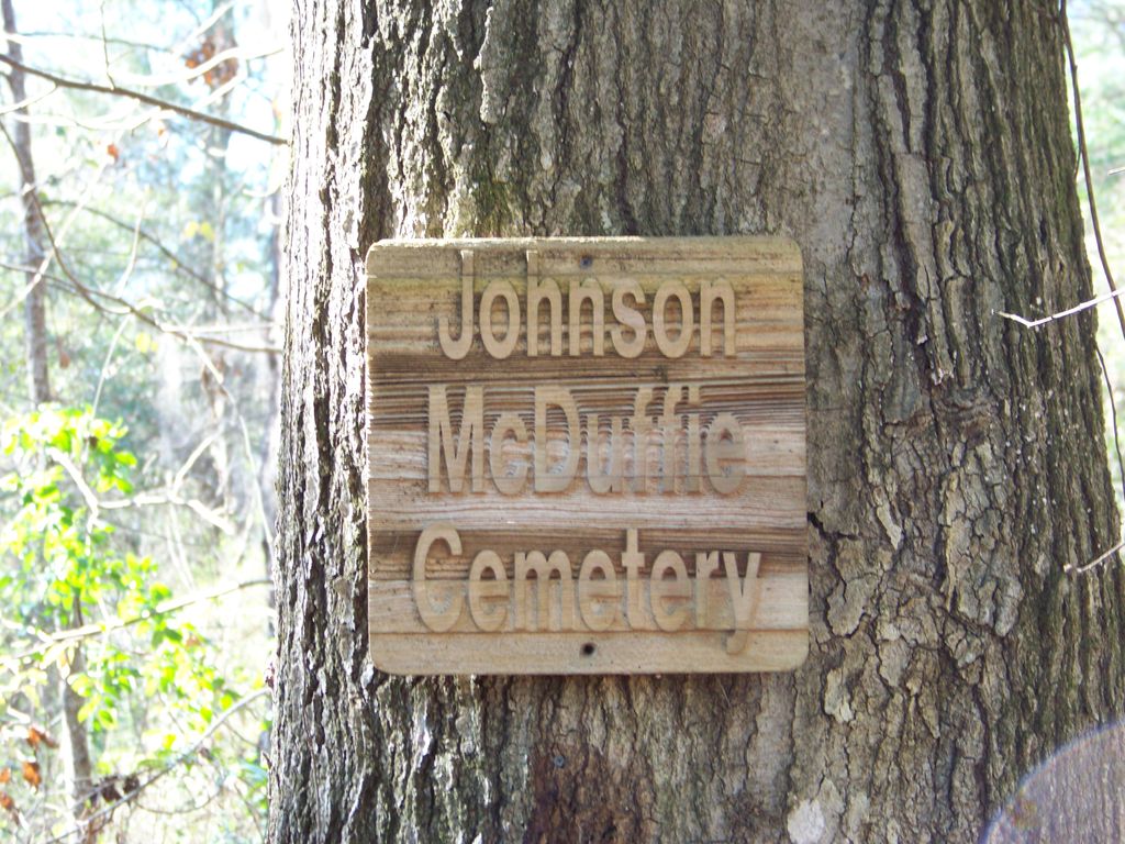
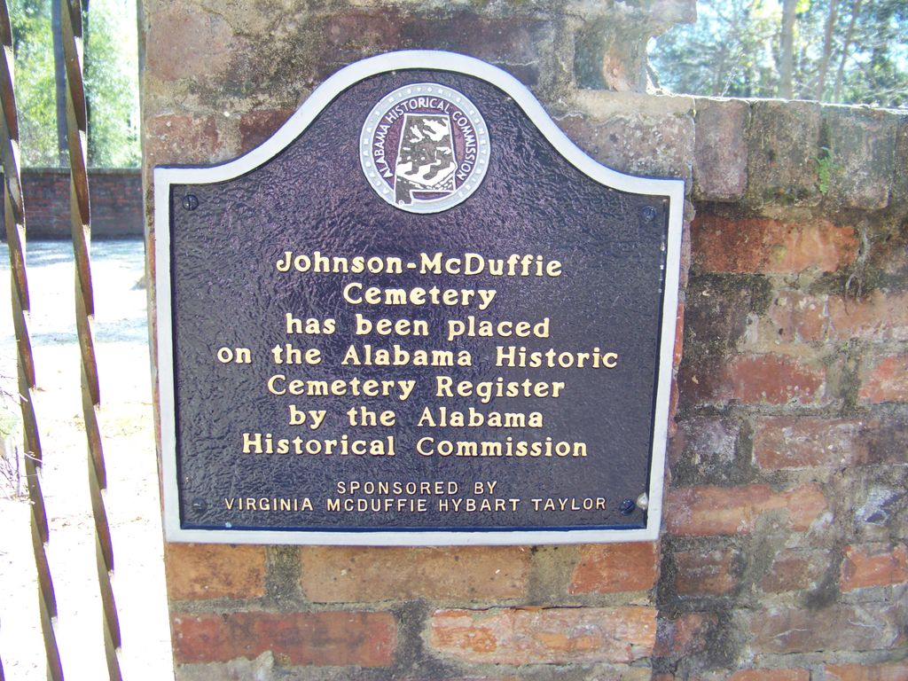
| Description | : | The Johnson-MCDuffie Cemetery has been placed on the Alabama Historic Cemetery Register by the Alabama Historical Commission - Sponsored by Virginia McDuffie Hybart Taylor The cemetery is located on McDuffie Landing Road (paved). Directions from Monroeville - Drive north from Courthouse Square on AL41 N approximately 19 miles. Turn left onto McDuffie Landing Road. Go about 3/10 of a mile. There is a dirt road on left with a cable across the entrance. There will be a wooden sign posted on a tree with cemetery name. Cemetery is about 50 yards up this road. Directions from Camden - Drive... Read More |
frequently asked questions (FAQ):
-
Where is Johnson-McDuffie Cemetery?
Johnson-McDuffie Cemetery is located at Franklin, Monroe County ,Alabama ,USA.
-
Johnson-McDuffie Cemetery cemetery's updated grave count on graveviews.com?
0 memorials
-
Where are the coordinates of the Johnson-McDuffie Cemetery?
Latitude: 31.7479900
Longitude: -87.4259500
Nearby Cemetories:
1. Powell Cemetery
Packards Bend, Monroe County, USA
Coordinate: 31.7581005, -87.4617004
2. Morrissette Family Cemetery
Packards Bend, Monroe County, USA
Coordinate: 31.7720500, -87.4610000
3. River Ridge Cemetery
Franklin, Monroe County, USA
Coordinate: 31.7251470, -87.3897660
4. York Cemetery
Monroe County, USA
Coordinate: 31.7250004, -87.3897018
5. Saint Peter Baptist Church Cemetery
Franklin, Monroe County, USA
Coordinate: 31.7128720, -87.3924870
6. Independent Baptist Church Cemetery
Packards Bend, Monroe County, USA
Coordinate: 31.7736740, -87.4867700
7. Springhill First Baptist Church Cemetery
Franklin, Monroe County, USA
Coordinate: 31.6932190, -87.3952440
8. Mount Sinai A.M.E. Church Cemetery
Lower Peach Tree, Wilcox County, USA
Coordinate: 31.7693550, -87.4942630
9. Bells Landing Cemetery
Hybart, Monroe County, USA
Coordinate: 31.8079970, -87.3973410
10. Carr Cemetery
River Ridge, Monroe County, USA
Coordinate: 31.7657080, -87.3520520
11. Packer Cemetery
Packards Bend, Monroe County, USA
Coordinate: 31.8075790, -87.4644330
12. Red Hills Cemetery
Franklin, Monroe County, USA
Coordinate: 31.7326860, -87.3465070
13. Hybart Cemetery
Monroe County, USA
Coordinate: 31.8132992, -87.3846970
14. Pine Flat Baptist Church Cemetery
Hybart, Monroe County, USA
Coordinate: 31.8197980, -87.3825610
15. Kidd and McCoy Family Cemetery
Lower Peach Tree, Wilcox County, USA
Coordinate: 31.7843420, -87.5157130
16. Chance Baptist Church Cemetery
Chance, Clarke County, USA
Coordinate: 31.7468000, -87.5309130
17. Bell Cemetery
Vredenburgh, Monroe County, USA
Coordinate: 31.7791400, -87.3150450
18. Corinth-Deer Cemetery
Franklin, Monroe County, USA
Coordinate: 31.6491670, -87.4012540
19. Bryant-Deer Cemetery
Monroe County, USA
Coordinate: 31.6488991, -87.4013977
20. Mount Gilead Baptist Cemetery
Coy, Wilcox County, USA
Coordinate: 31.8464800, -87.4584800
21. Kidd Family Cemetery
Chance, Clarke County, USA
Coordinate: 31.7332200, -87.5464200
22. Mount Ararat Cemetery
Monroe County, USA
Coordinate: 31.6449300, -87.4054900
23. Waymon Chapel Cemetery
Hybart, Monroe County, USA
Coordinate: 31.8387394, -87.3645450
24. Crosby Cemetery
Wilcox County, USA
Coordinate: 31.8386940, -87.3570060