
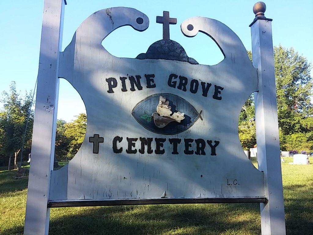
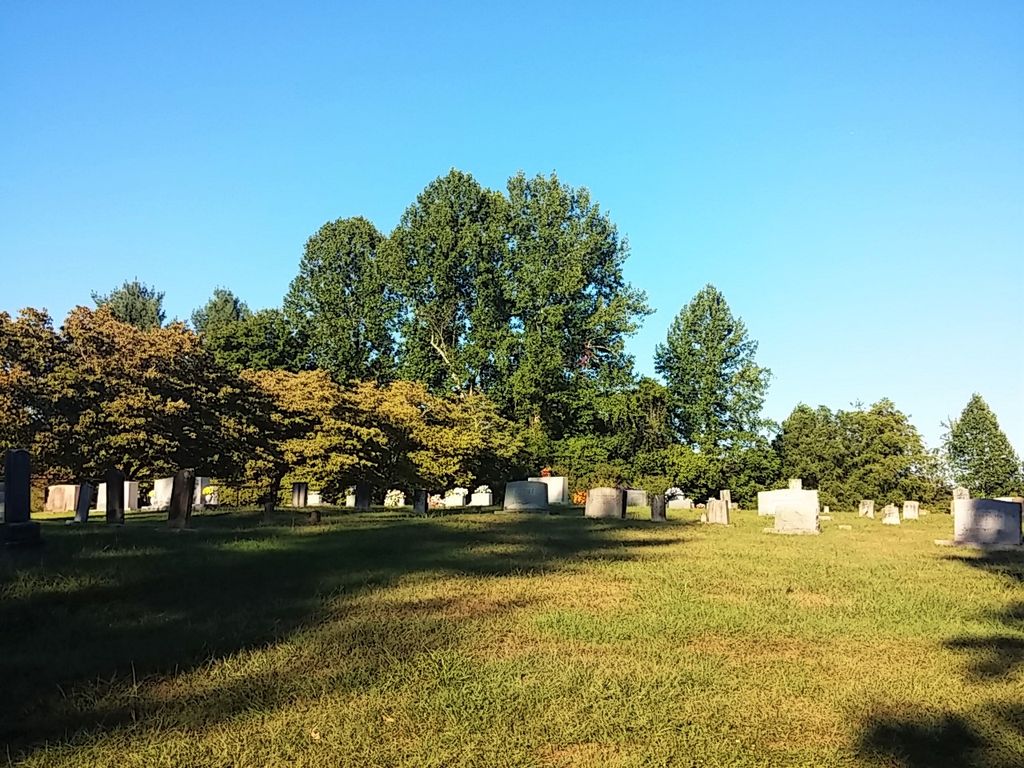
| Memorials | : | 37 |
| Location | : | Fogertown, Clay County, USA |
| Coordinate | : | 37.2431400, -83.8606400 |
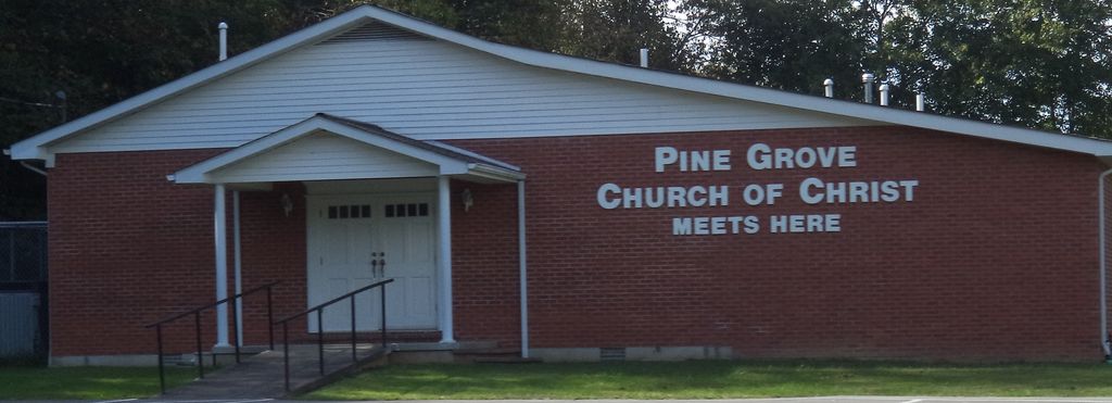
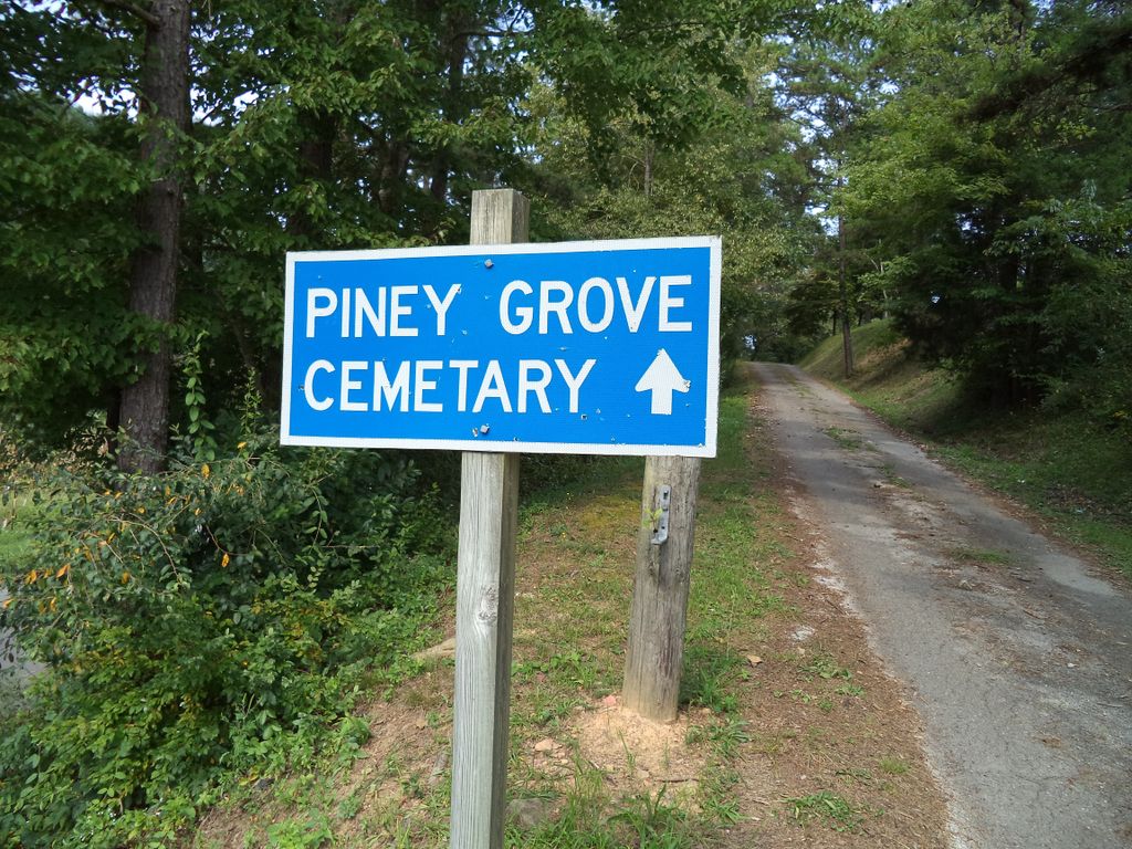
| Description | : | From Manchester, take Hwy. 421 North to Hwy. 472/Fogertown Road. Take Hwy. 472 about 3 miles to Muncy Fork Rd. The Pine Grove Church of Christ is located just past the entrance to Muncy Fork Rd. Go about a 1/2 mile on Muncy Fork Rd. Take the lane on the right up the hill to the cemetery. |
frequently asked questions (FAQ):
-
Where is Pine Grove Cemetery?
Pine Grove Cemetery is located at Muncy Fork Rd Fogertown, Clay County ,Kentucky , 40962USA.
-
Pine Grove Cemetery cemetery's updated grave count on graveviews.com?
35 memorials
-
Where are the coordinates of the Pine Grove Cemetery?
Latitude: 37.2431400
Longitude: -83.8606400
Nearby Cemetories:
1. Macedonia Church Cemetery
Burning Springs, Clay County, USA
Coordinate: 37.2413400, -83.8358900
2. Cress Cemetery
Shepherdtown, Clay County, USA
Coordinate: 37.2638100, -83.8709100
3. York Cemetery
Burning Springs, Clay County, USA
Coordinate: 37.2667500, -83.8624100
4. Lloyd Bowling Cemetery
Burning Springs, Clay County, USA
Coordinate: 37.2714000, -83.8484860
5. Old Harris Cemetery
Sidell, Clay County, USA
Coordinate: 37.2226100, -83.8327800
6. Benge Cemetery
Fogertown, Clay County, USA
Coordinate: 37.2300400, -83.8987400
7. Thompson Cemetery
Burning Springs, Clay County, USA
Coordinate: 37.2430000, -83.8148500
8. Mize Branch Community Cemetery
Manchester, Clay County, USA
Coordinate: 37.2347259, -83.8159595
9. Fields Family Cemetery
Fogertown, Clay County, USA
Coordinate: 37.2083700, -83.8770600
10. Dewey McQueen Cemetery
Burning Springs, Clay County, USA
Coordinate: 37.2806000, -83.8700900
11. Mcqueen Family Cemetery
Burning Springs, Clay County, USA
Coordinate: 37.2607180, -83.8157650
12. Wilson Cemetery
Burning Springs, Clay County, USA
Coordinate: 37.2826450, -83.8543290
13. George McQueen Cemetery
Clay County, USA
Coordinate: 37.2618100, -83.8162100
14. Stivers Cemetery
Fogertown, Clay County, USA
Coordinate: 37.2194405, -83.9011078
15. Smith Cemetery #4
Burning Springs, Clay County, USA
Coordinate: 37.2691100, -83.8175700
16. Smith Cemetery #9
Burning Springs, Clay County, USA
Coordinate: 37.2692250, -83.8176530
17. Sizemore Cemetery
Fall Rock, Clay County, USA
Coordinate: 37.2217130, -83.8113370
18. Spurlock-Gabbard Cemetery
Fall Rock, Clay County, USA
Coordinate: 37.2283790, -83.8050060
19. Ben Hacker Cemetery
Fogertown, Clay County, USA
Coordinate: 37.2350630, -83.9201200
20. Sandlin Cemetery
Sidell, Clay County, USA
Coordinate: 37.2052994, -83.8221970
21. Rader Cemetery
Clay County, USA
Coordinate: 37.2283860, -83.9194220
22. Bishop Falls Cemetery
Fall Rock, Clay County, USA
Coordinate: 37.2127800, -83.8049030
23. Scott Cemetery
Burning Springs, Clay County, USA
Coordinate: 37.2424500, -83.7902800
24. Wyatt Cemetery
Sidell, Clay County, USA
Coordinate: 37.1876000, -83.8421300