
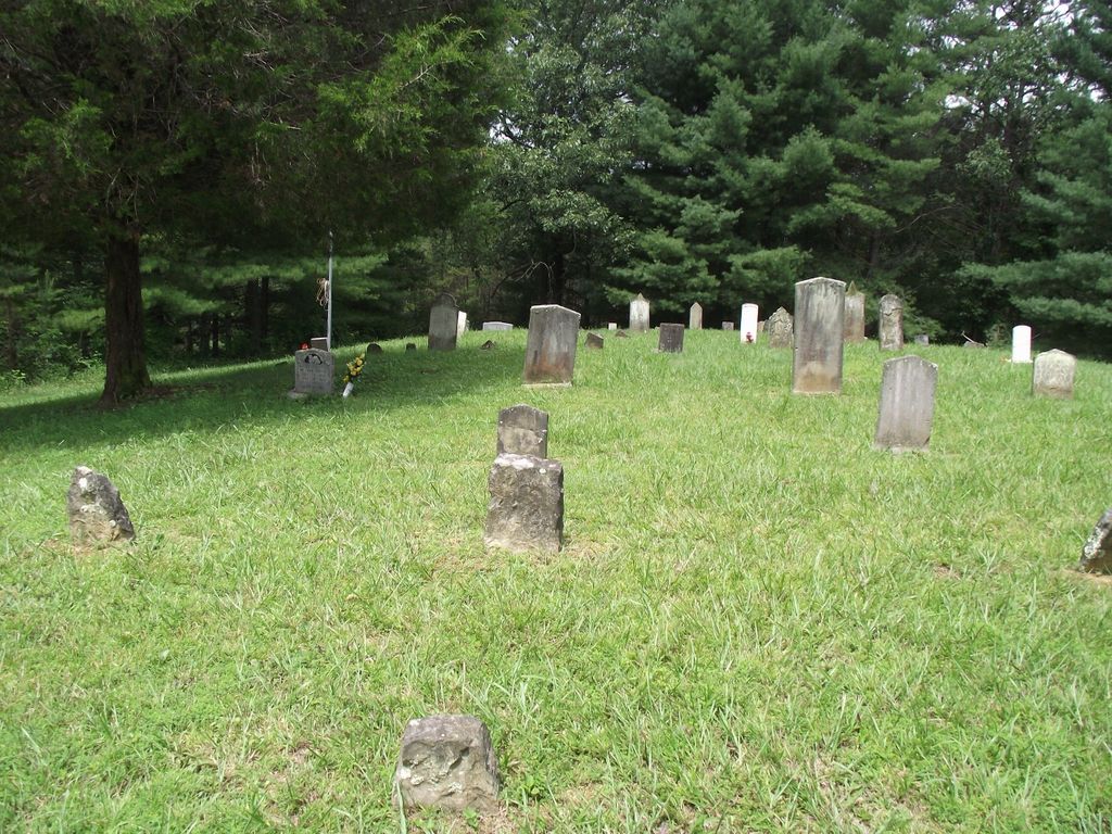
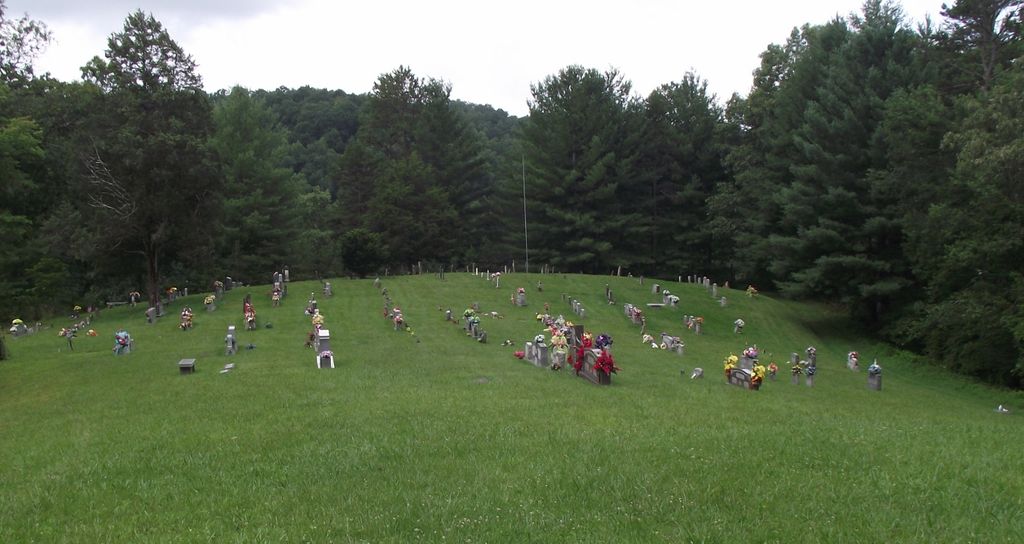
| Memorials | : | 32 |
| Location | : | Burning Springs, Clay County, USA |
| Coordinate | : | 37.2826450, -83.8543290 |
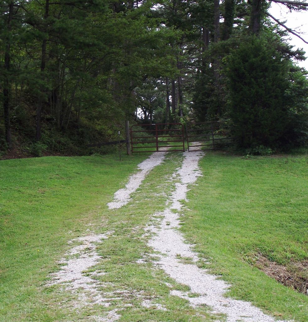
| Description | : | Cemetery located off of 421 in Clay Co about two miles south of the Jackson Co line. The mailbox at the driveway had Robinson III & off of that driveway, to the right, is a gravel road. As you start up the road, go through a gate & drive to the top of the hill. |
frequently asked questions (FAQ):
-
Where is Wilson Cemetery?
Wilson Cemetery is located at Burning Springs, Clay County ,Kentucky ,USA.
-
Wilson Cemetery cemetery's updated grave count on graveviews.com?
32 memorials
-
Where are the coordinates of the Wilson Cemetery?
Latitude: 37.2826450
Longitude: -83.8543290
Nearby Cemetories:
1. Lloyd Bowling Cemetery
Burning Springs, Clay County, USA
Coordinate: 37.2714000, -83.8484860
2. Dewey McQueen Cemetery
Burning Springs, Clay County, USA
Coordinate: 37.2806000, -83.8700900
3. York Cemetery
Burning Springs, Clay County, USA
Coordinate: 37.2667500, -83.8624100
4. Cress Cemetery
Shepherdtown, Clay County, USA
Coordinate: 37.2638100, -83.8709100
5. Robinson Cemetery #1
Clay County, USA
Coordinate: 37.3055992, -83.8694000
6. Lewis Cemetery
Clay County, USA
Coordinate: 37.3097000, -83.8424988
7. Smith Cemetery #9
Burning Springs, Clay County, USA
Coordinate: 37.2692250, -83.8176530
8. Smith Cemetery #4
Burning Springs, Clay County, USA
Coordinate: 37.2691100, -83.8175700
9. George McQueen Cemetery
Clay County, USA
Coordinate: 37.2618100, -83.8162100
10. Mcqueen Family Cemetery
Burning Springs, Clay County, USA
Coordinate: 37.2607180, -83.8157650
11. Pine Grove Cemetery
Fogertown, Clay County, USA
Coordinate: 37.2431400, -83.8606400
12. Mount Olivet Cemetery
Sextons Creek, Clay County, USA
Coordinate: 37.3203100, -83.8355300
13. McDaniel Cemetery
Chestnutburg, Clay County, USA
Coordinate: 37.2825012, -83.7996979
14. Macedonia Church Cemetery
Burning Springs, Clay County, USA
Coordinate: 37.2413400, -83.8358900
15. Pennington-Morgan Cemetery
Sextons Creek, Clay County, USA
Coordinate: 37.3227997, -83.8281021
16. Thompson Cemetery
Burning Springs, Clay County, USA
Coordinate: 37.2430000, -83.8148500
17. Genty Cemetery
Chestnutburg, Clay County, USA
Coordinate: 37.2971992, -83.7932968
18. Neeley Cemetery
Clay County, USA
Coordinate: 37.3274994, -83.8158035
19. Mize Branch Community Cemetery
Manchester, Clay County, USA
Coordinate: 37.2347259, -83.8159595
20. Woods Cemetery
Burning Springs, Clay County, USA
Coordinate: 37.2621700, -83.7846000
21. Ball Cemetery
Chestnutburg, Clay County, USA
Coordinate: 37.2933006, -83.7810974
22. Old Harris Cemetery
Sidell, Clay County, USA
Coordinate: 37.2226100, -83.8327800
23. Benge Cemetery
Fogertown, Clay County, USA
Coordinate: 37.2300400, -83.8987400
24. Wilson Cemetery
Annville, Jackson County, USA
Coordinate: 37.3464012, -83.8589020