
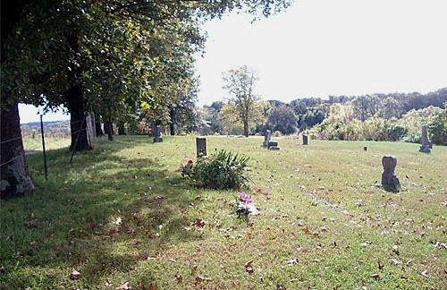
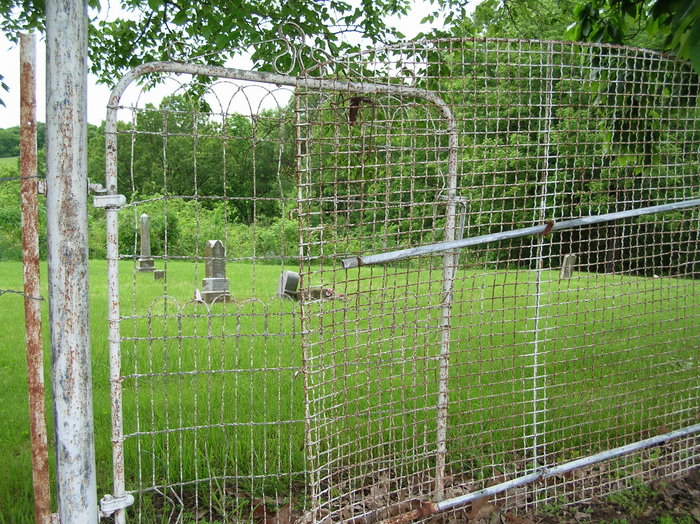
| Memorials | : | 0 |
| Location | : | Clarks Fork, Cooper County, USA |
| Coordinate | : | 38.8720870, -92.6635600 |
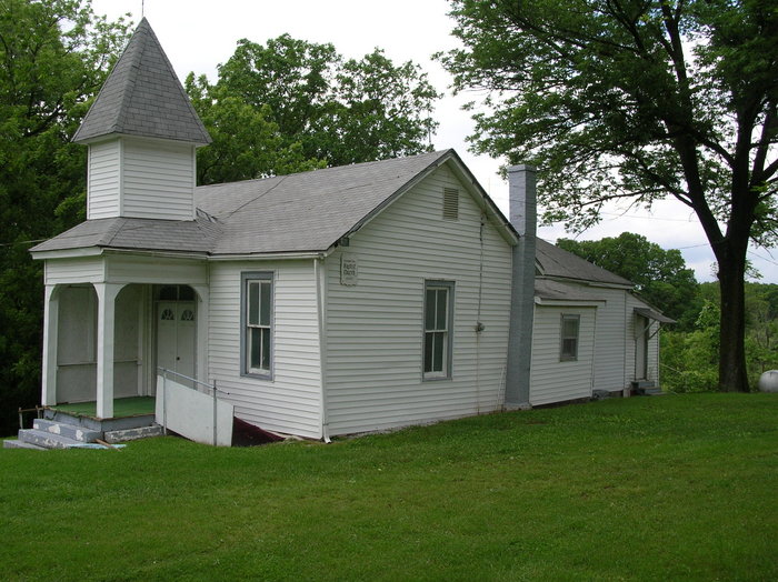
| Description | : | From Hwy 70, take Hwy 87 south for about 5 miles, make a right on Pleasant Hill Rd. About 1 mile on Pleasant Hill Rd. on the right hand side, next to the church. |
frequently asked questions (FAQ):
-
Where is Pleasant Hill Missionary Baptist Church Cemetery?
Pleasant Hill Missionary Baptist Church Cemetery is located at Clarks Fork, Cooper County ,Missouri ,USA.
-
Pleasant Hill Missionary Baptist Church Cemetery cemetery's updated grave count on graveviews.com?
0 memorials
-
Where are the coordinates of the Pleasant Hill Missionary Baptist Church Cemetery?
Latitude: 38.8720870
Longitude: -92.6635600
Nearby Cemetories:
1. Walnut Grove Church Cemetery
Cooper County, USA
Coordinate: 38.8716480, -92.6421770
2. Trinity Lutheran Cemetery
Clarks Fork, Cooper County, USA
Coordinate: 38.8512540, -92.6827680
3. Candy Court Cemetery
Prairie Home, Cooper County, USA
Coordinate: 38.8477200, -92.6385900
4. New Salem Cemetery
Prairie Home, Cooper County, USA
Coordinate: 38.8432999, -92.6267014
5. McCulloch Cemetery
Cooper County, USA
Coordinate: 38.8293991, -92.6731033
6. Shipley - Morrow Cemetery
Boonville, Cooper County, USA
Coordinate: 38.8973710, -92.6152590
7. Toler Cemetery
Cooper County, USA
Coordinate: 38.8260994, -92.6682968
8. Mount Hermon Baptist Cemetery
Clarks Fork, Cooper County, USA
Coordinate: 38.8824560, -92.7340030
9. Providence Baptist Church Cemetery
Prairie Home, Cooper County, USA
Coordinate: 38.8405991, -92.5950012
10. Ellis Cemetery
Cooper County, USA
Coordinate: 38.8125000, -92.6410980
11. Hail Ridge Cemetery
Boonville, Cooper County, USA
Coordinate: 38.9394444, -92.6941667
12. New Salem Missionary Baptist Church Cemetery
Cooper County, USA
Coordinate: 38.8990990, -92.5782040
13. Goochs Mill Baptist Church Cemetery
Boonville, Cooper County, USA
Coordinate: 38.9002890, -92.5777260
14. Zion Lutheran Cemetery
Lone Elm, Cooper County, USA
Coordinate: 38.8215000, -92.7366000
15. Brown-Cartner Family Cemetery
Billingsville, Cooper County, USA
Coordinate: 38.8812900, -92.7609200
16. Robison Cemetery
Prairie Home, Cooper County, USA
Coordinate: 38.8335991, -92.5742035
17. Saint Peters Evangelical and Reformed Church Cemet
Prairie Home, Cooper County, USA
Coordinate: 38.8505710, -92.5577550
18. Pleasant Grove Lutheran Cemetery
Wooldridge, Cooper County, USA
Coordinate: 38.8693300, -92.5518200
19. Schmidt Cemetery
Wooldridge, Cooper County, USA
Coordinate: 38.9500008, -92.6046982
20. Apperson Cemetery
Cooper County, USA
Coordinate: 38.7841700, -92.6328000
21. Pisgah Baptist Church Cemetery
Pisgah, Cooper County, USA
Coordinate: 38.7775000, -92.6508330
22. Pisgah Christian Church Cemetery
Pisgah, Cooper County, USA
Coordinate: 38.7771340, -92.6518470
23. Harris Cemetery
Pisgah, Cooper County, USA
Coordinate: 38.7858009, -92.6050034
24. Clayton Cemetery
Overton, Cooper County, USA
Coordinate: 38.9427986, -92.5744019