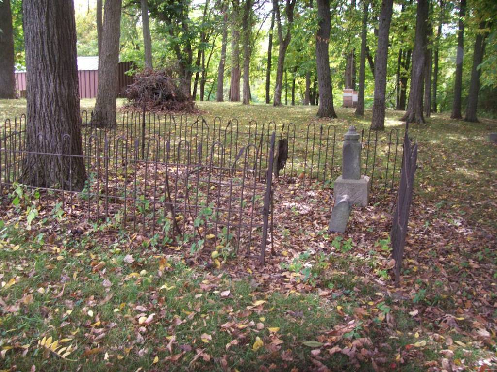
| Memorials | : | 0 |
| Location | : | Boonville, Cooper County, USA |
| Coordinate | : | 38.9394444, -92.6941667 |
| Description | : | General Location: Boonville Congressional Township: Southeast of Boonville Section: Southwest quarter of northwest quarter of northwest quarter of southeast quarter of section 8 Longitude & Latitude: 38 56 22 : 92 41 39 Directions: About one quarter mile off Bingham Road; at the intersection of I-70; on the south side of Bingham Road and north of I-70. This cemetery is located on the grounds of State School #53. |
frequently asked questions (FAQ):
-
Where is Hail Ridge Cemetery?
Hail Ridge Cemetery is located at Boonville, Cooper County ,Missouri ,USA.
-
Hail Ridge Cemetery cemetery's updated grave count on graveviews.com?
0 memorials
-
Where are the coordinates of the Hail Ridge Cemetery?
Latitude: 38.9394444
Longitude: -92.6941667
Nearby Cemetories:
1. Boonville Memorial Gardens Cemetery
Boonville, Cooper County, USA
Coordinate: 38.9670460, -92.7271950
2. Missouri Boys Training School Cemetery
Boonville, Cooper County, USA
Coordinate: 38.9732120, -92.7297190
3. Walnut Grove Cemetery
Boonville, Cooper County, USA
Coordinate: 38.9713783, -92.7324524
4. Saint Peter and Paul Catholic Cemetery
Boonville, Cooper County, USA
Coordinate: 38.9730060, -92.7306800
5. Sunset Hills Cemetery
Boonville, Cooper County, USA
Coordinate: 38.9636130, -92.7458480
6. Mount Hermon Baptist Cemetery
Clarks Fork, Cooper County, USA
Coordinate: 38.8824560, -92.7340030
7. Schmidt Cemetery
Wooldridge, Cooper County, USA
Coordinate: 38.9500008, -92.6046982
8. Pleasant Hill Missionary Baptist Church Cemetery
Clarks Fork, Cooper County, USA
Coordinate: 38.8720870, -92.6635600
9. Cooper County Poor Farm Cemetery
Boonville, Cooper County, USA
Coordinate: 38.9108430, -92.7820330
10. Shipley - Morrow Cemetery
Boonville, Cooper County, USA
Coordinate: 38.8973710, -92.6152590
11. Brown-Cartner Family Cemetery
Billingsville, Cooper County, USA
Coordinate: 38.8812900, -92.7609200
12. Walnut Grove Church Cemetery
Cooper County, USA
Coordinate: 38.8716480, -92.6421770
13. Saint Johns UCC Cemetery
Billingsville, Cooper County, USA
Coordinate: 38.9042410, -92.7951050
14. Trinity Lutheran Cemetery
Clarks Fork, Cooper County, USA
Coordinate: 38.8512540, -92.6827680
15. Jennings Cemetery
Howard County, USA
Coordinate: 39.0157160, -92.6355600
16. Sulphur Springs Cemetery
New Franklin, Howard County, USA
Coordinate: 39.0053368, -92.6174850
17. Adams Cemetery
New Franklin, Howard County, USA
Coordinate: 39.0033210, -92.6126350
18. Robinson Cemetery
Howard County, USA
Coordinate: 39.0264015, -92.6596985
19. Clayton Cemetery
Overton, Cooper County, USA
Coordinate: 38.9427986, -92.5744019
20. Drake-Campbell Cemetery
Howard County, USA
Coordinate: 39.0307999, -92.6502991
21. Goochs Mill Baptist Church Cemetery
Boonville, Cooper County, USA
Coordinate: 38.9002890, -92.5777260
22. New Salem Missionary Baptist Church Cemetery
Cooper County, USA
Coordinate: 38.8990990, -92.5782040
23. Clarks Chapel Cemetery
New Franklin, Howard County, USA
Coordinate: 39.0102910, -92.7851010
24. Candy Court Cemetery
Prairie Home, Cooper County, USA
Coordinate: 38.8477200, -92.6385900

