
| Memorials | : | 161 |
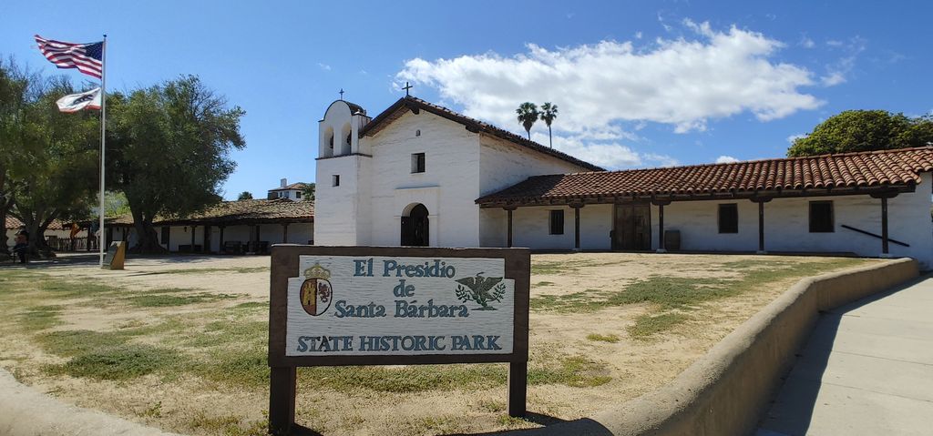
| Location | : | Santa Barbara, Santa Barbara County, USA |
| Coordinate | : | 34.4228790, -119.6991480 |
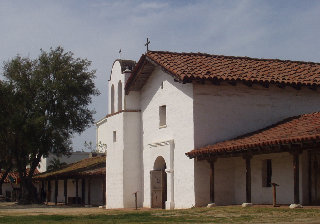
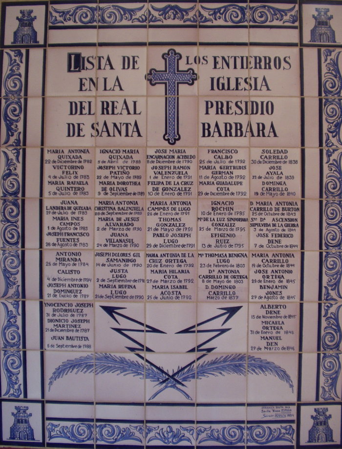
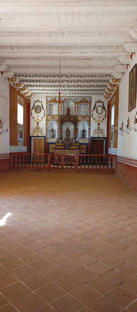
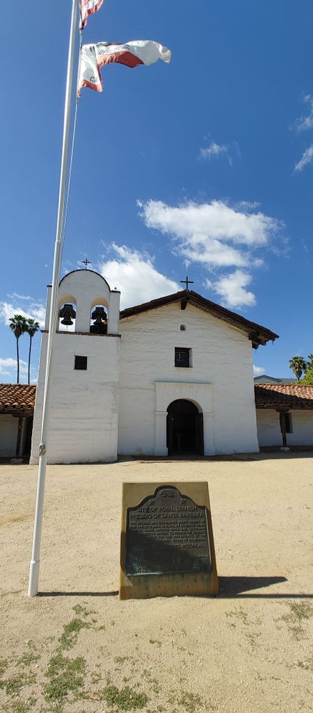
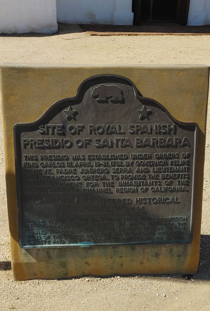
| Description | : | SANTA BARBARA PRESIDIO CEMETERY (1782-1850) The Santa Barbara Presidio chapel functioned as a parish church and primarily served the spiritual needs of Santa Barbara's "razon" (non-Indian) population. The presidio chapel was where they worshipped, and where they were married, baptized, and buried. The first burials at the Presidio of Santa Barbara were inside the chapel, subsequent burials were beyond the presidio wall behind the chapel and in a small cemetery for infants and young children adjacent to the chapel. After February 1807 the presidio chapel's parishioners were buried in the Santa Barbara Mission Cemetery, with the exception of two burials early... Read More |
frequently asked questions (FAQ):
-
Where is Presidio Cemetery?
Presidio Cemetery is located at 123 East Cañon Perdido Street Santa Barbara, Santa Barbara County ,California , 93101USA.
-
Presidio Cemetery cemetery's updated grave count on graveviews.com?
161 memorials
-
Where are the coordinates of the Presidio Cemetery?
Latitude: 34.4228790
Longitude: -119.6991480
Nearby Cemetories:
1. Mission Santa Barbara Cemetery
Santa Barbara, Santa Barbara County, USA
Coordinate: 34.4378800, -119.7134600
2. Santa Barbara Cemetery
Santa Barbara, Santa Barbara County, USA
Coordinate: 34.4188995, -119.6544037
3. Calvary Cemetery
Santa Barbara, Santa Barbara County, USA
Coordinate: 34.4432983, -119.7466965
4. All Saints By The Sea Episcopal Church Columbarium
Montecito, Santa Barbara County, USA
Coordinate: 34.4210500, -119.6312100
5. Cieneguitas Catholic Cemetery
La Patera, Santa Barbara County, USA
Coordinate: 34.4402920, -119.7744090
6. Potters Field Cemetery
Goleta, Santa Barbara County, USA
Coordinate: 34.4526310, -119.7686540
7. Goleta Cemetery
Goleta, Santa Barbara County, USA
Coordinate: 34.4407997, -119.7802963
8. Christ the King Episcopal Church Memorial Garden
Santa Barbara, Santa Barbara County, USA
Coordinate: 34.4343418, -119.7998439
9. Montecito Cemetery
Montecito, Santa Barbara County, USA
Coordinate: 34.4363080, -119.5959850
10. Carpinteria Cemetery
Carpinteria, Santa Barbara County, USA
Coordinate: 34.4118996, -119.5385971
11. Ferrer Family Ranch Grounds
Carpinteria, Santa Barbara County, USA
Coordinate: 34.3821940, -119.4812560
12. Rancho del Cielo Cemetery
Santa Barbara, Santa Barbara County, USA
Coordinate: 34.5304780, -120.0758920
13. Capuchin Cemetery
Santa Ynez, Santa Barbara County, USA
Coordinate: 34.6442860, -120.0270440
14. Ojai United Methodist Memorial Garden
Ojai, Ventura County, USA
Coordinate: 34.4437040, -119.2665540
15. Saint Thomas Aquinas Cemetery
Ojai, Ventura County, USA
Coordinate: 34.4301250, -119.2650250
16. Mission San Buenaventura Cemetery
Ventura, Ventura County, USA
Coordinate: 34.2811890, -119.2982090
17. Nordhoff Cemetery
Ojai, Ventura County, USA
Coordinate: 34.4446600, -119.2604400
18. Ojai Presbyterian Church Columbarium
Ojai, Ventura County, USA
Coordinate: 34.4494250, -119.2530420
19. Saint Andrews Episcopal Church Columbarium
Ojai, Ventura County, USA
Coordinate: 34.4454300, -119.2513700
20. First United Methodist Church Ventura Columbarium
Ventura, Ventura County, USA
Coordinate: 34.2793589, -119.2819936
21. Cemetery Memorial Park
Ventura, Ventura County, USA
Coordinate: 34.2811900, -119.2800700
22. Saint Pauls Episcopal Church Memorial Garden
Ventura, Ventura County, USA
Coordinate: 34.2759070, -119.2522820
23. Oak Hill Cemetery
Ballard, Santa Barbara County, USA
Coordinate: 34.6324997, -120.1106033
24. Mission Santa Ines Cemetery
Solvang, Santa Barbara County, USA
Coordinate: 34.5943880, -120.1365550