
| Memorials | : | 0 |
| Location | : | East Bradford Township, Chester County, USA |
| Coordinate | : | 39.9906110, -75.6753890 |
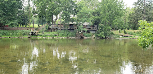
| Description | : | The land on which this cemetery is located was first settled by Thomas Price, who got a warrant for 286 acres in 1733 and probably settled thereon. He died in 1756, and the next owner was Michale Righter, followed by William Mercer Sr. who procured another warrant in 1791 and took out his patent in 1811. William Mercer Sr. divided the property in 1812 between his two sons, Joseph and Thomas, and sold the parcel (consisting of wood lot and cemetery) to Jesse Davis, of Goshen Township, who sold it to John James Sr. in 1836. Only a few low, flat stones... Read More |
frequently asked questions (FAQ):
-
Where is Price-Burgoin Family Burial Ground?
Price-Burgoin Family Burial Ground is located at East of Skelp Level Road East Bradford Township, Chester County ,Pennsylvania , 19335USA.
-
Price-Burgoin Family Burial Ground cemetery's updated grave count on graveviews.com?
0 memorials
-
Where are the coordinates of the Price-Burgoin Family Burial Ground?
Latitude: 39.9906110
Longitude: -75.6753890
Nearby Cemetories:
1. Downingtown Friends Meeting Cemetery
Downingtown, Chester County, USA
Coordinate: 40.0139400, -75.6887000
2. Saint Joseph Cemetery
Downingtown, Chester County, USA
Coordinate: 39.9900017, -75.7155991
3. Northwood Cemetery
Downingtown, Chester County, USA
Coordinate: 40.0222015, -75.6921997
4. Grove United Methodist Church Cemetery
Grove, Chester County, USA
Coordinate: 40.0049019, -75.6331024
5. Lindley Hill African Methodist Episcopal Cemetery
Downingtown, Chester County, USA
Coordinate: 40.0275803, -75.6924133
6. Marshallton United Methodist Church Cemetery
Marshallton, Chester County, USA
Coordinate: 39.9506989, -75.6769028
7. Bradford Friends Burying Ground
Marshallton, Chester County, USA
Coordinate: 39.9497000, -75.6802000
8. Bradford Cemetery
Marshallton, Chester County, USA
Coordinate: 39.9474800, -75.6809000
9. Saint Agnes Roman Catholic Church Grounds
West Chester, Chester County, USA
Coordinate: 39.9590876, -75.6088266
10. Romansville United Methodist Church Cemetery
Romansville, Chester County, USA
Coordinate: 39.9510994, -75.7385025
11. Romansville Friends Burying Ground
Romansville, Chester County, USA
Coordinate: 39.9536018, -75.7431030
12. Saint Paul's Lutheran Church Cemetery
Lionville, Chester County, USA
Coordinate: 40.0534000, -75.6556000
13. Uwchlan Friends Burial Ground
Uwchlan Township, Chester County, USA
Coordinate: 40.0541992, -75.6601028
14. Holy Trinity Episcopal Church Memorial Garden
West Chester, Chester County, USA
Coordinate: 39.9574630, -75.6024650
15. Hopewell United Methodist Church Cemetery
Downingtown, Chester County, USA
Coordinate: 40.0382996, -75.7351990
16. East Brandywine Baptist Church Cemetery
Guthriesville, Chester County, USA
Coordinate: 40.0256004, -75.7491989
17. Caln Orthodox Friends Burial Ground
Coatesville, Chester County, USA
Coordinate: 40.0071710, -75.7634290
18. Calvary Lutheran Church Columbarium
West Chester, Chester County, USA
Coordinate: 39.9491036, -75.6026425
19. Chester County Alms House Cemeteries
Newlin Township, Chester County, USA
Coordinate: 39.9319000, -75.7255000
20. Saint Paul's United Church Of Christ Cemetery
Lionville, Chester County, USA
Coordinate: 40.0560341, -75.6413193
21. Old Caln Friends Meeting Burial Ground
Coatesville, Chester County, USA
Coordinate: 40.0074997, -75.7647018
22. Church Farm School Chapel of the Atonement Crypt
Exton, Chester County, USA
Coordinate: 40.0308530, -75.5940140
23. Saint Paul's Episcopal Church Cemetery
Exton, Chester County, USA
Coordinate: 40.0326004, -75.5899963
24. Benson's Chapel Methodist Episcopal Cemetery
Eagle, Chester County, USA
Coordinate: 40.0687400, -75.6816500