
| Memorials | : | 1 |
| Location | : | Newlin Township, Chester County, USA |
| Coordinate | : | 39.9319000, -75.7255000 |
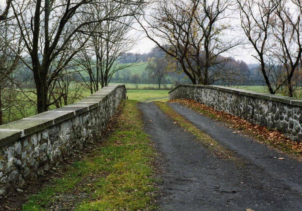
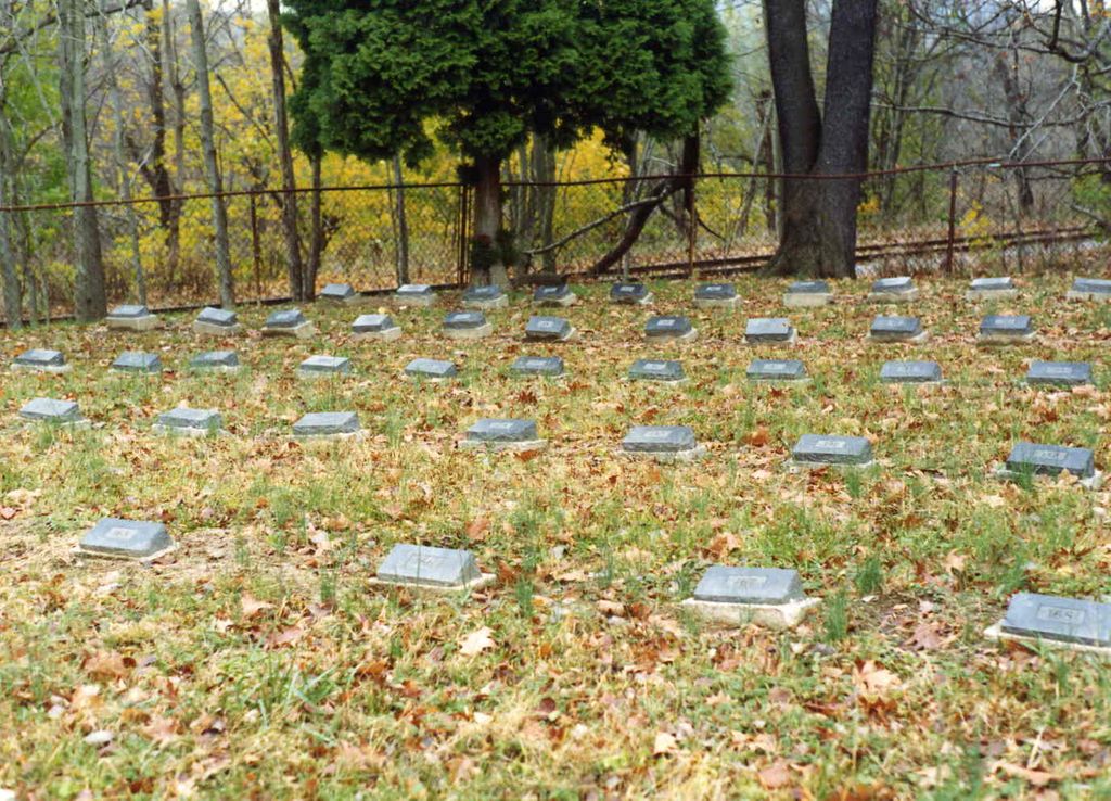
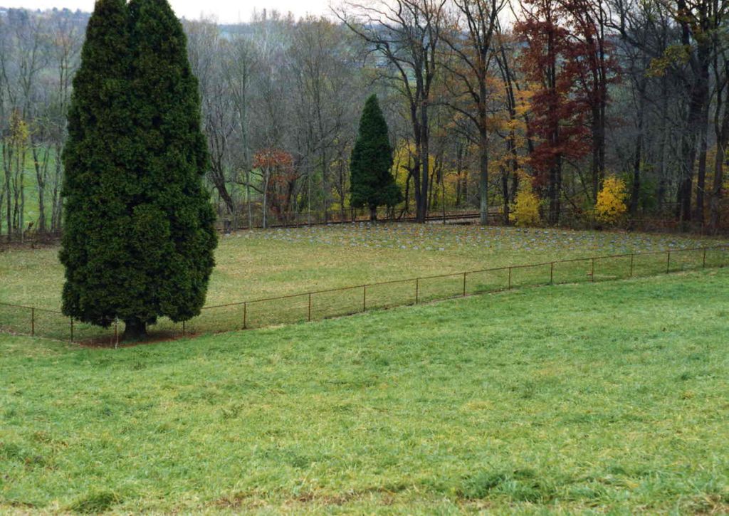
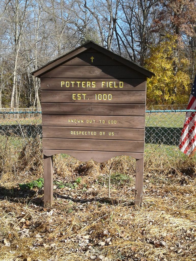
| Description | : | The Chester County Poor (or Alms) House was established in 1800. During its long history it went by many names — first as the Chester County Alms House, then as the Chester County Home, then the Chester County Institutional District, then the Embreeville State Hospital, and finally, until its closure in 1997 as the Embreeville State Center — there were three cemeteries located at the site. The oldest cemetery was located on a triangular plot of land on the West Bradford side of the township line, near the site of "Indian Hannah" Freeman's original stone marker, northwest of Conley Drive. This... Read More |
frequently asked questions (FAQ):
-
Where is Chester County Alms House Cemeteries?
Chester County Alms House Cemeteries is located at 1664 Embreeville Rd Newlin Township, Chester County ,Pennsylvania , 19320USA.
-
Chester County Alms House Cemeteries cemetery's updated grave count on graveviews.com?
1 memorials
-
Where are the coordinates of the Chester County Alms House Cemeteries?
Latitude: 39.9319000
Longitude: -75.7255000

Nearby Cemetories:
1. Romansville United Methodist Church Cemetery
Romansville, Chester County, USA
Coordinate: 39.9510994, -75.7385025
2. Romansville Friends Burying Ground
Romansville, Chester County, USA
Coordinate: 39.9536018, -75.7431030
3. Old Hephzibah Baptist Church Cemetery
Laurel, Chester County, USA
Coordinate: 39.9373410, -75.7695410
4. Unionville Cemetery
Unionville, Chester County, USA
Coordinate: 39.8950310, -75.7296066
5. Bradford Cemetery
Marshallton, Chester County, USA
Coordinate: 39.9474800, -75.6809000
6. Bradford Friends Burying Ground
Marshallton, Chester County, USA
Coordinate: 39.9497000, -75.6802000
7. Saint Michael Lutheran Church Columbarium
Unionville, Chester County, USA
Coordinate: 39.8926920, -75.7191700
8. Marlborough Friends Burial Ground
Marlboro, Chester County, USA
Coordinate: 39.8953000, -75.7044000
9. Marshallton United Methodist Church Cemetery
Marshallton, Chester County, USA
Coordinate: 39.9506989, -75.6769028
10. Ebenezer African Methodist Episcopal Cemetery
Unionville, Chester County, USA
Coordinate: 39.8888830, -75.7137970
11. Derry Union American Methodist Episcopal Cemetery
East Fallowfield Township, Chester County, USA
Coordinate: 39.9649185, -75.7764344
12. Doe Run Valley Presbyterian Church Cemetery
Coatesville, Chester County, USA
Coordinate: 39.9488000, -75.7900000
13. Saint Joseph Cemetery
Downingtown, Chester County, USA
Coordinate: 39.9900017, -75.7155991
14. Hephzibah Baptist Church Cemetery
East Fallowfield Township, Chester County, USA
Coordinate: 39.9505997, -75.8088989
15. Price-Burgoin Family Burial Ground
East Bradford Township, Chester County, USA
Coordinate: 39.9906110, -75.6753890
16. Lutheran Church of the Good Shepherd Columbarium
Coatesville, Chester County, USA
Coordinate: 39.9842680, -75.7891530
17. Pennsbury Union American Methodist Episcopal Cemetery
Pocopson, Chester County, USA
Coordinate: 39.8977440, -75.6413930
18. London Grove Friends Burial Ground
London Grove Township, Chester County, USA
Coordinate: 39.8691500, -75.7743200
19. Longwood Cemetery
Kennett Square, Chester County, USA
Coordinate: 39.8680496, -75.6728821
20. Parkersville Friends Meeting Cemetery
Parkersville, Chester County, USA
Coordinate: 39.8861008, -75.6447983
21. Saint Patrick Roman Catholic Cemetery
Kennett Square, Chester County, USA
Coordinate: 39.8546982, -75.7146988
22. Union Hill Cemetery
Kennett Square, Chester County, USA
Coordinate: 39.8544006, -75.7161026
23. Fairview Cemetery
Coatesville, Chester County, USA
Coordinate: 39.9789009, -75.8071976
24. Episcopal Church of the Advent Memorial Garden
Kennett Square, Chester County, USA
Coordinate: 39.8516000, -75.7160000