
| Memorials | : | 34 |
| Location | : | Brackenridge, Allegheny County, USA |
| Website | : | sites.google.com/site/prospectcemeterybrackenridge/ |
| Coordinate | : | 40.6102982, -79.7472000 |
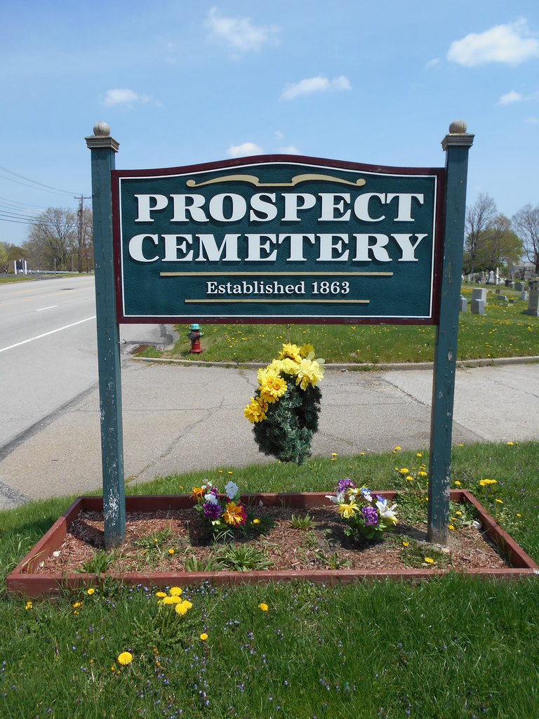
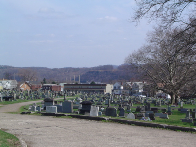
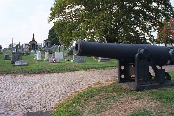
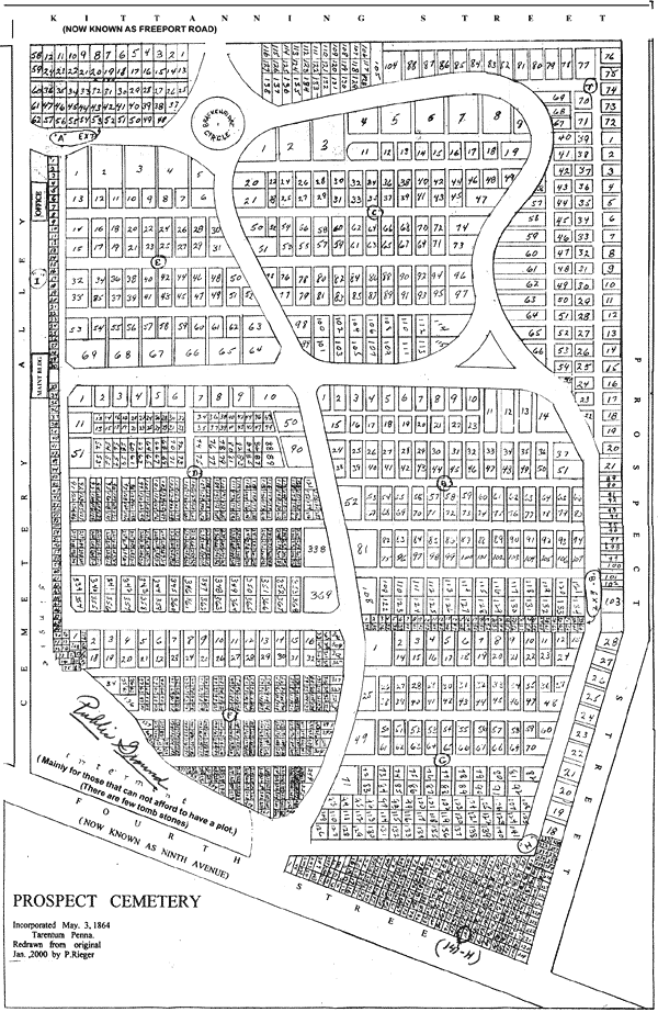
| Description | : | Established in 1863 and incorporated in 1864, Prospect Cemetery was formed as the first public cemetery in the area. Encompassing 13 acres, it lies on a hill surrounded by homes on all side streets. During the early years graves were relocated from local church and family cemeteries to family lots in Prospect Cemetery, and stones as old as 1817 can be found in the cemetery. More than 13,000 graves are now in Prospect Cemetery, although nearly half of them have no grave stone to mark someone's last resting place. Some of the original records were lost in the St. Patrick's Day... Read More |
frequently asked questions (FAQ):
-
Where is Prospect Cemetery?
Prospect Cemetery is located at Brackenridge, Allegheny County ,Pennsylvania ,USA.
-
Prospect Cemetery cemetery's updated grave count on graveviews.com?
33 memorials
-
Where are the coordinates of the Prospect Cemetery?
Latitude: 40.6102982
Longitude: -79.7472000
Nearby Cemetories:
1. Beth Jacob Congregational Cemetery
New Kensington, Westmoreland County, USA
Coordinate: 40.5928001, -79.7481995
2. Ross Cemetery
Lower Burrell, Westmoreland County, USA
Coordinate: 40.5881190, -79.7422660
3. Burtner Cemetery
Natrona Heights, Allegheny County, USA
Coordinate: 40.6299000, -79.7293000
4. Bethel Cemetery
Lower Burrell, Westmoreland County, USA
Coordinate: 40.5891991, -79.7292023
5. Union Cemetery
Arnold, Westmoreland County, USA
Coordinate: 40.5819016, -79.7549973
6. Saint Joseph Parish Cemetery
Natrona Heights, Allegheny County, USA
Coordinate: 40.6316150, -79.7158960
7. Morrison Cemetery
Lower Burrell, Westmoreland County, USA
Coordinate: 40.6082500, -79.7003600
8. Mount Airy Cemetery
Natrona Heights, Allegheny County, USA
Coordinate: 40.6371994, -79.7089005
9. Pet Haven at Mount Airy
Natrona Heights, Allegheny County, USA
Coordinate: 40.6388615, -79.7090183
10. Saint Mary Cemetery
Lower Burrell, Westmoreland County, USA
Coordinate: 40.5868988, -79.6964035
11. Mount Hope Cemetery
Westmoreland County, USA
Coordinate: 40.6166382, -79.6881180
12. Greenwood Memorial Park
Lower Burrell, Westmoreland County, USA
Coordinate: 40.5957985, -79.6849976
13. Puckety UP Church Cemetery
Lower Burrell, Westmoreland County, USA
Coordinate: 40.5787010, -79.6961975
14. Millerstown Cemetery
Millerstown, Allegheny County, USA
Coordinate: 40.6491013, -79.7982025
15. Logans Ferry UP Church Cemetery
Parnassus, Westmoreland County, USA
Coordinate: 40.5539080, -79.7591810
16. Round Hill Cemetery
New Kensington, Westmoreland County, USA
Coordinate: 40.5529060, -79.7620316
17. Bethesda Cemetery
Westmoreland County, USA
Coordinate: 40.5833015, -79.6744003
18. Walter Chapel Cemetery
Cheswick, Allegheny County, USA
Coordinate: 40.5895996, -79.8247986
19. Dugan Cemetery
Allegheny County, USA
Coordinate: 40.5447006, -79.7339020
20. Lefever Family Cemetery
Indiana Township, Allegheny County, USA
Coordinate: 40.5709000, -79.8244000
21. Brookland Cemetery
Bagdad, Westmoreland County, USA
Coordinate: 40.6493988, -79.6669006
22. Deer Creek Cemetery
Cheswick, Allegheny County, USA
Coordinate: 40.5536003, -79.8182983
23. East Union Church Cemetery
Cheswick, Allegheny County, USA
Coordinate: 40.6096687, -79.8520432
24. Pine Run Presbyterian Church Cemetery
Markle, Westmoreland County, USA
Coordinate: 40.5811005, -79.6417007