
| Memorials | : | 11 |
| Location | : | Natrona Heights, Allegheny County, USA |
| Coordinate | : | 40.6316150, -79.7158960 |
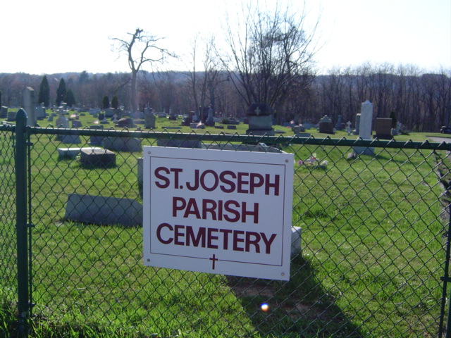
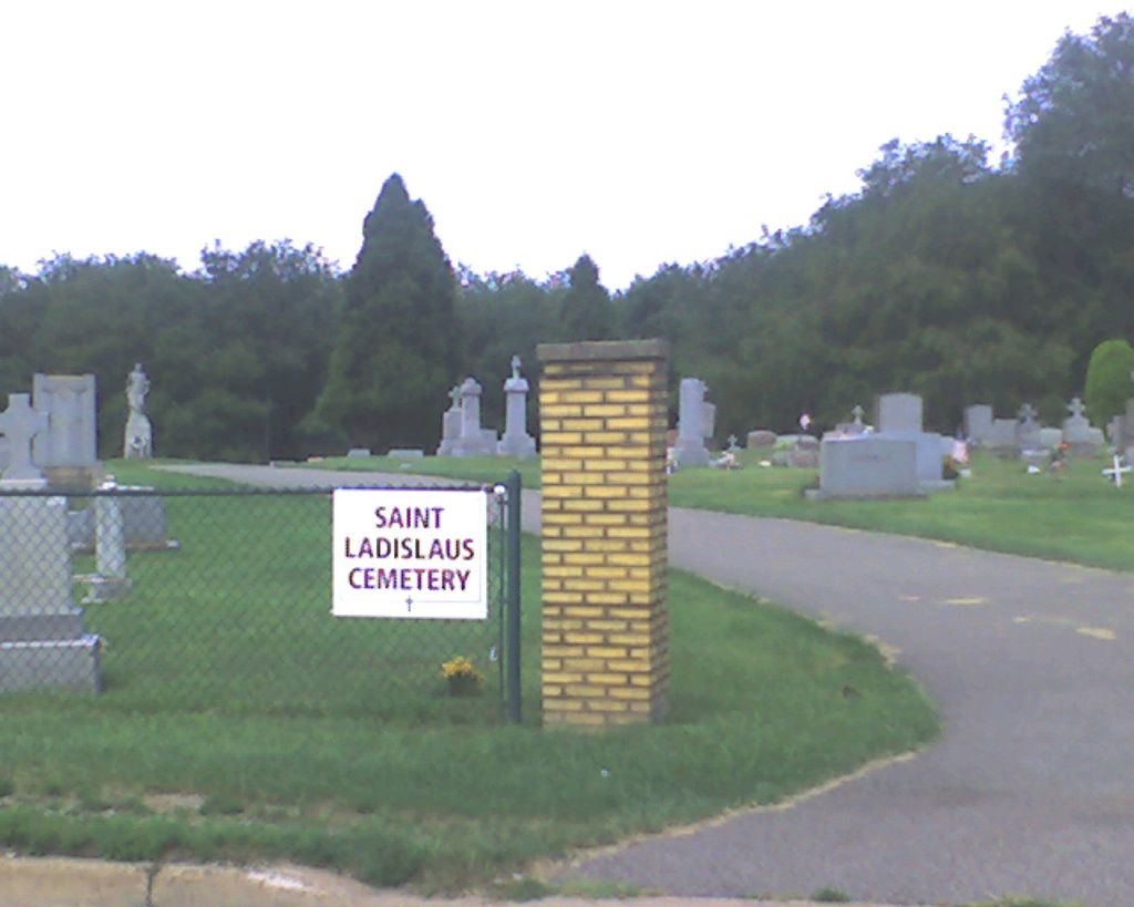
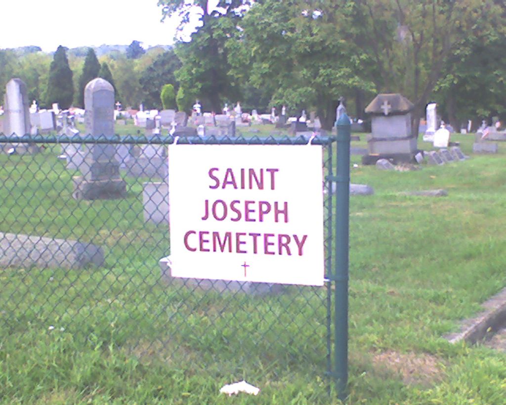
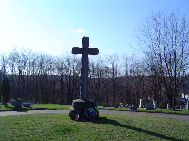
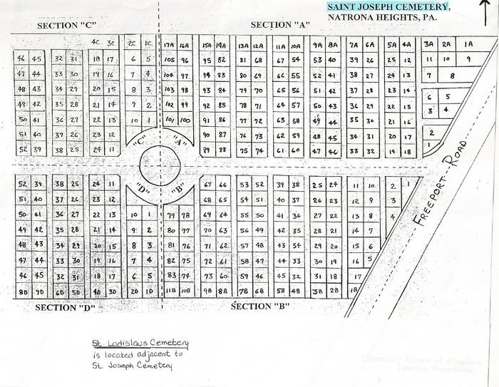
| Description | : | St. Joseph Parish Cemetery is the combination of two separate cemeteries. Located adjacent to each other in Natrona Heights (Harrison Twp.), Allegheny Co., PA, St. Ladislaus Cemetery and St. Joseph Cemetery were accessible by unconnected driveways, but there was no dividing fence between them. A merger of the church parishes brought a merger of the cemeteries. St. Joseph Roman Catholic Church was founded in 1868 in Natrona (Harrison Twp., Allegheny Co., PA) on land donated by Penn Salt Co. By 1895 the church had purchased land and began construction of a new church, school, rectory, and convent. When completed the original... Read More |
frequently asked questions (FAQ):
-
Where is Saint Joseph Parish Cemetery?
Saint Joseph Parish Cemetery is located at 2325 & 2401 Freeport Road Natrona Heights, Allegheny County ,Pennsylvania ,USA.
-
Saint Joseph Parish Cemetery cemetery's updated grave count on graveviews.com?
11 memorials
-
Where are the coordinates of the Saint Joseph Parish Cemetery?
Latitude: 40.6316150
Longitude: -79.7158960
Nearby Cemetories:
1. Mount Airy Cemetery
Natrona Heights, Allegheny County, USA
Coordinate: 40.6371994, -79.7089005
2. Pet Haven at Mount Airy
Natrona Heights, Allegheny County, USA
Coordinate: 40.6388615, -79.7090183
3. Burtner Cemetery
Natrona Heights, Allegheny County, USA
Coordinate: 40.6299000, -79.7293000
4. Mount Hope Cemetery
Westmoreland County, USA
Coordinate: 40.6166382, -79.6881180
5. Morrison Cemetery
Lower Burrell, Westmoreland County, USA
Coordinate: 40.6082500, -79.7003600
6. Prospect Cemetery
Brackenridge, Allegheny County, USA
Coordinate: 40.6102982, -79.7472000
7. Brookland Cemetery
Bagdad, Westmoreland County, USA
Coordinate: 40.6493988, -79.6669006
8. Greenwood Memorial Park
Lower Burrell, Westmoreland County, USA
Coordinate: 40.5957985, -79.6849976
9. Bethel Cemetery
Lower Burrell, Westmoreland County, USA
Coordinate: 40.5891991, -79.7292023
10. Beth Jacob Congregational Cemetery
New Kensington, Westmoreland County, USA
Coordinate: 40.5928001, -79.7481995
11. Saint Mary Cemetery
Lower Burrell, Westmoreland County, USA
Coordinate: 40.5868988, -79.6964035
12. Ross Cemetery
Lower Burrell, Westmoreland County, USA
Coordinate: 40.5881190, -79.7422660
13. Puckety UP Church Cemetery
Lower Burrell, Westmoreland County, USA
Coordinate: 40.5787010, -79.6961975
14. Saint Mary's Cemetery
Freeport, Armstrong County, USA
Coordinate: 40.6800003, -79.6781006
15. Freeport Cemetery
Freeport, Armstrong County, USA
Coordinate: 40.6810989, -79.6791992
16. Bethesda Cemetery
Westmoreland County, USA
Coordinate: 40.5833015, -79.6744003
17. Union Cemetery
Arnold, Westmoreland County, USA
Coordinate: 40.5819016, -79.7549973
18. Millerstown Cemetery
Millerstown, Allegheny County, USA
Coordinate: 40.6491013, -79.7982025
19. Pine Run Presbyterian Church Cemetery
Markle, Westmoreland County, USA
Coordinate: 40.5811005, -79.6417007
20. Sober Hill Cemetery
Leechburg, Armstrong County, USA
Coordinate: 40.6650760, -79.6245240
21. Leechburg Cemetery
Leechburg, Armstrong County, USA
Coordinate: 40.6320220, -79.6064030
22. Murphys Cemetery
Armstrong County, USA
Coordinate: 40.6935997, -79.6425018
23. Logans Ferry UP Church Cemetery
Parnassus, Westmoreland County, USA
Coordinate: 40.5539080, -79.7591810
24. Round Hill Cemetery
New Kensington, Westmoreland County, USA
Coordinate: 40.5529060, -79.7620316