| Memorials | : | 4 |
| Location | : | Oneida, Clay County, USA |
| Coordinate | : | 37.2517600, -83.5994800 |
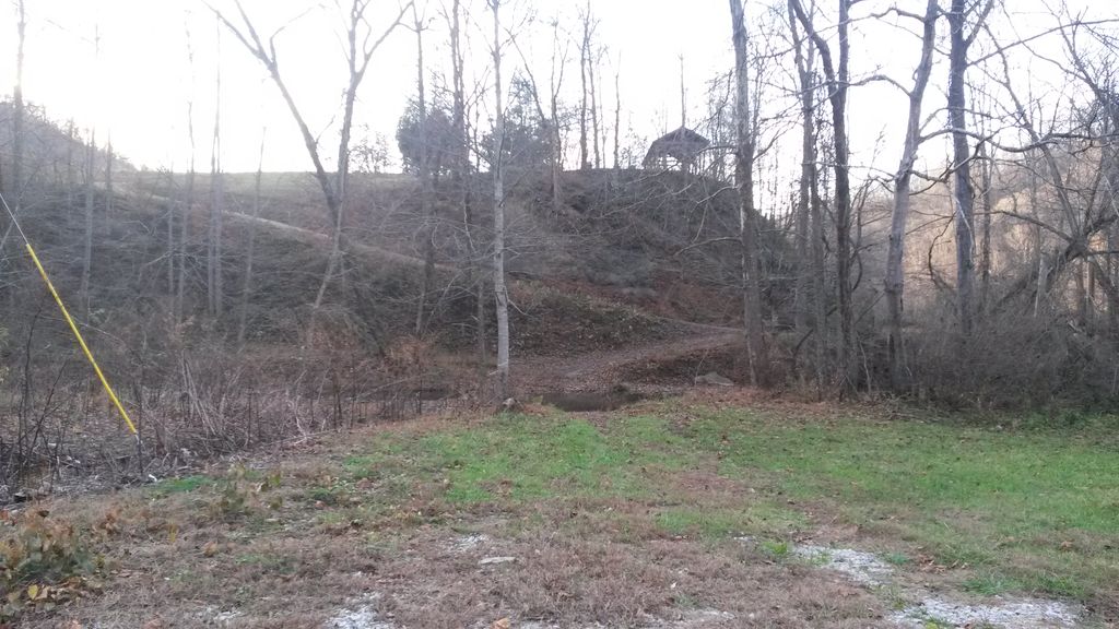
| Description | : | This cemetery is located on Route 1482 about four miles southeast of Oneida, Clay County, Kentucky. It is situated on top of a hill directly across Big Bullskin Creek from the old home of Roland Hunter Davidson.The graves are in no specific order, some are identified by initials and there are several unmarked graves on the east side of the cemetery. (info. taken from RootsWeb courtesy of Ralph Hamblin) |
frequently asked questions (FAQ):
-
Where is R H Davidson Cemetery?
R H Davidson Cemetery is located at KY-1482 Oneida, Clay County ,Kentucky , 40972USA.
-
R H Davidson Cemetery cemetery's updated grave count on graveviews.com?
4 memorials
-
Where are the coordinates of the R H Davidson Cemetery?
Latitude: 37.2517600
Longitude: -83.5994800
Nearby Cemetories:
1. Burns-Davidson Cemetery
Brutus, Clay County, USA
Coordinate: 37.2461100, -83.5948400
2. Vernon Burns Family Cemetery
Oneida, Clay County, USA
Coordinate: 37.2503360, -83.6164050
3. L H Burns Cemetery
Oneida, Clay County, USA
Coordinate: 37.2571100, -83.6164300
4. Andrew Burns Cemetery
Oneida, Clay County, USA
Coordinate: 37.2561400, -83.6216500
5. Little Bullskin Cemetery
Brutus, Clay County, USA
Coordinate: 37.2732600, -83.5908800
6. Flatwoods Cemetery
Spurlock, Clay County, USA
Coordinate: 37.2260100, -83.6114500
7. Burns Cemetery
Oneida, Clay County, USA
Coordinate: 37.2721200, -83.6241500
8. Martin-Davidson Cemetery
Oneida, Clay County, USA
Coordinate: 37.2486800, -83.6348100
9. Fairview Cemetery
Panco, Clay County, USA
Coordinate: 37.2461500, -83.5598900
10. Sierra Brooke Hensley Cemetery
Oneida, Clay County, USA
Coordinate: 37.2646960, -83.6373880
11. Brown-Wilson Cemetery
Oneida, Clay County, USA
Coordinate: 37.2606730, -83.6402730
12. Davidson Cemetery
Oneida, Clay County, USA
Coordinate: 37.2362800, -83.6376100
13. Daniel Baker Cemetery
Barcreek, Clay County, USA
Coordinate: 37.2244000, -83.6268700
14. William C Gilbert Cemetery
Spurlock, Clay County, USA
Coordinate: 37.2218800, -83.6235500
15. Reuben Baker Cemetery
Barcreek, Clay County, USA
Coordinate: 37.2251000, -83.6325900
16. Spurlock Cemetery
Barcreek, Clay County, USA
Coordinate: 37.2312000, -83.6394000
17. Phillip Wilson Cemetery
Barcreek, Clay County, USA
Coordinate: 37.2262600, -83.6348400
18. Gibson Family Cemetery
Big Creek, Clay County, USA
Coordinate: 37.2137900, -83.5970800
19. Andy Baker Cemetery
Barcreek, Clay County, USA
Coordinate: 37.2246100, -83.6333700
20. Irvin Hill Cemetery
Oneida, Clay County, USA
Coordinate: 37.2506900, -83.6476100
21. Davidson Cemetery
Oneida, Clay County, USA
Coordinate: 37.2506220, -83.6476240
22. Lincoln Gilbert Cemetery
Spurlock, Clay County, USA
Coordinate: 37.2178100, -83.6276900
23. Herd Cemetery
Barcreek, Clay County, USA
Coordinate: 37.2277910, -83.6427200
24. Oneida Cemetery
Oneida, Clay County, USA
Coordinate: 37.2669200, -83.6516600

