
| Memorials | : | 0 |
| Location | : | Ratley and Upton, Stratford-on-Avon District, England |
| Coordinate | : | 52.1228440, -1.4411190 |
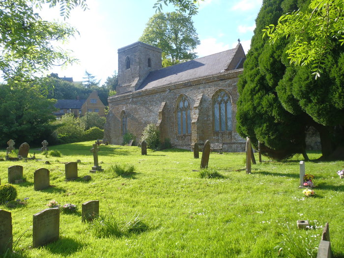
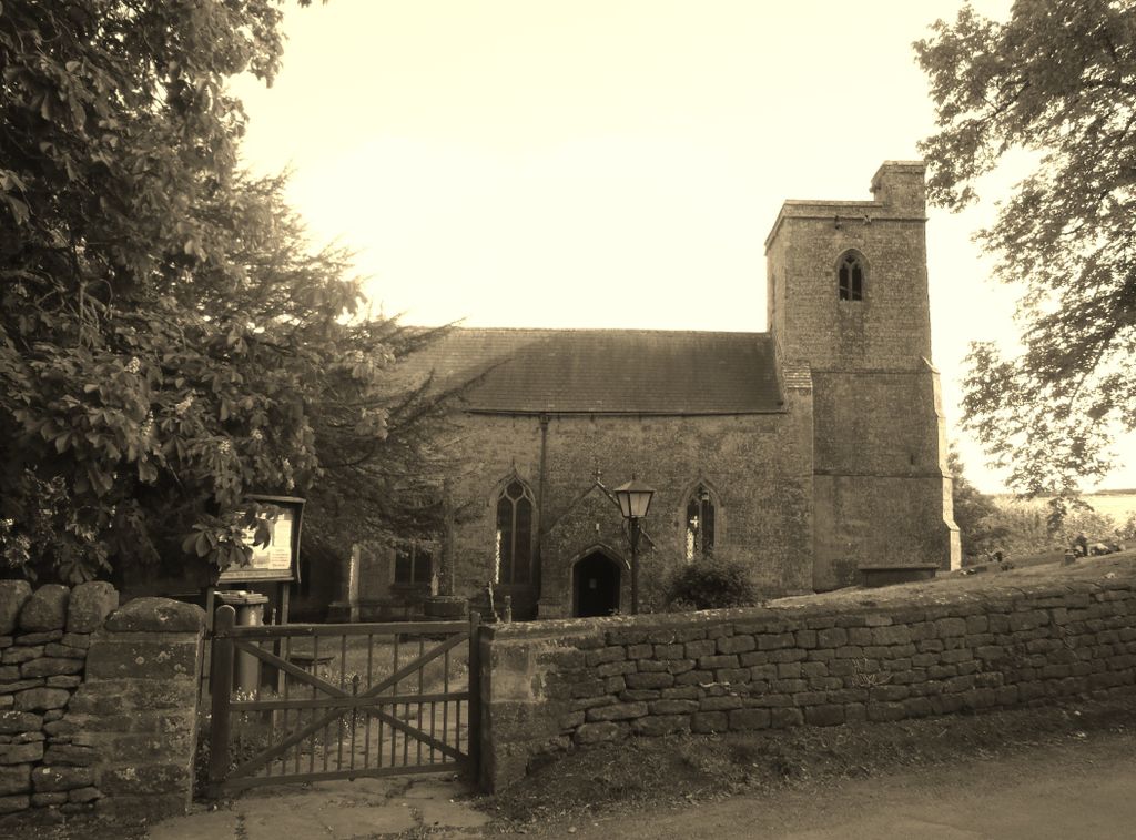
| Description | : | The Church of England parish church is Decorated Gothic and almost all of it was built in the 14th century. It is one of a few churches in England dedicated to St. Peter ad Vincula. In the church is a book where people with the surname of Ratley can sign their names. The Battle of Edge Hill, the first battle of the English Civil War, was fought very near the village |
frequently asked questions (FAQ):
-
Where is Ratley St Peter Ad Vincula Churchyard?
Ratley St Peter Ad Vincula Churchyard is located at High Street Ratley and Upton, Stratford-on-Avon District ,Warwickshire , OX15 6DSEngland.
-
Ratley St Peter Ad Vincula Churchyard cemetery's updated grave count on graveviews.com?
0 memorials
-
Where are the coordinates of the Ratley St Peter Ad Vincula Churchyard?
Latitude: 52.1228440
Longitude: -1.4411190
Nearby Cemetories:
1. St Peter Church
Radway, Stratford-on-Avon District, England
Coordinate: 52.1298000, -1.4636000
2. St. John's Churchyard
Hornton, Cherwell District, England
Coordinate: 52.1020090, -1.4287560
3. St Michael Churchyard
Warmington, Stratford-on-Avon District, England
Coordinate: 52.1241420, -1.4028940
4. St. Joseph's Churchyard
Avon Dassett, Stratford-on-Avon District, England
Coordinate: 52.1464266, -1.4020356
5. St. John The Baptist Churchyard
Avon Dassett, Stratford-on-Avon District, England
Coordinate: 52.1479847, -1.4002128
6. St Michael and All Angels Churchyard
Alkerton, Cherwell District, England
Coordinate: 52.0834080, -1.4509680
7. All Saints Churchyard
Burton Dassett, Stratford-on-Avon District, England
Coordinate: 52.1609570, -1.4200750
8. St. Laurence Churchyard
Shotteswell, Stratford-on-Avon District, England
Coordinate: 52.1061720, -1.3787950
9. St Etheldreda Churchyard
Horley, Cherwell District, England
Coordinate: 52.0924610, -1.3930320
10. St Mary's churchyard
Tysoe, Stratford-on-Avon District, England
Coordinate: 52.0966300, -1.5036400
11. St. Botolph's Churchyard
Farnborough, Stratford-on-Avon District, England
Coordinate: 52.1427340, -1.3675320
12. All Saint's Churchyard
Mollington, Cherwell District, England
Coordinate: 52.1238200, -1.3557600
13. St Peter and St Clare Churchyard
Fenny Compton, Stratford-on-Avon District, England
Coordinate: 52.1657924, -1.3919803
14. St Peter's Churchyard
Kineton, Stratford-on-Avon District, England
Coordinate: 52.1570720, -1.5107830
15. St. Peters Churchyard
Hanwell, Cherwell District, England
Coordinate: 52.0887920, -1.3657000
16. All Saints Churchyard
Wroxton, Cherwell District, England
Coordinate: 52.0726220, -1.3925790
17. Gaydon Cemetery
Gaydon, Stratford-on-Avon District, England
Coordinate: 52.1796880, -1.4632870
18. All Saints Churchyard
Chadshunt, Stratford-on-Avon District, England
Coordinate: 52.1743200, -1.4906810
19. St Peter and St Paul Churchyard
Butlers Marston, Stratford-on-Avon District, England
Coordinate: 52.1469300, -1.5329250
20. St Lawrence C of E Churchyard
Oxhill, Stratford-on-Avon District, England
Coordinate: 52.1071350, -1.5383597
21. St. Giles Churchyard
Gaydon, Stratford-on-Avon District, England
Coordinate: 52.1825900, -1.4683490
22. St Peter's Churchyard
Drayton, Cherwell District, England
Coordinate: 52.0707360, -1.3764670
23. All Saints' Church Great Bourton
Bourton, Cherwell District, England
Coordinate: 52.1062460, -1.3349970
24. St Anne's Parish Church
Epwell, Cherwell District, England
Coordinate: 52.0615780, -1.4866280