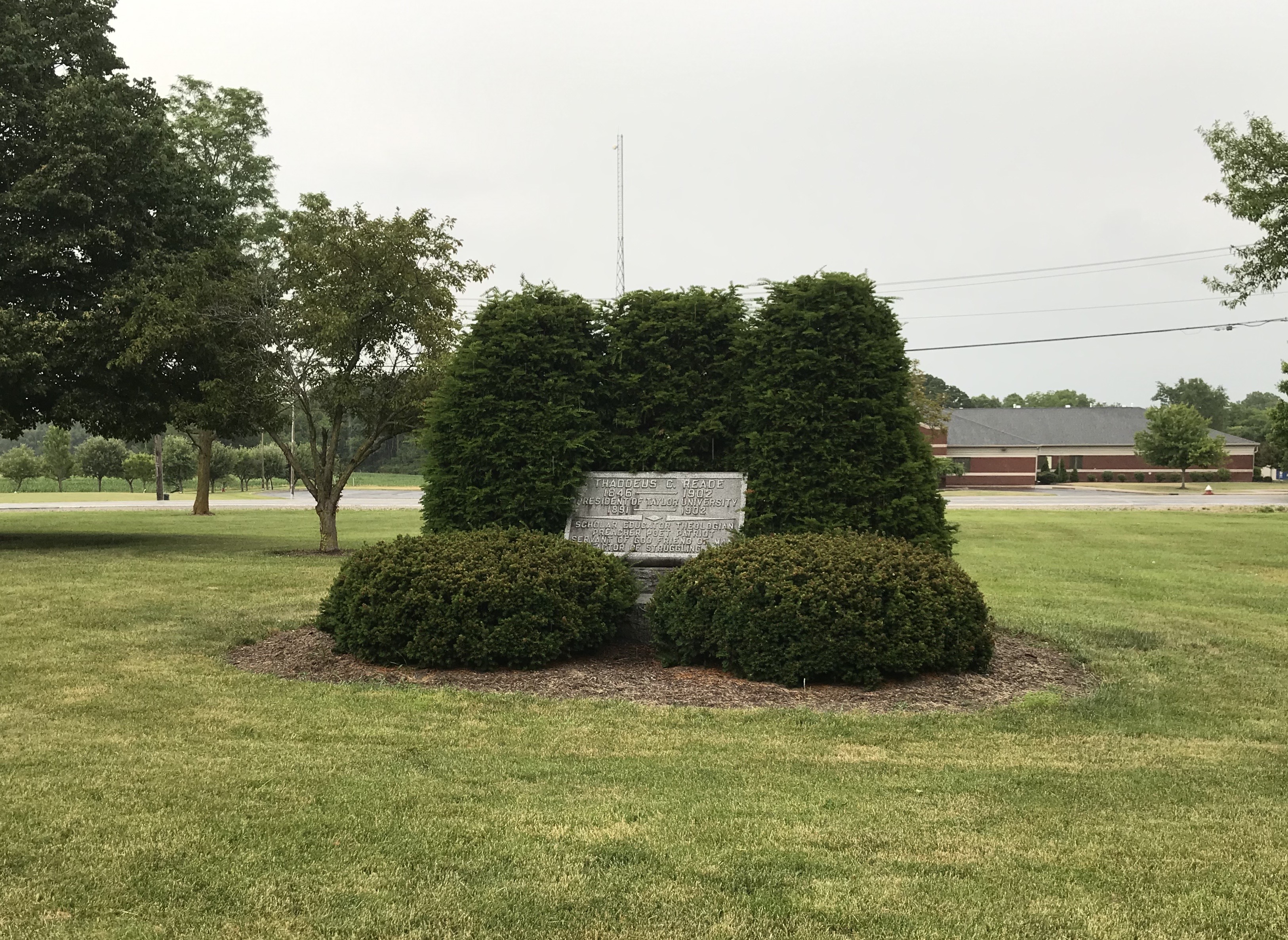
| Memorials | : | 1 |
| Location | : | Upland, Grant County, USA |
| Coordinate | : | 40.4579590, -85.4944370 |
| Description | : | The burial site is located on the Taylor University campus east of the Admissions Office on the east side of Vayhinger Circle about 0.1 miles south of its intersection with W Reade Avenue. Indiana Cemetery Locations, Volume 2, published by the Indiana Genealogical Society (01 April 2006), gives the primary cemetery name as Reade Cemetery. The cemetery is listed in the Cemetery and Burial Grounds Registry of the Indiana Department of Natural Resources (DNR) and in the State Historical Architectural and Archaeological Research Database (SHAARD) with Cemetery Record Number CR-27-32 (Reade Grave). |
frequently asked questions (FAQ):
-
Where is Reade Burial Site?
Reade Burial Site is located at Vayhinger Circle Upland, Grant County ,Indiana , 46989USA.
-
Reade Burial Site cemetery's updated grave count on graveviews.com?
1 memorials
-
Where are the coordinates of the Reade Burial Site?
Latitude: 40.4579590
Longitude: -85.4944370
Nearby Cemetories:
1. Shiloh Cemetery
Upland, Grant County, USA
Coordinate: 40.4371986, -85.4843979
2. Mittank Cemetery
Upland, Grant County, USA
Coordinate: 40.4358177, -85.5134506
3. Ballinger Cemetery
Upland, Grant County, USA
Coordinate: 40.4774437, -85.5230713
4. Jefferson Cemetery
Upland, Grant County, USA
Coordinate: 40.4801941, -85.5239792
5. Atkinson Cemetery
Upland, Grant County, USA
Coordinate: 40.5003560, -85.5020860
6. Levengood Cemetery
Upland, Grant County, USA
Coordinate: 40.5080643, -85.4653931
7. Miles Cemetery
Hartford City, Blackford County, USA
Coordinate: 40.4795303, -85.4271317
8. Leffler Cemetery
Washington Township, Blackford County, USA
Coordinate: 40.4996400, -85.4454880
9. Hults Cemetery
Upland, Grant County, USA
Coordinate: 40.5224020, -85.5048540
10. McCormick Cemetery
Jonesboro, Grant County, USA
Coordinate: 40.4546967, -85.5833054
11. Harmony Cemetery
Matthews, Grant County, USA
Coordinate: 40.3901176, -85.5093613
12. Matthews IOOF Cemetery
Matthews, Grant County, USA
Coordinate: 40.3889694, -85.4879227
13. Shields Cemetery
Hartford City, Blackford County, USA
Coordinate: 40.4822830, -85.4018490
14. Blackford County Farm Cemetery
Licking Township, Blackford County, USA
Coordinate: 40.4091520, -85.4144360
15. Bethel Cemetery
Jonesboro, Grant County, USA
Coordinate: 40.4557910, -85.5971240
16. Oak Chapel Cemetery
Upland, Grant County, USA
Coordinate: 40.5324135, -85.4578934
17. Cunningham Cemetery
Shamrock Lakes, Blackford County, USA
Coordinate: 40.4118300, -85.4080300
18. Olive Branch Cemetery
Washington Township, Delaware County, USA
Coordinate: 40.3786011, -85.4728012
19. Gas City Cemetery
Gas City, Grant County, USA
Coordinate: 40.4803960, -85.6023840
20. Elizabethtown Cemetery
Washington Township, Delaware County, USA
Coordinate: 40.3767014, -85.4511032
21. Puckett Cemetery
Marion, Grant County, USA
Coordinate: 40.5246544, -85.5733109
22. Walnut Creek Cemetery
Gas City, Grant County, USA
Coordinate: 40.4949570, -85.6062170
23. Stoll Cemetery
Washington Township, Blackford County, USA
Coordinate: 40.5046980, -85.3868470
24. Kelly Cemetery
Washington Township, Blackford County, USA
Coordinate: 40.5342770, -85.4191110

