
| Memorials | : | 0 |
| Location | : | Washington Township, Blackford County, USA |
| Coordinate | : | 40.5046980, -85.3868470 |
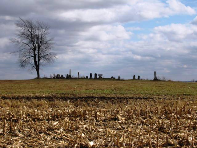
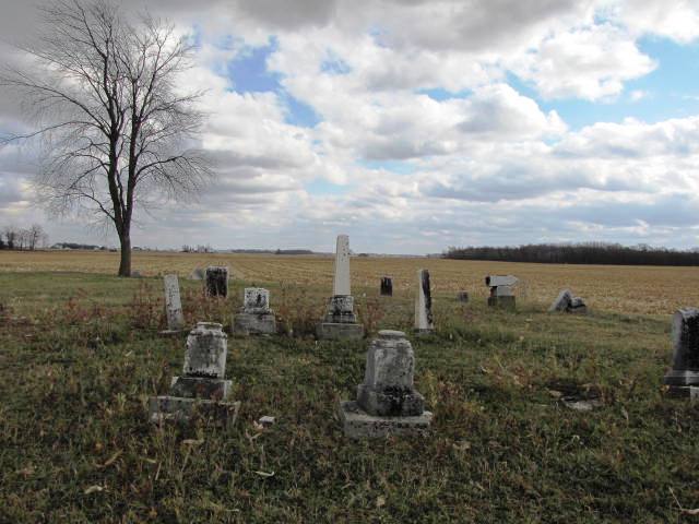
| Description | : | The cemetery is located in Washington Township (NW quadrant of the SW quadrant of the NW quadrant of Section 27 Township 24N Range 10E) on the east side of N County Road 100 W about 0.25 miles south of its intersection with W County Road 400 N. Indiana Cemetery Locations, Volume 2, published by the Indiana Genealogical Society (01 April 2006), gives the primary cemetery name as Hadden Cemetery with an alternate name of Stoll Cemetery. The cemetery is listed in the Cemetery and Burial Grounds Registry of the Indiana Department of Natural Resources (DNR) and in the... Read More |
frequently asked questions (FAQ):
-
Where is Stoll Cemetery?
Stoll Cemetery is located at N County Road 100 W Washington Township, Blackford County ,Indiana , 47348USA.
-
Stoll Cemetery cemetery's updated grave count on graveviews.com?
0 memorials
-
Where are the coordinates of the Stoll Cemetery?
Latitude: 40.5046980
Longitude: -85.3868470
Nearby Cemetories:
1. Shields Cemetery
Hartford City, Blackford County, USA
Coordinate: 40.4822830, -85.4018490
2. Center Cemetery
Roll, Blackford County, USA
Coordinate: 40.5305430, -85.3895290
3. Herbaugh Cemetery
Hartford City, Blackford County, USA
Coordinate: 40.5008200, -85.3390700
4. Kelly Cemetery
Washington Township, Blackford County, USA
Coordinate: 40.5342770, -85.4191110
5. Miles Cemetery
Hartford City, Blackford County, USA
Coordinate: 40.4795303, -85.4271317
6. Leffler Cemetery
Washington Township, Blackford County, USA
Coordinate: 40.4996400, -85.4454880
7. Roll Cemetery
Roll, Blackford County, USA
Coordinate: 40.5520287, -85.3950500
8. Penrod Cemetery
Montpelier, Blackford County, USA
Coordinate: 40.5161781, -85.3231201
9. Lockett Cemetery
Washington Township, Blackford County, USA
Coordinate: 40.5565240, -85.3756020
10. Schmidt Cemetery
Roll, Blackford County, USA
Coordinate: 40.5585136, -85.3850555
11. North Cemetery (Defunct)
Hartford City, Blackford County, USA
Coordinate: 40.4542000, -85.3611000
12. Willman Cemetery
Hartford City, Blackford County, USA
Coordinate: 40.4563599, -85.3487091
13. Baptist Cemetery (Defunct)
Hartford City, Blackford County, USA
Coordinate: 40.4504840, -85.3610550
14. Lion Cemetery
Licking Township, Blackford County, USA
Coordinate: 40.4591850, -85.3386640
15. Levengood Cemetery
Upland, Grant County, USA
Coordinate: 40.5080643, -85.4653931
16. Oak Chapel Cemetery
Upland, Grant County, USA
Coordinate: 40.5324135, -85.4578934
17. Hartford City Cemetery
Hartford City, Blackford County, USA
Coordinate: 40.4499760, -85.3515060
18. Goghnaur Cemetery
Jackson Township, Blackford County, USA
Coordinate: 40.4732900, -85.3100000
19. Balsley Cemetery
Hartford City, Blackford County, USA
Coordinate: 40.5635750, -85.4321520
20. Asbury United Methodist Cemetery
Wells County, USA
Coordinate: 40.5816650, -85.3722229
21. Atkinson Cemetery
Upland, Grant County, USA
Coordinate: 40.5003560, -85.5020860
22. Hults Cemetery
Upland, Grant County, USA
Coordinate: 40.5224020, -85.5048540
23. Reade Burial Site
Upland, Grant County, USA
Coordinate: 40.4579590, -85.4944370
24. Cunningham Cemetery
Shamrock Lakes, Blackford County, USA
Coordinate: 40.4118300, -85.4080300