
| Memorials | : | 0 |
| Location | : | Hartford City, Blackford County, USA |
| Coordinate | : | 40.4822830, -85.4018490 |
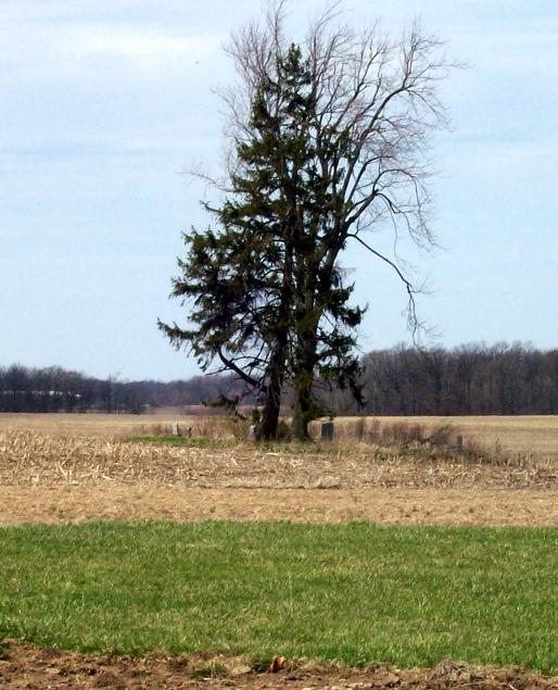
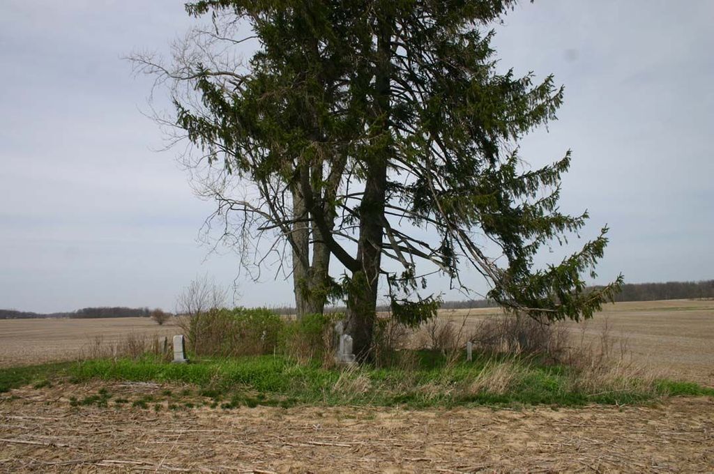
| Description | : | The cemetery is located in Washington Township (NW quadrant of the SE quadrant of the SW quadrant of Section 33 Township 24N Range 10E) about 1050 feet north of County Road 200 N about 0.6 miles west of its intersection with N County Road 100 W. Indiana Cemetery Locations, Volume 2, published by the Indiana Genealogical Society (01 April 2006), gives the primary cemetery name as Shields Cemetery. The cemetery is listed in the Cemetery and Burial Grounds Registry of the Indiana Department of Natural Resources (DNR) and in the State Historical Architectural and Archaeological Research Database (SHAARD)... Read More |
frequently asked questions (FAQ):
-
Where is Shields Cemetery?
Shields Cemetery is located at County Road 200 N Hartford City, Blackford County ,Indiana , 47348USA.
-
Shields Cemetery cemetery's updated grave count on graveviews.com?
0 memorials
-
Where are the coordinates of the Shields Cemetery?
Latitude: 40.4822830
Longitude: -85.4018490
Nearby Cemetories:
1. Miles Cemetery
Hartford City, Blackford County, USA
Coordinate: 40.4795303, -85.4271317
2. Stoll Cemetery
Washington Township, Blackford County, USA
Coordinate: 40.5046980, -85.3868470
3. Leffler Cemetery
Washington Township, Blackford County, USA
Coordinate: 40.4996400, -85.4454880
4. North Cemetery (Defunct)
Hartford City, Blackford County, USA
Coordinate: 40.4542000, -85.3611000
5. Baptist Cemetery (Defunct)
Hartford City, Blackford County, USA
Coordinate: 40.4504840, -85.3610550
6. Willman Cemetery
Hartford City, Blackford County, USA
Coordinate: 40.4563599, -85.3487091
7. Center Cemetery
Roll, Blackford County, USA
Coordinate: 40.5305430, -85.3895290
8. Hartford City Cemetery
Hartford City, Blackford County, USA
Coordinate: 40.4499760, -85.3515060
9. Herbaugh Cemetery
Hartford City, Blackford County, USA
Coordinate: 40.5008200, -85.3390700
10. Lion Cemetery
Licking Township, Blackford County, USA
Coordinate: 40.4591850, -85.3386640
11. Kelly Cemetery
Washington Township, Blackford County, USA
Coordinate: 40.5342770, -85.4191110
12. Levengood Cemetery
Upland, Grant County, USA
Coordinate: 40.5080643, -85.4653931
13. Oak Chapel Cemetery
Upland, Grant County, USA
Coordinate: 40.5324135, -85.4578934
14. Penrod Cemetery
Montpelier, Blackford County, USA
Coordinate: 40.5161781, -85.3231201
15. Roll Cemetery
Roll, Blackford County, USA
Coordinate: 40.5520287, -85.3950500
16. Goghnaur Cemetery
Jackson Township, Blackford County, USA
Coordinate: 40.4732900, -85.3100000
17. Cunningham Cemetery
Shamrock Lakes, Blackford County, USA
Coordinate: 40.4118300, -85.4080300
18. Blackford County Farm Cemetery
Licking Township, Blackford County, USA
Coordinate: 40.4091520, -85.4144360
19. Reade Burial Site
Upland, Grant County, USA
Coordinate: 40.4579590, -85.4944370
20. Lockett Cemetery
Washington Township, Blackford County, USA
Coordinate: 40.5565240, -85.3756020
21. Schmidt Cemetery
Roll, Blackford County, USA
Coordinate: 40.5585136, -85.3850555
22. Shiloh Cemetery
Upland, Grant County, USA
Coordinate: 40.4371986, -85.4843979
23. Atkinson Cemetery
Upland, Grant County, USA
Coordinate: 40.5003560, -85.5020860
24. Sprague Cemetery
Hartford City, Blackford County, USA
Coordinate: 40.4054060, -85.3746060