
| Memorials | : | 0 |
| Location | : | Morley, Metropolitan Borough of Leeds, England |
| Coordinate | : | 53.7488403, -1.6048510 |
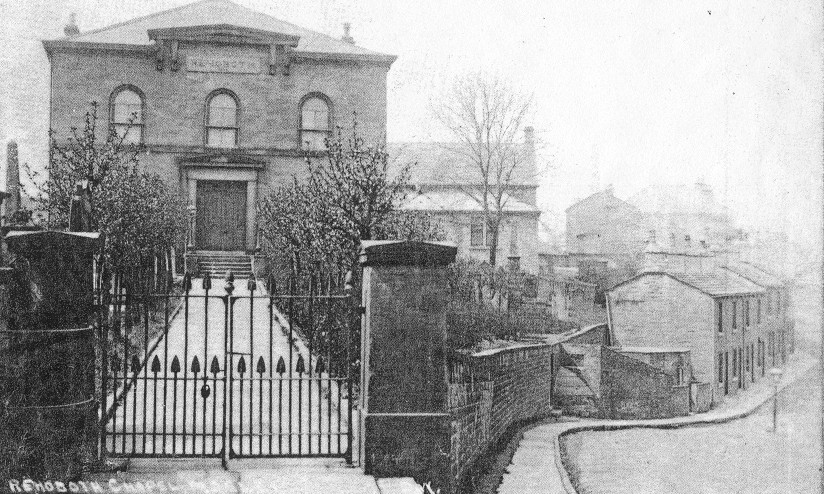
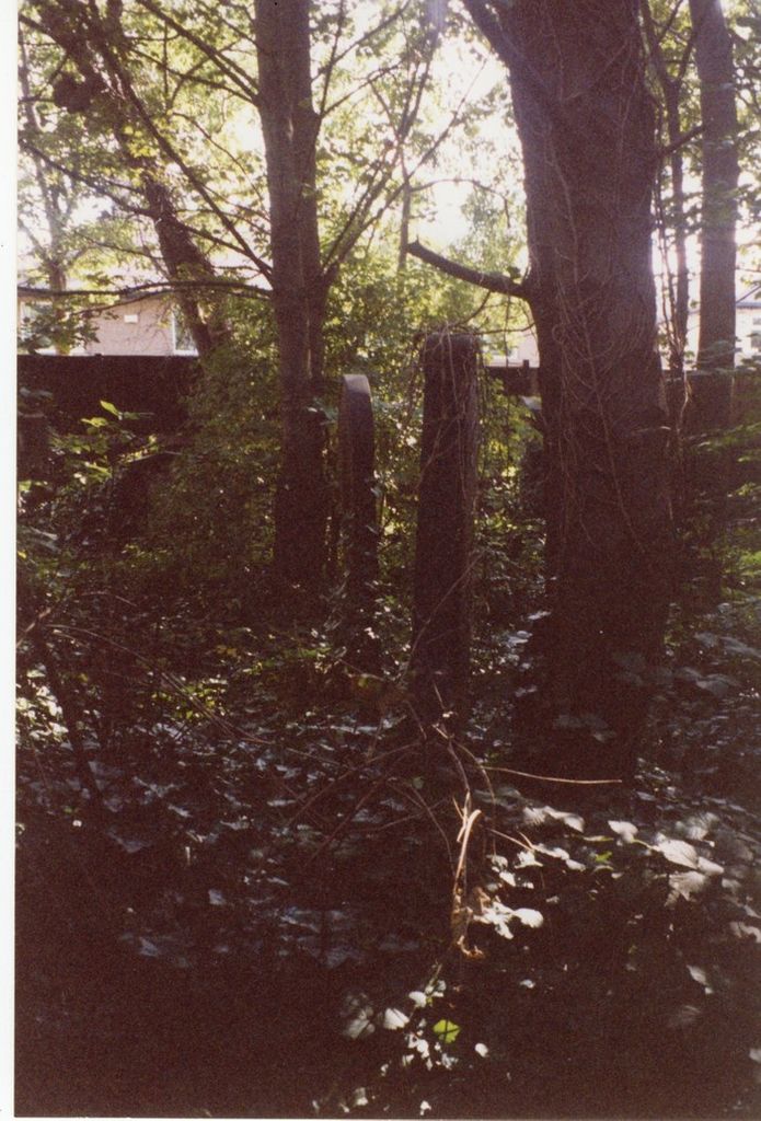
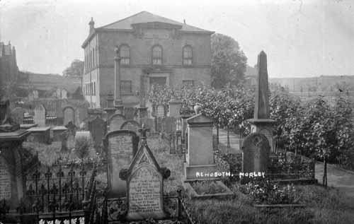
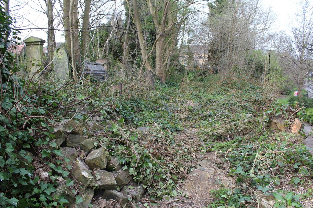
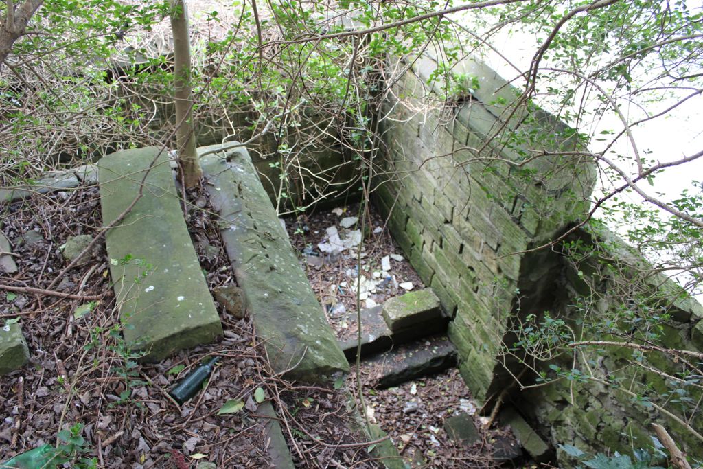
| Description | : | Morley (near Leeds), Yorkshire, England. Dawson Lane and Brunswick St. Located at the top of Dawson Hill, the burial ground was connected to the old, now defunct, Rehoboth Independent Chapel. It is abandoned and nearly all tombstones are overgrown with trees and massive amounts of wild ivy. The burial ground is divided into two sections,divided by a modern parking lot. |
frequently asked questions (FAQ):
-
Where is Rehoboth Independent Chapel Burial Ground?
Rehoboth Independent Chapel Burial Ground is located at Morley, Metropolitan Borough of Leeds ,West Yorkshire ,England.
-
Rehoboth Independent Chapel Burial Ground cemetery's updated grave count on graveviews.com?
0 memorials
-
Where are the coordinates of the Rehoboth Independent Chapel Burial Ground?
Latitude: 53.7488403
Longitude: -1.6048510

Nearby Cemetories:
1. St Mary in the Wood Churchyard
Morley, Metropolitan Borough of Leeds, England
Coordinate: 53.7477900, -1.6015600
2. Banks Hill Wesleyan Methodist Chapelyard
Morley, Metropolitan Borough of Leeds, England
Coordinate: 53.7495480, -1.6000880
3. Zion Independent Chapel Cemetery
Morley, Metropolitan Borough of Leeds, England
Coordinate: 53.7447500, -1.6021900
4. St Peter Churchyard
Morley, Metropolitan Borough of Leeds, England
Coordinate: 53.7527430, -1.6006510
5. Central Methodist Churchyard
Morley, Metropolitan Borough of Leeds, England
Coordinate: 53.7440900, -1.6008100
6. Morley Cemetery
Morley, Metropolitan Borough of Leeds, England
Coordinate: 53.7458687, -1.6174150
7. St. Andrew's Parish Church, Bruntcliffe
Morley, Metropolitan Borough of Leeds, England
Coordinate: 53.7394270, -1.6162170
8. Daffil Chapel Cemetery
Churwell, Metropolitan Borough of Leeds, England
Coordinate: 53.7602100, -1.5921100
9. Topcliffe Congregational Chapelyard
Tingley, Metropolitan Borough of Leeds, England
Coordinate: 53.7394380, -1.5811710
10. Friends Burial Ground
Gildersome, Metropolitan Borough of Leeds, England
Coordinate: 53.7574920, -1.6325950
11. St. Peter's Churchyard
Gildersome, Metropolitan Borough of Leeds, England
Coordinate: 53.7592020, -1.6335180
12. United Hebrew Congregation Cemetery
Gildersome, Metropolitan Borough of Leeds, England
Coordinate: 53.7682170, -1.5974320
13. Gildersome Cemetery
Gildersome, Metropolitan Borough of Leeds, England
Coordinate: 53.7589030, -1.6345120
14. Beth Hamedrash Hagadol Jewish Cemetery
Gildersome, Metropolitan Borough of Leeds, England
Coordinate: 53.7698580, -1.5939460
15. Gildersome Baptist Churchyard
Gildersome, Metropolitan Borough of Leeds, England
Coordinate: 53.7614030, -1.6363030
16. Hill Top Jewish Cemetery
Leeds, Metropolitan Borough of Leeds, England
Coordinate: 53.7729490, -1.5964940
17. Tingley Burial Ground
Tingley, Metropolitan Borough of Leeds, England
Coordinate: 53.7286210, -1.5789120
18. New Farnley Jewish Cemetery
New Farnley, Metropolitan Borough of Leeds, England
Coordinate: 53.7711990, -1.6305990
19. Cottingley Hall Cemetery and Crematorium
Beeston, Metropolitan Borough of Leeds, England
Coordinate: 53.7716480, -1.5802520
20. St Mary the Virgin Churchyard
Woodkirk, Metropolitan Borough of Leeds, England
Coordinate: 53.7207590, -1.5896010
21. Zion New Methodist Churchyard
Adwalton, Metropolitan Borough of Leeds, England
Coordinate: 53.7542200, -1.6553510
22. Nethertown United Reformed Churchyard
Drighlington, Metropolitan Borough of Leeds, England
Coordinate: 53.7596520, -1.6534150
23. St. Mary the Virgin Churchyard
Beeston, Metropolitan Borough of Leeds, England
Coordinate: 53.7730820, -1.5667070
24. Beeston Cemetery
Beeston, Metropolitan Borough of Leeds, England
Coordinate: 53.7737300, -1.5647100