
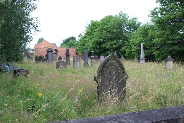
| Memorials | : | 1 |
| Location | : | Morley, Metropolitan Borough of Leeds, England |
| Coordinate | : | 53.7447500, -1.6021900 |
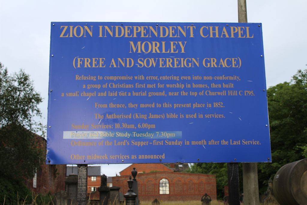
| Description | : | The Zion Chapel cemetery is situated between the Morrisons supermarket car park and the Wesley Mill. |
frequently asked questions (FAQ):
-
Where is Zion Independent Chapel Cemetery?
Zion Independent Chapel Cemetery is located at Merlyn-Rees Ave, off Wesley Street Morley, Metropolitan Borough of Leeds ,West Yorkshire , LS27 9SLEngland.
-
Zion Independent Chapel Cemetery cemetery's updated grave count on graveviews.com?
1 memorials
-
Where are the coordinates of the Zion Independent Chapel Cemetery?
Latitude: 53.7447500
Longitude: -1.6021900
Nearby Cemetories:
1. Central Methodist Churchyard
Morley, Metropolitan Borough of Leeds, England
Coordinate: 53.7440900, -1.6008100
2. St Mary in the Wood Churchyard
Morley, Metropolitan Borough of Leeds, England
Coordinate: 53.7477900, -1.6015600
3. Rehoboth Independent Chapel Burial Ground
Morley, Metropolitan Borough of Leeds, England
Coordinate: 53.7488403, -1.6048510
4. Banks Hill Wesleyan Methodist Chapelyard
Morley, Metropolitan Borough of Leeds, England
Coordinate: 53.7495480, -1.6000880
5. St Peter Churchyard
Morley, Metropolitan Borough of Leeds, England
Coordinate: 53.7527430, -1.6006510
6. Morley Cemetery
Morley, Metropolitan Borough of Leeds, England
Coordinate: 53.7458687, -1.6174150
7. St. Andrew's Parish Church, Bruntcliffe
Morley, Metropolitan Borough of Leeds, England
Coordinate: 53.7394270, -1.6162170
8. Topcliffe Congregational Chapelyard
Tingley, Metropolitan Borough of Leeds, England
Coordinate: 53.7394380, -1.5811710
9. Daffil Chapel Cemetery
Churwell, Metropolitan Borough of Leeds, England
Coordinate: 53.7602100, -1.5921100
10. Tingley Burial Ground
Tingley, Metropolitan Borough of Leeds, England
Coordinate: 53.7286210, -1.5789120
11. Friends Burial Ground
Gildersome, Metropolitan Borough of Leeds, England
Coordinate: 53.7574920, -1.6325950
12. St. Peter's Churchyard
Gildersome, Metropolitan Borough of Leeds, England
Coordinate: 53.7592020, -1.6335180
13. United Hebrew Congregation Cemetery
Gildersome, Metropolitan Borough of Leeds, England
Coordinate: 53.7682170, -1.5974320
14. Gildersome Cemetery
Gildersome, Metropolitan Borough of Leeds, England
Coordinate: 53.7589030, -1.6345120
15. St Mary the Virgin Churchyard
Woodkirk, Metropolitan Borough of Leeds, England
Coordinate: 53.7207590, -1.5896010
16. Beth Hamedrash Hagadol Jewish Cemetery
Gildersome, Metropolitan Borough of Leeds, England
Coordinate: 53.7698580, -1.5939460
17. Gildersome Baptist Churchyard
Gildersome, Metropolitan Borough of Leeds, England
Coordinate: 53.7614030, -1.6363030
18. Hill Top Jewish Cemetery
Leeds, Metropolitan Borough of Leeds, England
Coordinate: 53.7729490, -1.5964940
19. Cottingley Hall Cemetery and Crematorium
Beeston, Metropolitan Borough of Leeds, England
Coordinate: 53.7716480, -1.5802520
20. New Farnley Jewish Cemetery
New Farnley, Metropolitan Borough of Leeds, England
Coordinate: 53.7711990, -1.6305990
21. Zion New Methodist Churchyard
Adwalton, Metropolitan Borough of Leeds, England
Coordinate: 53.7542200, -1.6553510
22. Nethertown United Reformed Churchyard
Drighlington, Metropolitan Borough of Leeds, England
Coordinate: 53.7596520, -1.6534150
23. All Saints Churchyard
Batley, Metropolitan Borough of Kirklees, England
Coordinate: 53.7159004, -1.6360000
24. St. Mary the Virgin Churchyard
Beeston, Metropolitan Borough of Leeds, England
Coordinate: 53.7730820, -1.5667070