
| Memorials | : | 15 |
| Location | : | Lowgap, Surry County, USA |
| Coordinate | : | 36.5101929, -80.8920288 |
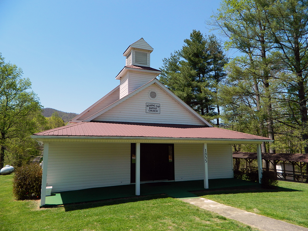
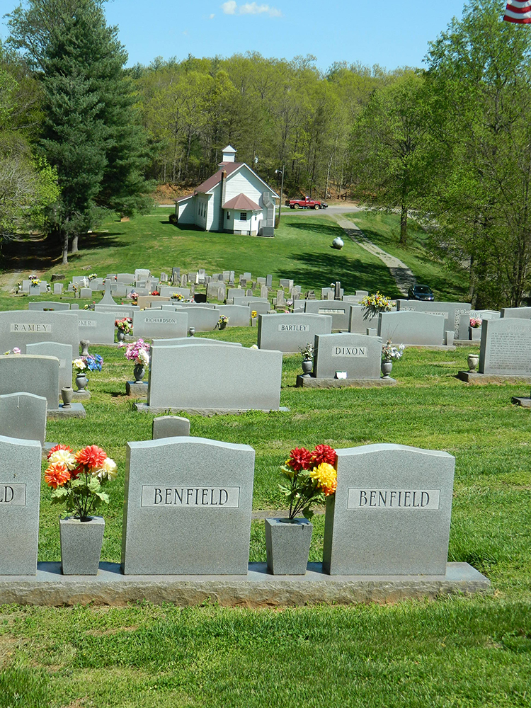
| Description | : | From intersection of US Hwy 52 and NC Hwy 89 in Mt. Airy, NC, go west on NC Hwy 89 for 16.6 miles and take a left on Carson Creek Rd. Proceed on Carson Creek Road for about a mile and veer slightly left on Ramey Creek Road. From that point go about a mile and the church will be on the right and the cemetery will be behind the church. This cemetery and church name are often confused with Roaring Gap Baptist Church which is located in the town of Thurmond, in Wilkes County. |
frequently asked questions (FAQ):
-
Where is Roaring Gap Baptist Church Cemetery?
Roaring Gap Baptist Church Cemetery is located at 1855 Ramey Creek Road Lowgap, Surry County ,North Carolina , 27024USA.
-
Roaring Gap Baptist Church Cemetery cemetery's updated grave count on graveviews.com?
3 memorials
-
Where are the coordinates of the Roaring Gap Baptist Church Cemetery?
Latitude: 36.5101929
Longitude: -80.8920288


Nearby Cemetories:
1. Fishers Gap Church Cemetery
Lowgap, Surry County, USA
Coordinate: 36.5231400, -80.8833923
2. Mountain View Baptist Church Cemetery
Lowgap, Surry County, USA
Coordinate: 36.5197420, -80.8645570
3. Liberty Union Baptist Cemetery
Lowgap, Surry County, USA
Coordinate: 36.5273056, -80.8688583
4. Shinault Family Cemetery
Lowgap, Surry County, USA
Coordinate: 36.5333640, -80.8758540
5. Galyean Family Cemetery
Lowgap, Surry County, USA
Coordinate: 36.5346140, -80.8703660
6. Saddle Mountain Baptist Church Cemetery
Ennice, Alleghany County, USA
Coordinate: 36.5082300, -80.9386300
7. Cockerham Family Cemetery
Lowgap, Surry County, USA
Coordinate: 36.5284720, -80.8465830
8. Cumberland Knob Cemetery
Surry County, USA
Coordinate: 36.5535100, -80.9073400
9. Barker Graveyard
Lowgap, Surry County, USA
Coordinate: 36.5295540, -80.8340600
10. Ladonia Baptist Church Cemetery
Ladonia, Surry County, USA
Coordinate: 36.4780280, -80.8386670
11. Mount Vernon Baptist Church Cemetery
Beulah, Surry County, USA
Coordinate: 36.5003624, -80.8213882
12. Carpenter - Snow Family Cemetery
Dobson, Surry County, USA
Coordinate: 36.4523330, -80.8820280
13. Smith Family Cemetery
Grayson County, USA
Coordinate: 36.5701930, -80.8726180
14. Goodson Cemetery
Grayson County, USA
Coordinate: 36.5688900, -80.8611200
15. Edmonds Cemetery
Edmonds, Alleghany County, USA
Coordinate: 36.5593310, -80.9457070
16. Montgomery Cemetery
Surry County, USA
Coordinate: 36.5439722, -80.8204722
17. Haven of Rest Bible Church Cemetery
Grayson County, USA
Coordinate: 36.5740400, -80.9222210
18. Fairview Memorial Gardens
Low Gap, Grayson County, USA
Coordinate: 36.5784080, -80.9056970
19. Big Springs Regular Baptist Church Cemetery
Delhart, Grayson County, USA
Coordinate: 36.5710090, -80.9352570
20. New Bethel Baptist Church Cemetery
Ladonia, Surry County, USA
Coordinate: 36.4505610, -80.8420590
21. Choate Family Cemetery
Ennice, Alleghany County, USA
Coordinate: 36.4976010, -80.9803910
22. Isaacks Family Cemetery
Mount Airy, Surry County, USA
Coordinate: 36.4621670, -80.8236670
23. Jarrell Family Cemetery
Lowgap, Surry County, USA
Coordinate: 36.5427860, -80.8103660
24. Sarah Isaacs Cemetery
Franklin, Surry County, USA
Coordinate: 36.4636110, -80.8205830