
| Memorials | : | 0 |
| Location | : | Cleopatra, McLean County, USA |
| Coordinate | : | 37.6136000, -87.2814400 |
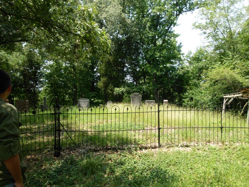
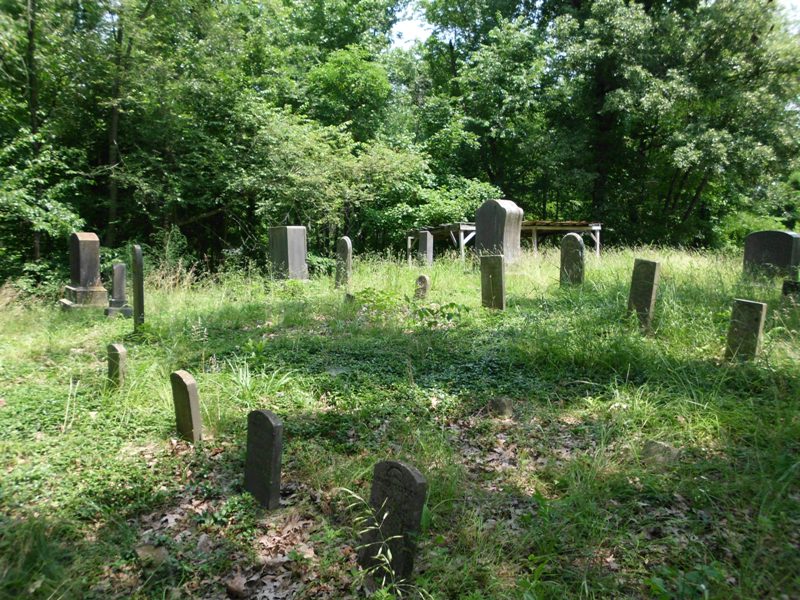
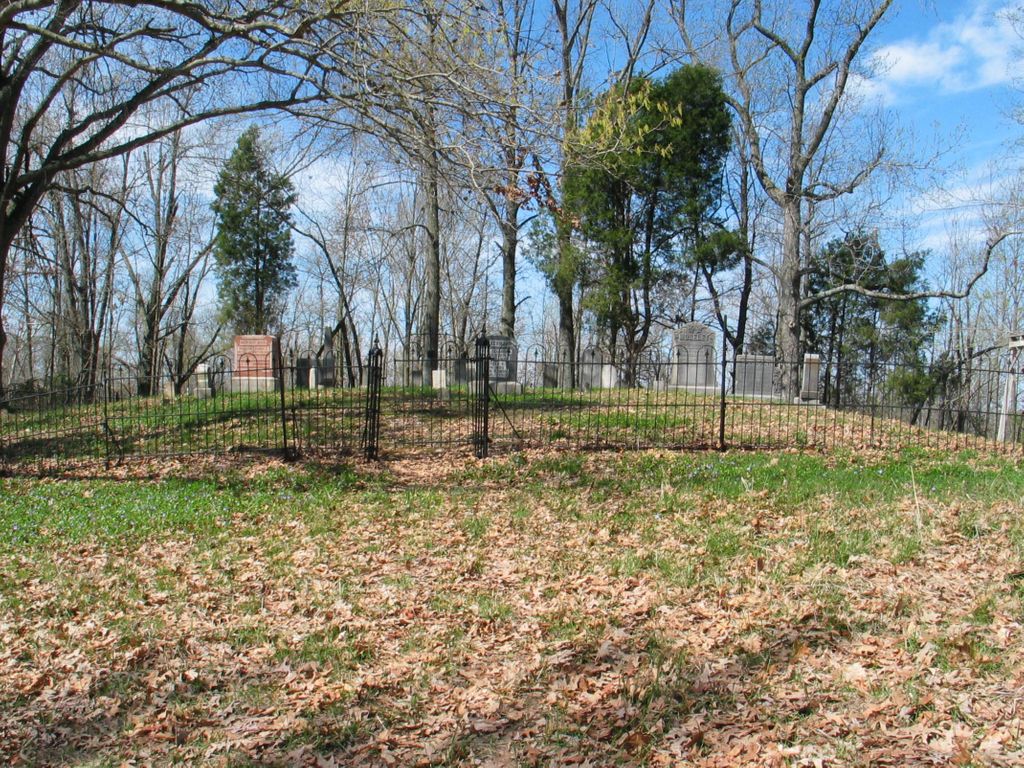
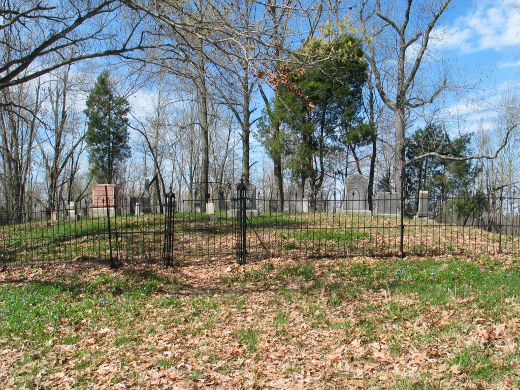
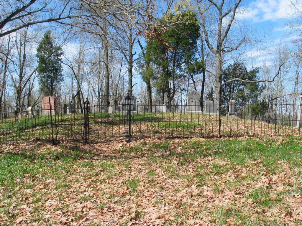
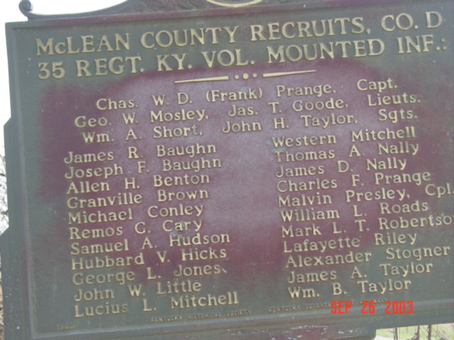
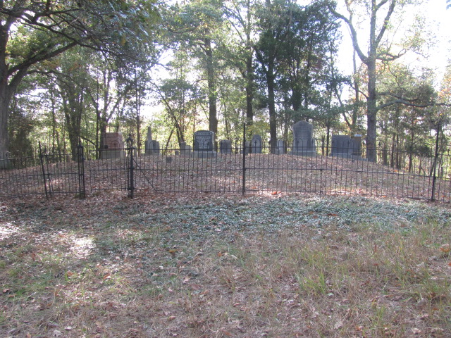
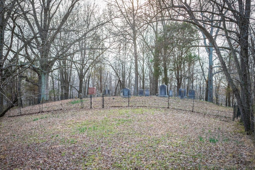
| Description | : | The Robert C. Moseley Family cemetery is on top of a hill, with no signs. The cemetery is off of HWY 140. The entrance is form State HWY 2156, you have to drive across a corn field and up a hill. The cemetery is surrounded by trees on three sides. The nearest community is Cleopatra. |
frequently asked questions (FAQ):
-
Where is Robert C. Moseley Family Cemetery?
Robert C. Moseley Family Cemetery is located at Cleopatra, McLean County ,Kentucky ,USA.
-
Robert C. Moseley Family Cemetery cemetery's updated grave count on graveviews.com?
0 memorials
-
Where are the coordinates of the Robert C. Moseley Family Cemetery?
Latitude: 37.6136000
Longitude: -87.2814400
Nearby Cemetories:
1. Ebenser Church of Christ Cemetery
Guffie, McLean County, USA
Coordinate: 37.5958170, -87.2850090
2. Little Flock Cemetery
West Louisville, Daviess County, USA
Coordinate: 37.6369900, -87.2733300
3. Mount Liberty Baptist Church Cemetery
Wyman, McLean County, USA
Coordinate: 37.6312256, -87.3094635
4. Dabney C Robertson Family Graveyard
Daviess County, USA
Coordinate: 37.6256720, -87.2453760
5. Brushy Fork Cemetery
Panther, Daviess County, USA
Coordinate: 37.6375999, -87.2545013
6. Old Macedonia Cemetery
Daviess County, USA
Coordinate: 37.6489000, -87.2822000
7. Leet-Wilhite Family Cemetery
Guffie, McLean County, USA
Coordinate: 37.6052100, -87.2320000
8. Brushy Fork Cemetery
Guffie, McLean County, USA
Coordinate: 37.6120370, -87.2289600
9. Old Macedonia Cemetery
Panther, Daviess County, USA
Coordinate: 37.6530000, -87.3042000
10. Beulah General Baptist Church Cemetery
McLean County, USA
Coordinate: 37.6285706, -87.3355026
11. Mount Vernon Baptist Church Cemetery
Calhoun, McLean County, USA
Coordinate: 37.5772400, -87.2452011
12. Antioch Presbyterian Church Cemetery
Poverty, McLean County, USA
Coordinate: 37.5950394, -87.3359985
13. New Salem Primitive Baptist Church Cemetery
Beech Grove, McLean County, USA
Coordinate: 37.6372795, -87.3351974
14. Short Family Cemetery
Panther, Daviess County, USA
Coordinate: 37.6387040, -87.2234630
15. Murphy Grave
Panther, Daviess County, USA
Coordinate: 37.6469530, -87.2270990
16. Wilson Cemetery
McLean County, USA
Coordinate: 37.5850370, -87.3401120
17. Mount Zion Methodist Episcopal Church Cemetery
Panther, Daviess County, USA
Coordinate: 37.6638700, -87.2325500
18. Calhoun Cemetery
Calhoun, McLean County, USA
Coordinate: 37.5496260, -87.2604020
19. Mount Pleasant Cumberland Presbyterian Cemetery
Glenville, Daviess County, USA
Coordinate: 37.6211070, -87.1914960
20. Nickel Ridge Cemetery
Panther, Daviess County, USA
Coordinate: 37.6505400, -87.2037100
21. Glenville Christian Church Cemetery
Glenville, Daviess County, USA
Coordinate: 37.6054040, -87.1909100
22. Glenville Methodist Church Cemetery
Glenville, Daviess County, USA
Coordinate: 37.6083300, -87.1905000
23. Glenville Baptist Church Cemetery
Glenville, Daviess County, USA
Coordinate: 37.6085815, -87.1892014
24. Pleasant Hope Church Cemetery
Calhoun, McLean County, USA
Coordinate: 37.5388908, -87.2583313