
| Memorials | : | 15 |
| Location | : | Glenville, Daviess County, USA |
| Coordinate | : | 37.6083300, -87.1905000 |
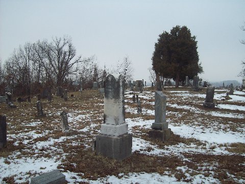
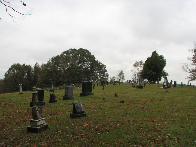
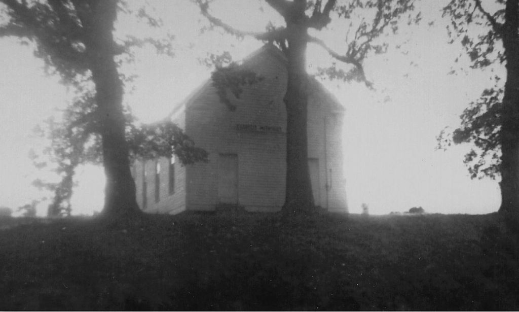
| Description | : | Located in Glenville, Daviess County, Kentucky south of Moseleyville, Kentucky and just north of the Mclean County Line. Set across the street from the Glenville Baptist Church on hwy 81 south. Very poor access to the cemetery and there is no signage. Glenville is right on the border of the Daviess and McLean County. |
frequently asked questions (FAQ):
-
Where is Glenville Methodist Church Cemetery?
Glenville Methodist Church Cemetery is located at Glenville, Daviess County ,Kentucky ,USA.
-
Glenville Methodist Church Cemetery cemetery's updated grave count on graveviews.com?
15 memorials
-
Where are the coordinates of the Glenville Methodist Church Cemetery?
Latitude: 37.6083300
Longitude: -87.1905000
Nearby Cemetories:
1. Glenville Baptist Church Cemetery
Glenville, Daviess County, USA
Coordinate: 37.6085815, -87.1892014
2. Glenville Christian Church Cemetery
Glenville, Daviess County, USA
Coordinate: 37.6054040, -87.1909100
3. Baird Family Cemetery
Glenville, Daviess County, USA
Coordinate: 37.6045640, -87.1835790
4. Mount Pleasant Cumberland Presbyterian Cemetery
Glenville, Daviess County, USA
Coordinate: 37.6211070, -87.1914960
5. Brushy Fork Cemetery
Guffie, McLean County, USA
Coordinate: 37.6120370, -87.2289600
6. Leet-Wilhite Family Cemetery
Guffie, McLean County, USA
Coordinate: 37.6052100, -87.2320000
7. Short Family Cemetery
Panther, Daviess County, USA
Coordinate: 37.6387040, -87.2234630
8. Nickel Ridge Cemetery
Panther, Daviess County, USA
Coordinate: 37.6505400, -87.2037100
9. Dabney C Robertson Family Graveyard
Daviess County, USA
Coordinate: 37.6256720, -87.2453760
10. Murphy Grave
Panther, Daviess County, USA
Coordinate: 37.6469530, -87.2270990
11. Smith-Ratliff Cemetery
McLean County, USA
Coordinate: 37.5645200, -87.1594300
12. Oak Grove Cemetery
McLean County, USA
Coordinate: 37.5590591, -87.2065964
13. Mount Vernon Baptist Church Cemetery
Calhoun, McLean County, USA
Coordinate: 37.5772400, -87.2452011
14. Johnson Family Graveyard
Calhoun, McLean County, USA
Coordinate: 37.5578295, -87.2134155
15. Utica Baptist Church Cemetery
Utica, Daviess County, USA
Coordinate: 37.6021300, -87.1182400
16. Brushy Fork Cemetery
Panther, Daviess County, USA
Coordinate: 37.6375999, -87.2545013
17. Pleasant Hope General Baptist Church Cemetery
Livermore, McLean County, USA
Coordinate: 37.5502205, -87.1675034
18. Trunnell Family Cemetery
Browns Valley, Daviess County, USA
Coordinate: 37.6320700, -87.1150200
19. Mount Zion Methodist Episcopal Church Cemetery
Panther, Daviess County, USA
Coordinate: 37.6638700, -87.2325500
20. Nalley-Taylor Family Cemetery
Buel, McLean County, USA
Coordinate: 37.5433000, -87.1711000
21. Saint Anthony Church Cemetery
Browns Valley, Daviess County, USA
Coordinate: 37.6431300, -87.1157100
22. Little Flock Cemetery
West Louisville, Daviess County, USA
Coordinate: 37.6369900, -87.2733300
23. Robert C. Moseley Family Cemetery
Cleopatra, McLean County, USA
Coordinate: 37.6136000, -87.2814400
24. Bethlehem Baptist Cemetery
Utica, Daviess County, USA
Coordinate: 37.6066000, -87.0986200