
| Memorials | : | 1 |
| Location | : | Guffie, McLean County, USA |
| Coordinate | : | 37.6120370, -87.2289600 |
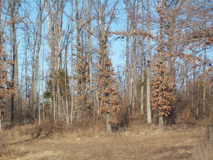
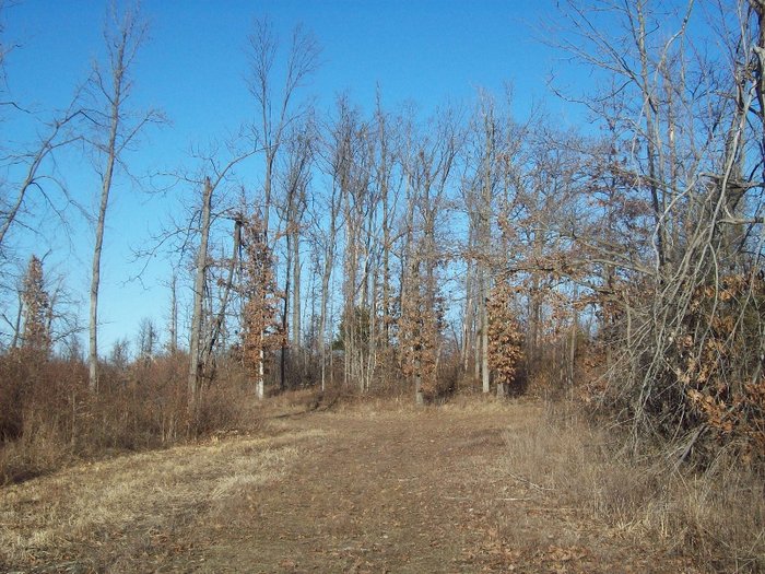
| Description | : | Old Brushy Fork Baptist Church Cemetery - located on the A.O. Oost farm about 1 mile east of Guffie near the Daviess - McLean Co. line on Oost Road, Most of these stones found in the cemetery are lying flat among trees and underbrush. This is the original site of the old Brushy Fork Church. In 1857 a log house of worship was built about 3 miles west (in Daviess County)where the second cemetery was developed. Later the land accross the road was developed and became the third Brushy Fork Cemetery. This information was obtained from the Daviess County Public Library... Read More |
frequently asked questions (FAQ):
-
Where is Brushy Fork Cemetery?
Brushy Fork Cemetery is located at Oost Road Guffie, McLean County ,Kentucky ,USA.
-
Brushy Fork Cemetery cemetery's updated grave count on graveviews.com?
1 memorials
-
Where are the coordinates of the Brushy Fork Cemetery?
Latitude: 37.6120370
Longitude: -87.2289600
Nearby Cemetories:
1. Leet-Wilhite Family Cemetery
Guffie, McLean County, USA
Coordinate: 37.6052100, -87.2320000
2. Dabney C Robertson Family Graveyard
Daviess County, USA
Coordinate: 37.6256720, -87.2453760
3. Short Family Cemetery
Panther, Daviess County, USA
Coordinate: 37.6387040, -87.2234630
4. Glenville Methodist Church Cemetery
Glenville, Daviess County, USA
Coordinate: 37.6083300, -87.1905000
5. Glenville Christian Church Cemetery
Glenville, Daviess County, USA
Coordinate: 37.6054040, -87.1909100
6. Mount Pleasant Cumberland Presbyterian Cemetery
Glenville, Daviess County, USA
Coordinate: 37.6211070, -87.1914960
7. Glenville Baptist Church Cemetery
Glenville, Daviess County, USA
Coordinate: 37.6085815, -87.1892014
8. Brushy Fork Cemetery
Panther, Daviess County, USA
Coordinate: 37.6375999, -87.2545013
9. Murphy Grave
Panther, Daviess County, USA
Coordinate: 37.6469530, -87.2270990
10. Baird Family Cemetery
Glenville, Daviess County, USA
Coordinate: 37.6045640, -87.1835790
11. Mount Vernon Baptist Church Cemetery
Calhoun, McLean County, USA
Coordinate: 37.5772400, -87.2452011
12. Robert C. Moseley Family Cemetery
Cleopatra, McLean County, USA
Coordinate: 37.6136000, -87.2814400
13. Little Flock Cemetery
West Louisville, Daviess County, USA
Coordinate: 37.6369900, -87.2733300
14. Nickel Ridge Cemetery
Panther, Daviess County, USA
Coordinate: 37.6505400, -87.2037100
15. Ebenser Church of Christ Cemetery
Guffie, McLean County, USA
Coordinate: 37.5958170, -87.2850090
16. Mount Zion Methodist Episcopal Church Cemetery
Panther, Daviess County, USA
Coordinate: 37.6638700, -87.2325500
17. Johnson Family Graveyard
Calhoun, McLean County, USA
Coordinate: 37.5578295, -87.2134155
18. Oak Grove Cemetery
McLean County, USA
Coordinate: 37.5590591, -87.2065964
19. Old Macedonia Cemetery
Daviess County, USA
Coordinate: 37.6489000, -87.2822000
20. Mount Liberty Baptist Church Cemetery
Wyman, McLean County, USA
Coordinate: 37.6312256, -87.3094635
21. Calhoun Cemetery
Calhoun, McLean County, USA
Coordinate: 37.5496260, -87.2604020
22. Old Macedonia Cemetery
Panther, Daviess County, USA
Coordinate: 37.6530000, -87.3042000
23. Smith-Ratliff Cemetery
McLean County, USA
Coordinate: 37.5645200, -87.1594300
24. Pleasant Hope Church Cemetery
Calhoun, McLean County, USA
Coordinate: 37.5388908, -87.2583313