
| Memorials | : | 0 |
| Location | : | Finger, McNairy County, USA |
| Coordinate | : | 35.3758011, -88.5203018 |
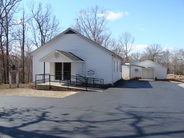
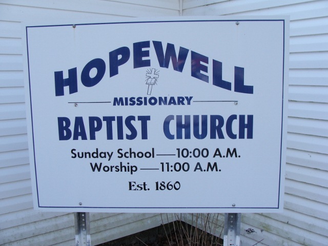
| Description | : | From the intersection of Arl Bailey Rd. & Bullman Rd., travel east on Arl Bailey Rd., going 0.9 mi., turning south onto Hopewell Church Ln., going 0.9 mi.; turning west (right) onto the cemetery driveway & passing the Hopewell Church, proceeding around the circular driveway. |
frequently asked questions (FAQ):
-
Where is Hopewell Church Cemetery?
Hopewell Church Cemetery is located at Hopewell Church Lane Finger, McNairy County ,Tennessee ,USA.
-
Hopewell Church Cemetery cemetery's updated grave count on graveviews.com?
0 memorials
-
Where are the coordinates of the Hopewell Church Cemetery?
Latitude: 35.3758011
Longitude: -88.5203018
Nearby Cemetories:
1. Sweetlips Cemetery
Sweet Lips, Chester County, USA
Coordinate: 35.3992004, -88.5205994
2. White Plains Cemetery
Finger, McNairy County, USA
Coordinate: 35.3731670, -88.5516960
3. Malone Cemetery
Finger, McNairy County, USA
Coordinate: 35.3602440, -88.5572960
4. Plunk Cemetery
Finger, McNairy County, USA
Coordinate: 35.3382988, -88.5333023
5. Anderson Slave Cemetery
Finger, McNairy County, USA
Coordinate: 35.3598000, -88.5659000
6. Rocky Knob Church Cemetery
Finger, McNairy County, USA
Coordinate: 35.3541985, -88.4783020
7. Robinson Cemetery
Chester County, USA
Coordinate: 35.4011002, -88.5642014
8. Robertson Cemetery
Henderson, Chester County, USA
Coordinate: 35.4013460, -88.5639870
9. Old Oak Grove Cemetery
Henderson, Chester County, USA
Coordinate: 35.3879000, -88.5727200
10. Maggie Jones United Methodist Church Cemetery
Finger, McNairy County, USA
Coordinate: 35.3291700, -88.5166300
11. Ingraham Cemetery
Finger, McNairy County, USA
Coordinate: 35.3266150, -88.5151560
12. Baucum Cemetery (Defunct)
McNairy County, USA
Coordinate: 35.3302994, -88.4935989
13. O'Neal Cemetery
McNairy County, USA
Coordinate: 35.3671410, -88.4553990
14. Massengill Cemetery
Jacks Creek, Chester County, USA
Coordinate: 35.4299500, -88.5287180
15. Faith Baptist Church Cemetery
Henderson, Chester County, USA
Coordinate: 35.4155970, -88.5666890
16. Lanes Chapel Cemetery
Finger, McNairy County, USA
Coordinate: 35.3312510, -88.5639110
17. Hendrix Cemetery
Finger, McNairy County, USA
Coordinate: 35.3189590, -88.5338280
18. Oak Grove Cemetery
Oak Grove, Chester County, USA
Coordinate: 35.4025002, -88.5858002
19. Kerby Family Cemetery
Finger, McNairy County, USA
Coordinate: 35.3656810, -88.5971940
20. Cabo Cemetery
Enville, Chester County, USA
Coordinate: 35.4245700, -88.4619800
21. Moss Cemetery
Chester County, USA
Coordinate: 35.4361000, -88.4805984
22. Blakeley Cemetery
Adamsville, McNairy County, USA
Coordinate: 35.3156050, -88.4795500
23. Alexander Cemetery
Finger, McNairy County, USA
Coordinate: 35.3029830, -88.5120090
24. Mount Carmel Cemetery
Finger, McNairy County, USA
Coordinate: 35.3424988, -88.6003036