
| Memorials | : | 0 |
| Location | : | Washburn, Barry County, USA |
| Coordinate | : | 36.5565600, -93.9813000 |
| Description | : | From the north: Take 37 south from Washburn. Turn right (south west) over the tracks on FR 1050. At FR 2265 turn left (south). The cemetery will be on the east side of the road before you get to FR 2270 and across the street from the Rock Springs Church. From the south: Take 37 north from Seligman, to FR 2265 and turn left (West). (The first cemetery you pass will be King/Kings (also known as P.E. Roller) Cemetery). Continue on past FR 2270 and when the road starts curving back north the cemetery will be... Read More |
frequently asked questions (FAQ):
-
Where is Rock Springs Cemetery?
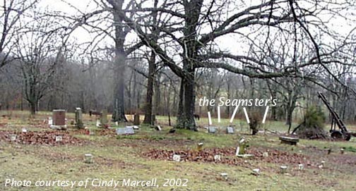
Rock Springs Cemetery is located at Washburn, Barry County ,Missouri ,USA.
-
Rock Springs Cemetery cemetery's updated grave count on graveviews.com?
0 memorials
-
Where are the coordinates of the Rock Springs Cemetery?
Latitude: 36.5565600
Longitude: -93.9813000
Nearby Cemetories:
1. King Cemetery
Seligman, Barry County, USA
Coordinate: 36.5513992, -93.9682999
2. Barnes Cemetery
Washburn, Barry County, USA
Coordinate: 36.5398000, -93.9634000
3. Burnett Cemetery
Seligman, Barry County, USA
Coordinate: 36.5327988, -93.9627991
4. Hickman Cemetery
Washburn, Barry County, USA
Coordinate: 36.5871000, -93.9928000
5. Cargile Cemetery
Washburn, Barry County, USA
Coordinate: 36.5598000, -94.0210000
6. Berryhill Cemetery
Washburn, Barry County, USA
Coordinate: 36.5931000, -93.9814000
7. New Salem Cemetery
Seligman, Barry County, USA
Coordinate: 36.5478200, -93.9269600
8. Seligman Cemetery
Seligman, Barry County, USA
Coordinate: 36.5261002, -93.9336014
9. Washburn Prairie Cemetery
Washburn, Barry County, USA
Coordinate: 36.5896988, -93.9308014
10. Old Washburn Cemetery
Washburn, Barry County, USA
Coordinate: 36.5927120, -93.9333630
11. Rowley Cemetery
Washburn, Barry County, USA
Coordinate: 36.6073980, -93.9609900
12. Yearns Cemetery
Barry County, USA
Coordinate: 36.5574323, -93.9143820
13. Reed-Trent Cemetery
Gateway, Benton County, USA
Coordinate: 36.4882800, -93.9574800
14. Beaver Cemetery
Seligman, Barry County, USA
Coordinate: 36.5078011, -93.9143982
15. True Love Cemetery
Washburn, Barry County, USA
Coordinate: 36.6258011, -93.9468994
16. Bayless Cemetery
Gateway, Benton County, USA
Coordinate: 36.4831009, -93.9539032
17. Potts Cemetery
Garfield, Benton County, USA
Coordinate: 36.4873620, -94.0228990
18. Roller Ridge Cemetery
Gateway, Benton County, USA
Coordinate: 36.4932700, -93.9267500
19. Scott Cemetery
Garfield, Benton County, USA
Coordinate: 36.4822006, -94.0314026
20. J.B. Walden Burial Site
Barry County, USA
Coordinate: 36.6118800, -93.8897180
21. Dent Cemetery
Jacket, McDonald County, USA
Coordinate: 36.5012100, -94.0781000
22. Clantonville Cemetery
Benton County, USA
Coordinate: 36.4813995, -93.9057999
23. Corinth Cemetery
Cassville, Barry County, USA
Coordinate: 36.6241989, -93.8927994
24. Crow Pond Cemetery
Exeter, Barry County, USA
Coordinate: 36.6549988, -93.9483032