
| Memorials | : | 0 |
| Location | : | Gateway, Benton County, USA |
| Coordinate | : | 36.4882800, -93.9574800 |
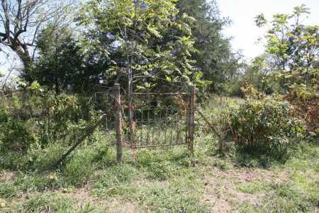
| Description | : | Neglected/Endangered Located approx. 1 mile north of Bayless Cemetery on Mill Hill Rd on the Anderson property (formerly Douglas property) east side, and must be accessed after crossing the Mo. state line. Cemetery sits on the Arkansas side of the stateline. Cannot be seen from the road. Permission to access is necessary. |
frequently asked questions (FAQ):
-
Where is Reed-Trent Cemetery?
Reed-Trent Cemetery is located at Gateway, Benton County ,Arkansas , 72733USA.
-
Reed-Trent Cemetery cemetery's updated grave count on graveviews.com?
0 memorials
-
Where are the coordinates of the Reed-Trent Cemetery?
Latitude: 36.4882800
Longitude: -93.9574800
Nearby Cemetories:
1. Bayless Cemetery
Gateway, Benton County, USA
Coordinate: 36.4831009, -93.9539032
2. Roller Ridge Cemetery
Gateway, Benton County, USA
Coordinate: 36.4932700, -93.9267500
3. Beaver Cemetery
Seligman, Barry County, USA
Coordinate: 36.5078011, -93.9143982
4. Clantonville Cemetery
Benton County, USA
Coordinate: 36.4813995, -93.9057999
5. Seligman Cemetery
Seligman, Barry County, USA
Coordinate: 36.5261002, -93.9336014
6. Burnett Cemetery
Seligman, Barry County, USA
Coordinate: 36.5327988, -93.9627991
7. Barnes Cemetery
Washburn, Barry County, USA
Coordinate: 36.5398000, -93.9634000
8. Potts Cemetery
Garfield, Benton County, USA
Coordinate: 36.4873620, -94.0228990
9. Union Chapel Cemetery
Garfield, Benton County, USA
Coordinate: 36.4304180, -93.9525340
10. Ruddick Cemetery
Garfield, Benton County, USA
Coordinate: 36.4295000, -93.9512400
11. Scott Cemetery
Garfield, Benton County, USA
Coordinate: 36.4822006, -94.0314026
12. King Cemetery
Seligman, Barry County, USA
Coordinate: 36.5513992, -93.9682999
13. Ford Cemetery
Benton County, USA
Coordinate: 36.4557991, -94.0261002
14. New Salem Cemetery
Seligman, Barry County, USA
Coordinate: 36.5478200, -93.9269600
15. Liberty Cemetery
Garfield, Benton County, USA
Coordinate: 36.4389000, -94.0105972
16. Rock Springs Cemetery
Washburn, Barry County, USA
Coordinate: 36.5565600, -93.9813000
17. Yearns Cemetery
Barry County, USA
Coordinate: 36.5574323, -93.9143820
18. Snoderly Cemetery
Brightwater, Benton County, USA
Coordinate: 36.4171982, -94.0010986
19. Pratt Cemetery
Garfield, Benton County, USA
Coordinate: 36.4375000, -94.0335999
20. Williams Cemetery
Benton County, USA
Coordinate: 36.4164009, -94.0002975
21. Henson Jennings Cemetery
Garfield, Benton County, USA
Coordinate: 36.4373300, -94.0347000
22. Paces Chapel Cemetery
Benton County, USA
Coordinate: 36.4372940, -94.0350770
23. Walnut Hill Cemetery
Brightwater, Benton County, USA
Coordinate: 36.4082985, -93.9907990
24. Twelve Corners Cemetery
Pea Ridge, Benton County, USA
Coordinate: 36.4700012, -94.0622025