
| Memorials | : | 0 |
| Location | : | Seligman, Barry County, USA |
| Coordinate | : | 36.5327988, -93.9627991 |
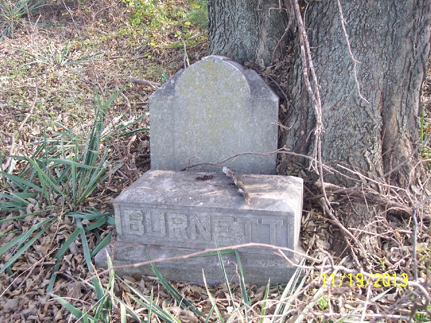
| Description | : | Northwest of Seligman - From Highway 37, turn onto FR 1062. The cemetery is on the corner of FR 1062 and FR 2280. The cemetery is fenced off from the pasture. Very grown up in briars and brush. The cemetery was a private burial plot for the Burnett family. The first burial was that of Felix Grundy Burnett who died after helping people out of a burning hotel in Eureka Springs, Arkansas. His was wife was buried there in 1910, his mother-in-law in 1906 and daughter-in-law in 1898. The other burials are those of young children in the... Read More |
frequently asked questions (FAQ):
-
Where is Burnett Cemetery?
Burnett Cemetery is located at Seligman, Barry County ,Missouri ,USA.
-
Burnett Cemetery cemetery's updated grave count on graveviews.com?
0 memorials
-
Where are the coordinates of the Burnett Cemetery?
Latitude: 36.5327988
Longitude: -93.9627991
Nearby Cemetories:
1. Barnes Cemetery
Washburn, Barry County, USA
Coordinate: 36.5398000, -93.9634000
2. King Cemetery
Seligman, Barry County, USA
Coordinate: 36.5513992, -93.9682999
3. Seligman Cemetery
Seligman, Barry County, USA
Coordinate: 36.5261002, -93.9336014
4. Rock Springs Cemetery
Washburn, Barry County, USA
Coordinate: 36.5565600, -93.9813000
5. New Salem Cemetery
Seligman, Barry County, USA
Coordinate: 36.5478200, -93.9269600
6. Reed-Trent Cemetery
Gateway, Benton County, USA
Coordinate: 36.4882800, -93.9574800
7. Yearns Cemetery
Barry County, USA
Coordinate: 36.5574323, -93.9143820
8. Beaver Cemetery
Seligman, Barry County, USA
Coordinate: 36.5078011, -93.9143982
9. Roller Ridge Cemetery
Gateway, Benton County, USA
Coordinate: 36.4932700, -93.9267500
10. Bayless Cemetery
Gateway, Benton County, USA
Coordinate: 36.4831009, -93.9539032
11. Cargile Cemetery
Washburn, Barry County, USA
Coordinate: 36.5598000, -94.0210000
12. Hickman Cemetery
Washburn, Barry County, USA
Coordinate: 36.5871000, -93.9928000
13. Berryhill Cemetery
Washburn, Barry County, USA
Coordinate: 36.5931000, -93.9814000
14. Washburn Prairie Cemetery
Washburn, Barry County, USA
Coordinate: 36.5896988, -93.9308014
15. Old Washburn Cemetery
Washburn, Barry County, USA
Coordinate: 36.5927120, -93.9333630
16. Potts Cemetery
Garfield, Benton County, USA
Coordinate: 36.4873620, -94.0228990
17. Clantonville Cemetery
Benton County, USA
Coordinate: 36.4813995, -93.9057999
18. Rowley Cemetery
Washburn, Barry County, USA
Coordinate: 36.6073980, -93.9609900
19. Scott Cemetery
Garfield, Benton County, USA
Coordinate: 36.4822006, -94.0314026
20. Ford Cemetery
Benton County, USA
Coordinate: 36.4557991, -94.0261002
21. True Love Cemetery
Washburn, Barry County, USA
Coordinate: 36.6258011, -93.9468994
22. Dent Cemetery
Jacket, McDonald County, USA
Coordinate: 36.5012100, -94.0781000
23. J.B. Walden Burial Site
Barry County, USA
Coordinate: 36.6118800, -93.8897180
24. Liberty Cemetery
Garfield, Benton County, USA
Coordinate: 36.4389000, -94.0105972