
| Memorials | : | 6 |
| Location | : | Hinton, Boone County, USA |
| Coordinate | : | 39.0536308, -92.3411484 |
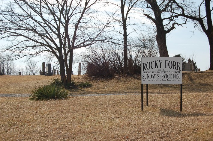
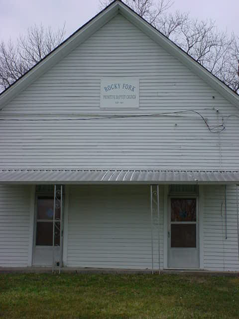
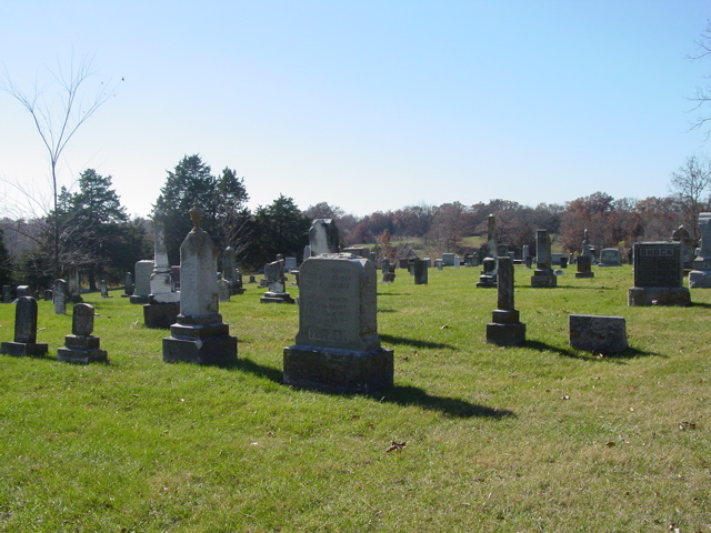
| Description | : | This cemetery is on main street of Hinton, Boone Co., Missouri sitting with Rocky Fork Baptist Church. The cemetery is owned and maintained by the Rocky Fork Baptist Church, which was founded in 1821, the cemetery was started shortly after that. This cemetery has alot of old headstones which are practically illegible, but others are quite clear. |
frequently asked questions (FAQ):
-
Where is Rocky Fork Baptist Church Cemetery?
Rocky Fork Baptist Church Cemetery is located at Hinton, Boone County ,Missouri ,USA.
-
Rocky Fork Baptist Church Cemetery cemetery's updated grave count on graveviews.com?
6 memorials
-
Where are the coordinates of the Rocky Fork Baptist Church Cemetery?
Latitude: 39.0536308
Longitude: -92.3411484
Nearby Cemetories:
1. Wade Cemetery
Hinton, Boone County, USA
Coordinate: 39.0648003, -92.3293686
2. Searcy Cemetery
Hinton, Boone County, USA
Coordinate: 39.0793915, -92.3542633
3. Toalson Family Cemetery
Boone County, USA
Coordinate: 39.0128817, -92.3409784
4. Botner Cemetery
Boone County, USA
Coordinate: 39.0800018, -92.3816986
5. Dripping Spring Christian Church Cemetery
Columbia, Boone County, USA
Coordinate: 39.0870200, -92.3747400
6. Oakland Church Cemetery
Columbia, Boone County, USA
Coordinate: 39.0299340, -92.2932260
7. Taylor Family Cemetery
Columbia, Boone County, USA
Coordinate: 39.0392600, -92.4094900
8. Creasy Springs Road Burial Ground
Columbia, Boone County, USA
Coordinate: 38.9976500, -92.3484230
9. Friendship Churchyard
Hallsville, Boone County, USA
Coordinate: 39.0978000, -92.2897900
10. O'Rear Family Cemetery
Columbia, Boone County, USA
Coordinate: 39.0007320, -92.2985890
11. Phillips Cemetery #2
Stephens, Boone County, USA
Coordinate: 39.0366448, -92.2633459
12. New Providence Cemetery
Columbia, Boone County, USA
Coordinate: 39.0071500, -92.4019100
13. Red Rock Cemetery
Harrisburg, Boone County, USA
Coordinate: 39.1059400, -92.4015400
14. Henry Family Cemetery
Columbia, Boone County, USA
Coordinate: 39.0113600, -92.2678300
15. Ariel Church Cemetery
Boone County, USA
Coordinate: 38.9872322, -92.3081589
16. Mount Moriah Cemetery
Boone County, USA
Coordinate: 39.0409000, -92.2397000
17. Payton-Goodrich-Willis-Shock Cemetery
Columbia, Boone County, USA
Coordinate: 38.9727560, -92.3566530
18. Memorial Park Cemetery
Columbia, Boone County, USA
Coordinate: 38.9696999, -92.3531036
19. Antioch Cemetery
Boone County, USA
Coordinate: 38.9852982, -92.2733002
20. Hinkson Creek Cemetery
Columbia, Boone County, USA
Coordinate: 38.9803009, -92.2750015
21. Cave Family Cemetery
Boone County, USA
Coordinate: 38.9710210, -92.2933960
22. Mount Hope Baptist Cemetery
Columbia, Boone County, USA
Coordinate: 39.0222200, -92.2313300
23. Evert Church Cemetery
Woodlandville, Boone County, USA
Coordinate: 39.0615160, -92.4631690
24. Bethlehem Cemetery
Harrisburg, Boone County, USA
Coordinate: 39.0965290, -92.4516360