
| Memorials | : | 7 |
| Location | : | Owings Mills, Baltimore County, USA |
| Coordinate | : | 39.4215500, -76.7619000 |
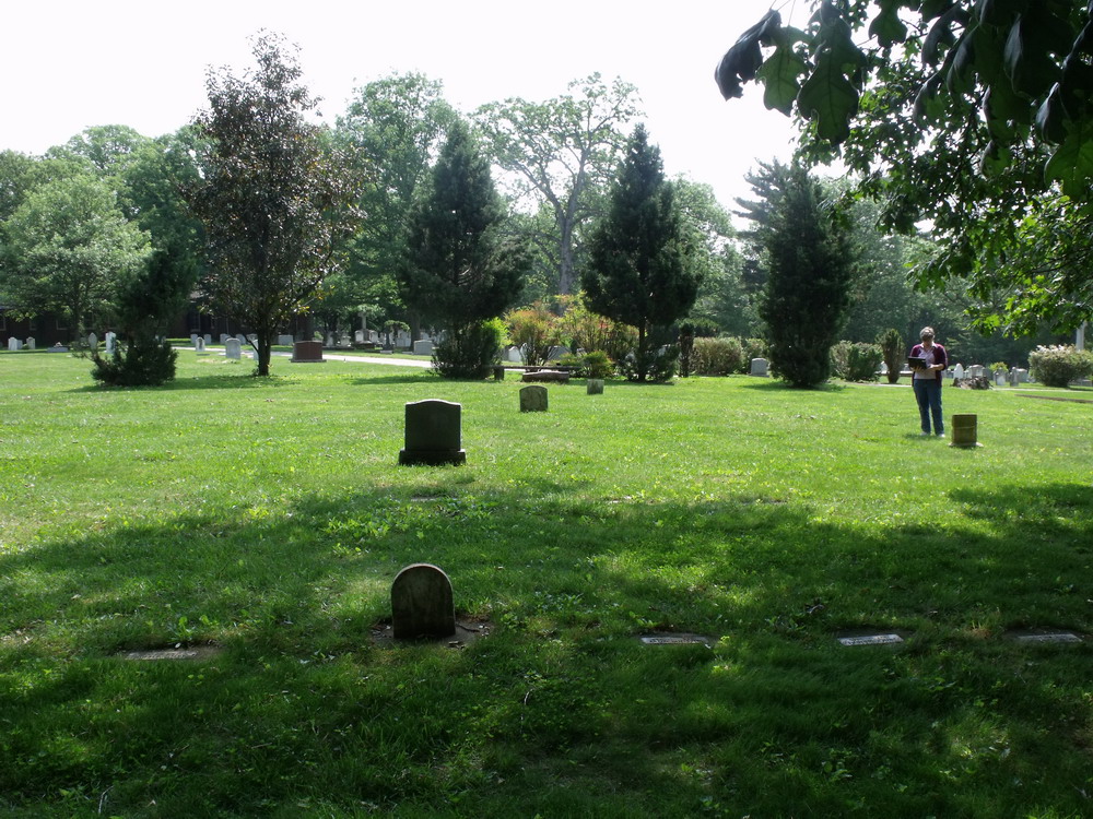
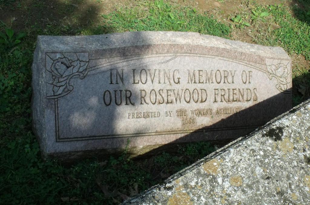
| Description | : | Cemetery is located adjacent to the cemetery of St. Thomas Episcopal Church Cemetery, Owings Mills, Baltimore County, Md. The hospital was founded in 1888 as the Asylum and Training School for the Feeble Minded. In 1961, it was renamed Rosewood State Hospital and in 1969 the name was once again changed to the Rosewood Center. The facility closed on June 30, 2008. Access to the graves is via the cemetery at St. Thomas Episcopal Church. |
frequently asked questions (FAQ):
-
Where is Rosewood State Hospital Cemetery?
Rosewood State Hospital Cemetery is located at 232 St Thomas Lane Owings Mills, Baltimore County ,Maryland ,USA.
-
Rosewood State Hospital Cemetery cemetery's updated grave count on graveviews.com?
7 memorials
-
Where are the coordinates of the Rosewood State Hospital Cemetery?
Latitude: 39.4215500
Longitude: -76.7619000
Nearby Cemetories:
1. Saint Thomas Episcopal Church Cemetery
Owings Mills, Baltimore County, USA
Coordinate: 39.4215500, -76.7619000
2. Har Sinai Cemetery
Owings Mills, Baltimore County, USA
Coordinate: 39.4353900, -76.7683800
3. Garrison Forest Cemetery
Owings Mills, Baltimore County, USA
Coordinate: 39.4363000, -76.7674800
4. Garrison Forest Veterans Cemetery
Owings Mills, Baltimore County, USA
Coordinate: 39.4407600, -76.7680800
5. Pleasant Hill United Methodist Church Cemetery
Owings Mills, Baltimore County, USA
Coordinate: 39.4294400, -76.7912700
6. Stone Chapel United Methodist Church Cemetery
Pikesville, Baltimore County, USA
Coordinate: 39.3934000, -76.7407500
7. Howard Graveyard at Grayrock
Pikesville, Baltimore County, USA
Coordinate: 39.3954560, -76.7367020
8. Holy Trinity Monastery Cemetery
Pikesville, Baltimore County, USA
Coordinate: 39.3971991, -76.7277734
9. Croxall Family Cemetery
Baltimore County, USA
Coordinate: 39.3968735, -76.7207870
10. Lowe Family Cemetery
Owings Mills, Baltimore County, USA
Coordinate: 39.4292600, -76.8135900
11. Carrolls-Gills United Methodist Church Cemetery
Lutherville, Baltimore County, USA
Coordinate: 39.4465300, -76.7185900
12. Druid Ridge Cemetery
Pikesville, Baltimore County, USA
Coordinate: 39.3793800, -76.7275700
13. Baltimore County Graveyard #86
Sparks, Baltimore County, USA
Coordinate: 39.4606500, -76.7146800
14. Mettam Memorial Baptist Church Cemetery
Pikesville, Baltimore County, USA
Coordinate: 39.3780700, -76.7197300
15. Saint Charles Borromeo Church Cemetery
Pikesville, Baltimore County, USA
Coordinate: 39.3738100, -76.7254000
16. Saters Baptist Historical Church Cemetery
Timonium, Baltimore County, USA
Coordinate: 39.4362920, -76.6870810
17. Mount Olive Cemetery
Randallstown, Baltimore County, USA
Coordinate: 39.3623400, -76.7769800
18. Saint Paul's Evangelical Lutheran Church Cemetery
Shawan, Baltimore County, USA
Coordinate: 39.4716830, -76.7174190
19. Shaarei Zion Cemetery Liberty Park
Randallstown, Baltimore County, USA
Coordinate: 39.3793600, -76.8196000
20. Saint Lukes Cemetery
Reisterstown, Baltimore County, USA
Coordinate: 39.4626900, -76.8210900
21. Saint Thomas Cemetery
Milford, Baltimore County, USA
Coordinate: 39.3605995, -76.7735977
22. Beth El Memorial Park
Randallstown, Baltimore County, USA
Coordinate: 39.3800400, -76.8209600
23. Baltimore Hebrew Cemetery
Reisterstown, Baltimore County, USA
Coordinate: 39.4507828, -76.8328094
24. Holy Family Cemetery
Randallstown, Baltimore County, USA
Coordinate: 39.3752800, -76.8156000