
| Memorials | : | 114 |
| Location | : | Owings Mills, Baltimore County, USA |
| Coordinate | : | 39.4363000, -76.7674800 |
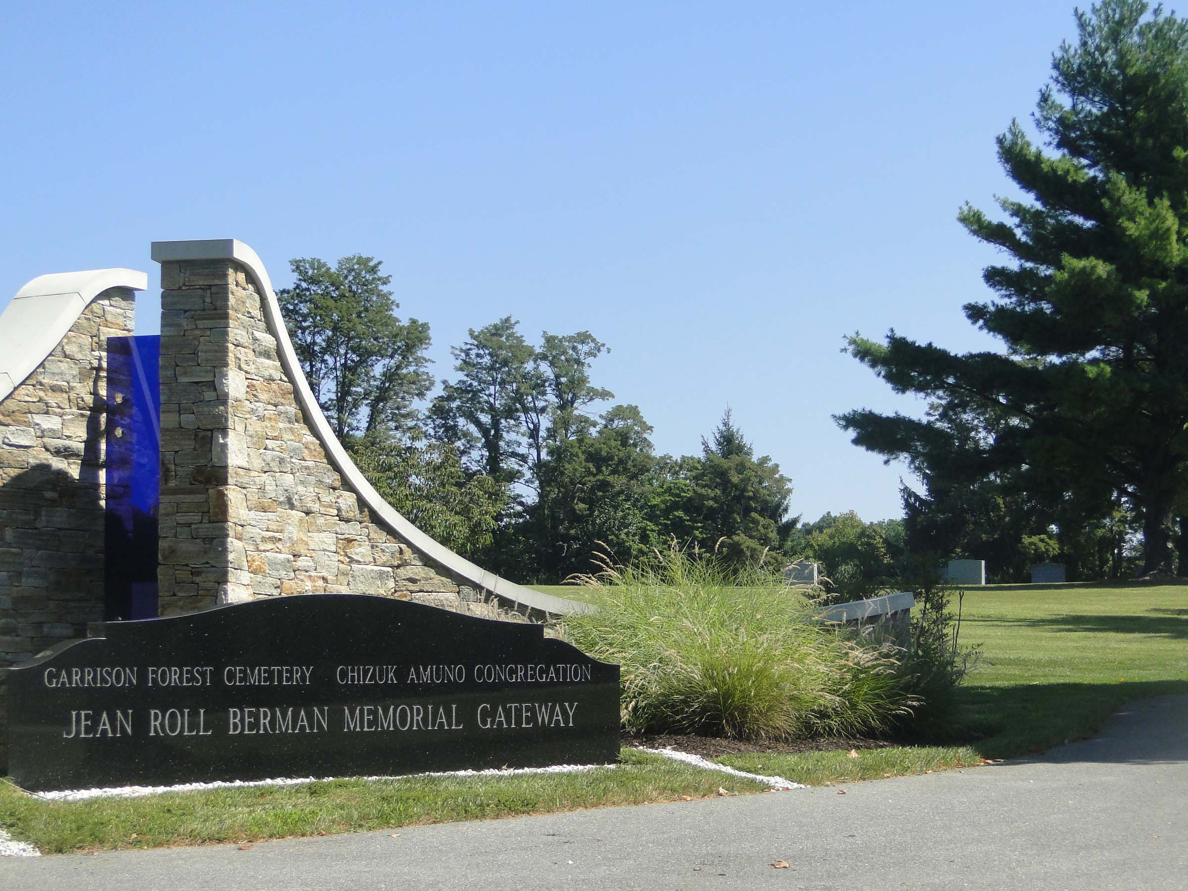
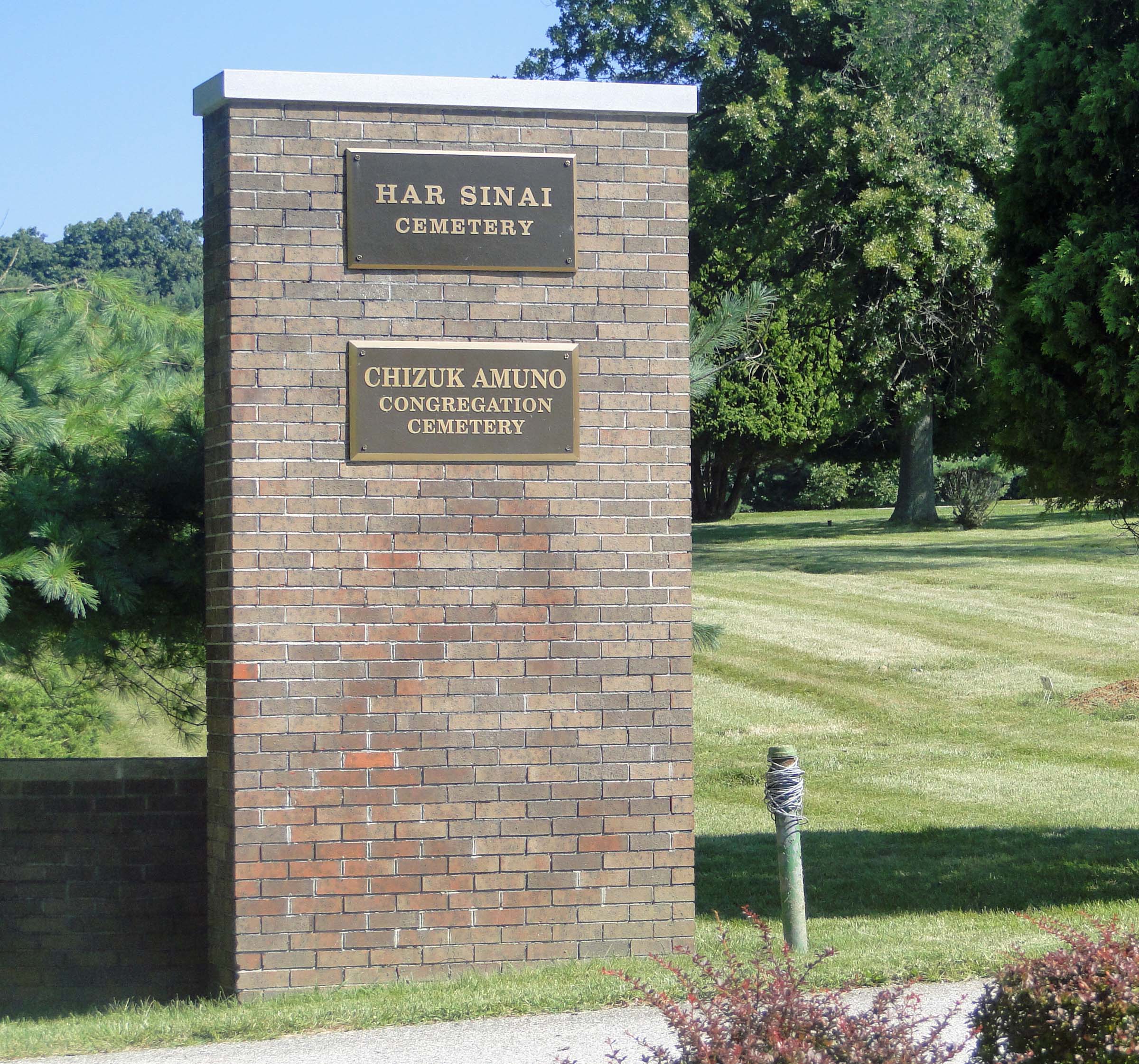
| Description | : | This cemetery shares an entrance and common ground with the Har Sinai Cemetery. There is a road that encircles the cemetery, a road that divides the left side (sign for Chizuk Amuno to the left), and a road that splits two quads on the right of that sign. Har Sinai Cemetery has burials outside the encircling road, starting from the left columbarium to the entrance, and the entire right outer property to the Chizuk Amuno Road. Har Sinai always has burials in the upper quad - this quad has sidewalks splitting the area into 4 sections (with a tree... Read More |
frequently asked questions (FAQ):
-
Where is Garrison Forest Cemetery?
Garrison Forest Cemetery is located at 11401 Garrison Forest Road Owings Mills, Baltimore County ,Maryland , 21117USA.
-
Garrison Forest Cemetery cemetery's updated grave count on graveviews.com?
114 memorials
-
Where are the coordinates of the Garrison Forest Cemetery?
Latitude: 39.4363000
Longitude: -76.7674800
Nearby Cemetories:
1. Har Sinai Cemetery
Owings Mills, Baltimore County, USA
Coordinate: 39.4353900, -76.7683800
2. Garrison Forest Veterans Cemetery
Owings Mills, Baltimore County, USA
Coordinate: 39.4407600, -76.7680800
3. Rosewood State Hospital Cemetery
Owings Mills, Baltimore County, USA
Coordinate: 39.4215500, -76.7619000
4. Saint Thomas Episcopal Church Cemetery
Owings Mills, Baltimore County, USA
Coordinate: 39.4215500, -76.7619000
5. Pleasant Hill United Methodist Church Cemetery
Owings Mills, Baltimore County, USA
Coordinate: 39.4294400, -76.7912700
6. Lowe Family Cemetery
Owings Mills, Baltimore County, USA
Coordinate: 39.4292600, -76.8135900
7. Carrolls-Gills United Methodist Church Cemetery
Lutherville, Baltimore County, USA
Coordinate: 39.4465300, -76.7185900
8. Howard Graveyard at Grayrock
Pikesville, Baltimore County, USA
Coordinate: 39.3954560, -76.7367020
9. Baltimore County Graveyard #86
Sparks, Baltimore County, USA
Coordinate: 39.4606500, -76.7146800
10. Stone Chapel United Methodist Church Cemetery
Pikesville, Baltimore County, USA
Coordinate: 39.3934000, -76.7407500
11. Saint Lukes Cemetery
Reisterstown, Baltimore County, USA
Coordinate: 39.4626900, -76.8210900
12. Holy Trinity Monastery Cemetery
Pikesville, Baltimore County, USA
Coordinate: 39.3971991, -76.7277734
13. All Saints Episcopal Church Cemetery
Reisterstown, Baltimore County, USA
Coordinate: 39.4625100, -76.8233200
14. Saint Paul's Evangelical Lutheran Church Cemetery
Shawan, Baltimore County, USA
Coordinate: 39.4716830, -76.7174190
15. Baltimore Hebrew Cemetery
Reisterstown, Baltimore County, USA
Coordinate: 39.4507828, -76.8328094
16. Croxall Family Cemetery
Baltimore County, USA
Coordinate: 39.3968735, -76.7207870
17. Reisterstown United Methodist Church Cemetery
Reisterstown, Baltimore County, USA
Coordinate: 39.4621110, -76.8296450
18. Oheb Shalom Memorial Park
Reisterstown, Baltimore County, USA
Coordinate: 39.4490013, -76.8368073
19. Sagamore Farm Grounds
Glyndon, Baltimore County, USA
Coordinate: 39.4912400, -76.7732000
20. Reisterstown Community Cemetery
Reisterstown, Baltimore County, USA
Coordinate: 39.4639400, -76.8308000
21. Grace Falls Road United Methodist Church Cemetery
Reisterstown, Baltimore County, USA
Coordinate: 39.4771300, -76.7081700
22. Conrad Uhler Family Cemetery
Reisterstown, Baltimore County, USA
Coordinate: 39.4714170, -76.8326930
23. Saters Baptist Historical Church Cemetery
Timonium, Baltimore County, USA
Coordinate: 39.4362920, -76.6870810
24. Druid Ridge Cemetery
Pikesville, Baltimore County, USA
Coordinate: 39.3793800, -76.7275700