
| Memorials | : | 0 |
| Location | : | Whitesburg, Carroll County, USA |
| Coordinate | : | 33.4867220, -84.9074080 |
| Description | : | From Whitesburg go south on Highway 16. Turn left on Old Newnan Road and the cemetery is located about 0.25 mile on the left. |
frequently asked questions (FAQ):
-
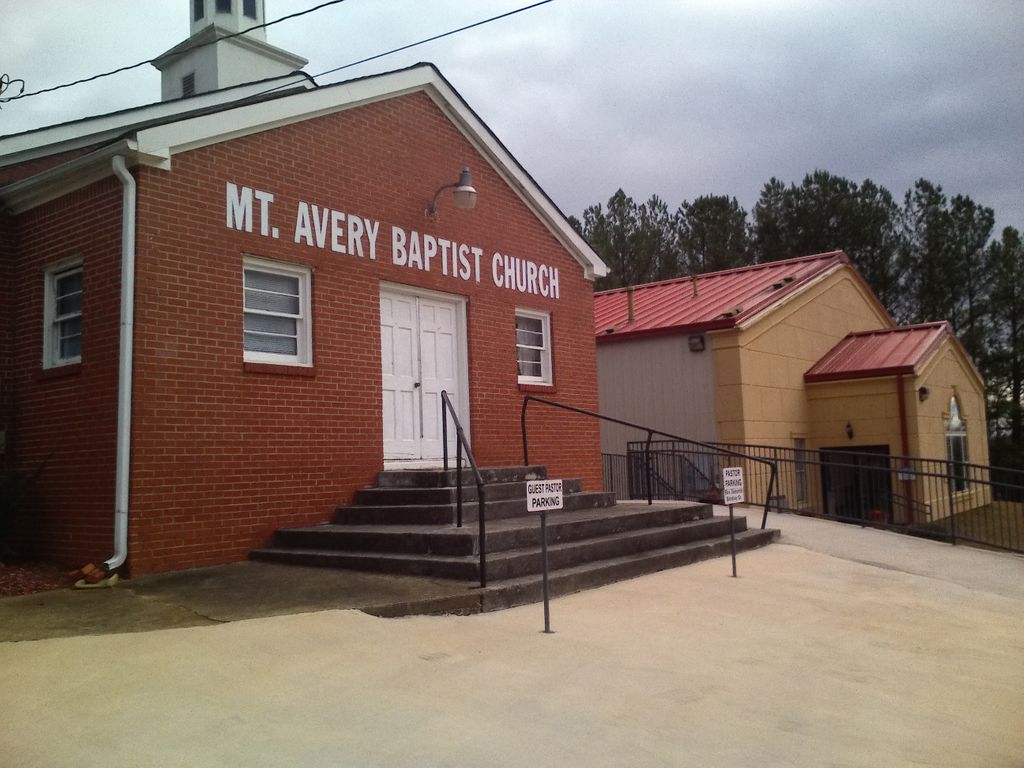
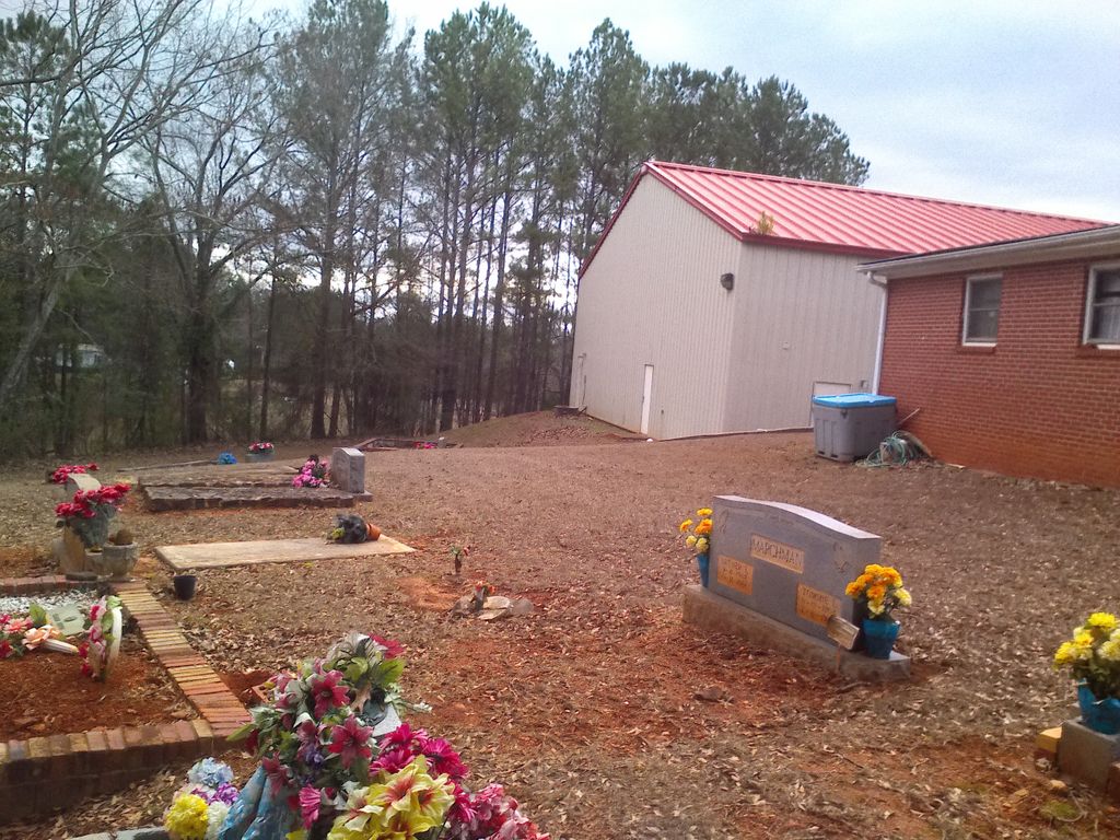
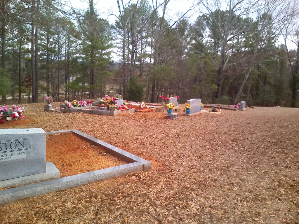
Where is Mount Avery Missionary Baptist Church Cemetery?
Mount Avery Missionary Baptist Church Cemetery is located at Old Newnan Road Whitesburg, Carroll County ,Georgia ,USA.
-
Mount Avery Missionary Baptist Church Cemetery cemetery's updated grave count on graveviews.com?
0 memorials
-
Where are the coordinates of the Mount Avery Missionary Baptist Church Cemetery?
Latitude: 33.4867220
Longitude: -84.9074080
Nearby Cemetories:
1. Taylor Cemetery
Whitesburg, Carroll County, USA
Coordinate: 33.4875450, -84.8988030
2. Dillard Cemetery
Whitesburg, Carroll County, USA
Coordinate: 33.4920640, -84.9213980
3. Ayers Cemetery
Whitesburg, Carroll County, USA
Coordinate: 33.5029340, -84.9100470
4. Whitesburg Cemetery
Whitesburg, Carroll County, USA
Coordinate: 33.5005989, -84.9180984
5. Culpepper Cemetery
Whitesburg, Carroll County, USA
Coordinate: 33.4870620, -84.9352600
6. Buyers Cemetery
Whitesburg, Carroll County, USA
Coordinate: 33.5079750, -84.8897370
7. Mount Calvary Cemetery
Carroll County, USA
Coordinate: 33.5085983, -84.9246979
8. Jones Mill Cemetery
Whitesburg, Carroll County, USA
Coordinate: 33.5139008, -84.9116974
9. Banning Church of God Cemetery
Whitesburg, Carroll County, USA
Coordinate: 33.5088340, -84.9296410
10. Summerlin - Adams Cemetery
Whitesburg, Carroll County, USA
Coordinate: 33.5028620, -84.8676250
11. Antioch Primitive Baptist Church Cemetery
Banning, Carroll County, USA
Coordinate: 33.5181007, -84.9321976
12. New Lebanon Cemetery
Sargent, Coweta County, USA
Coordinate: 33.4488983, -84.9060974
13. Corinth Baptist Church Cemetery
Whitesburg, Carroll County, USA
Coordinate: 33.5231018, -84.9233017
14. Rotherwood First Congregational Methodist Church C
Lowell, Carroll County, USA
Coordinate: 33.4709000, -84.9554730
15. Jones-Watson Cemetery
Whitesburg, Carroll County, USA
Coordinate: 33.5186780, -84.8694710
16. Allen Family Cemetery
Coweta County, USA
Coordinate: 33.4459630, -84.8837820
17. Mount Zion Cemetery
Coweta County, USA
Coordinate: 33.4514008, -84.8728027
18. Mount Avery Missionary Baptist Memory Gardens
Whitesburg, Carroll County, USA
Coordinate: 33.5317001, -84.8966980
19. Mount Zion Baptist Church Cemetery
Sargent, Coweta County, USA
Coordinate: 33.4513600, -84.8723500
20. Antioch Baptist Church Cemetery
Whitesburg, Carroll County, USA
Coordinate: 33.5228190, -84.8674190
21. Springer Cemetery
Carroll County, USA
Coordinate: 33.4660988, -84.9661026
22. Sargent Cemetery
Sargent, Coweta County, USA
Coordinate: 33.4421997, -84.8705978
23. Lang-Moore Cemetery
Roscoe, Coweta County, USA
Coordinate: 33.5039500, -84.8448900
24. Springer Family Cemetery
Lowell, Carroll County, USA
Coordinate: 33.4657500, -84.9695300