
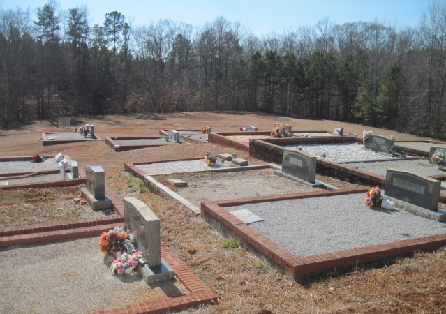
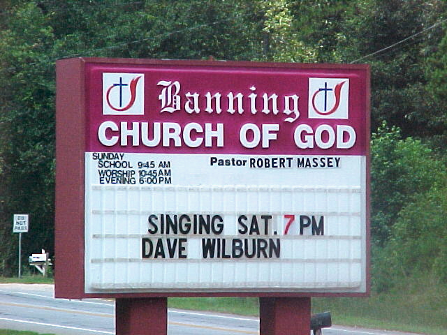
| Memorials | : | 1 |
| Location | : | Whitesburg, Carroll County, USA |
| Phone | : | 770-214-8963 |
| Coordinate | : | 33.5088340, -84.9296410 |
| Description | : | From Whitesburg take Highway 16 north for 1.5 miles to the church cemetery on the (left) west side of the road. |
frequently asked questions (FAQ):
-
Where is Banning Church of God Cemetery?
Banning Church of God Cemetery is located at 1426 North Highway 16 Whitesburg, Carroll County ,Georgia , 30185USA.
-
Banning Church of God Cemetery cemetery's updated grave count on graveviews.com?
1 memorials
-
Where are the coordinates of the Banning Church of God Cemetery?
Latitude: 33.5088340
Longitude: -84.9296410
Nearby Cemetories:
1. Mount Calvary Cemetery
Carroll County, USA
Coordinate: 33.5085983, -84.9246979
2. Antioch Primitive Baptist Church Cemetery
Banning, Carroll County, USA
Coordinate: 33.5181007, -84.9321976
3. Whitesburg Cemetery
Whitesburg, Carroll County, USA
Coordinate: 33.5005989, -84.9180984
4. Corinth Baptist Church Cemetery
Whitesburg, Carroll County, USA
Coordinate: 33.5231018, -84.9233017
5. Jones Mill Cemetery
Whitesburg, Carroll County, USA
Coordinate: 33.5139008, -84.9116974
6. Ayers Cemetery
Whitesburg, Carroll County, USA
Coordinate: 33.5029340, -84.9100470
7. Dillard Cemetery
Whitesburg, Carroll County, USA
Coordinate: 33.4920640, -84.9213980
8. Culpepper Cemetery
Whitesburg, Carroll County, USA
Coordinate: 33.4870620, -84.9352600
9. Mount Avery Missionary Baptist Church Cemetery
Whitesburg, Carroll County, USA
Coordinate: 33.4867220, -84.9074080
10. Buyers Cemetery
Whitesburg, Carroll County, USA
Coordinate: 33.5079750, -84.8897370
11. Taylor Cemetery
Whitesburg, Carroll County, USA
Coordinate: 33.4875450, -84.8988030
12. Driver-Boon-Bearden Family Cemetery
Carrollton, Carroll County, USA
Coordinate: 33.5353710, -84.9556820
13. Mount Avery Missionary Baptist Memory Gardens
Whitesburg, Carroll County, USA
Coordinate: 33.5317001, -84.8966980
14. Sparks Cemetery
Dingler Crossroads, Carroll County, USA
Coordinate: 33.5429840, -84.9445500
15. Rotherwood First Congregational Methodist Church C
Lowell, Carroll County, USA
Coordinate: 33.4709000, -84.9554730
16. Gray Family Cemetery
Carrollton, Carroll County, USA
Coordinate: 33.5025160, -84.9822250
17. Saint Paul Methodist Church Cemetery
Whitesburg, Carroll County, USA
Coordinate: 33.5503006, -84.9094009
18. Happy Hill Cemetery
Carrollton, Carroll County, USA
Coordinate: 33.5043983, -84.9888992
19. Ephesus Christian Church Cemetery
Whitesburg, Carroll County, USA
Coordinate: 33.4844017, -84.9828033
20. Jones-Watson Cemetery
Whitesburg, Carroll County, USA
Coordinate: 33.5186780, -84.8694710
21. Summerlin - Adams Cemetery
Whitesburg, Carroll County, USA
Coordinate: 33.5028620, -84.8676250
22. Springer Cemetery
Carroll County, USA
Coordinate: 33.4660988, -84.9661026
23. Harper Cemetery
Clem, Carroll County, USA
Coordinate: 33.5132490, -84.9936250
24. Antioch Baptist Church Cemetery
Whitesburg, Carroll County, USA
Coordinate: 33.5228190, -84.8674190