
| Memorials | : | 71 |
| Location | : | Bourne, Barnstable County, USA |
| Coordinate | : | 41.7714005, -70.5339966 |
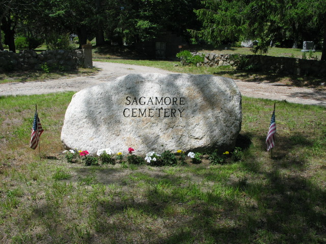
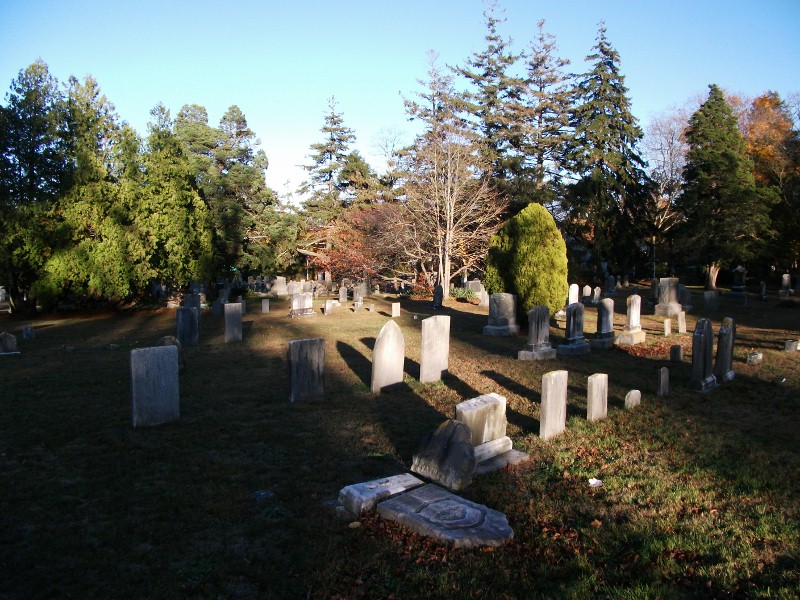
| Description | : | The oldest stone is dated 1803 and marks the grave of Tempe Bourne. The Bourne Assessors include this cemetery on Map 12.3 Lot 47. The Massachusetts Historical Commission refers to this cemetery in MACRIS as BOU809. There is a geocache located within this cemetery. |
frequently asked questions (FAQ):
-
Where is Sagamore Cemetery?
Sagamore Cemetery is located at Ben Abby Road and Rt. 6A Bourne, Barnstable County ,Massachusetts ,USA.
-
Sagamore Cemetery cemetery's updated grave count on graveviews.com?
71 memorials
-
Where are the coordinates of the Sagamore Cemetery?
Latitude: 41.7714005
Longitude: -70.5339966
Nearby Cemetories:
1. Saddle and Pillion Cemetery
Sagamore, Barnstable County, USA
Coordinate: 41.7672005, -70.5192032
2. Bournedale Burying Hill
Bourne, Barnstable County, USA
Coordinate: 41.7741520, -70.5611730
3. Bay View Cemetery
Sandwich, Barnstable County, USA
Coordinate: 41.7583008, -70.5102997
4. Freeman Cemetery
Sandwich, Barnstable County, USA
Coordinate: 41.7573013, -70.5083008
5. Bournedale Herring Pond Indian Cemetery
Bourne, Barnstable County, USA
Coordinate: 41.7861900, -70.5658722
6. Herring Pond Wampanoag Indian Cemetery
Plymouth, Plymouth County, USA
Coordinate: 41.7867290, -70.5658940
7. Saint Peters Cemetery
Sandwich, Barnstable County, USA
Coordinate: 41.7502480, -70.5079346
8. Old Town Cemetery
Sandwich, Barnstable County, USA
Coordinate: 41.7556992, -70.5011978
9. Herring Pond Cemetery
Plymouth, Plymouth County, USA
Coordinate: 41.7971700, -70.5588800
10. Cedarville Cemetery
Plymouth, Plymouth County, USA
Coordinate: 41.8049736, -70.5560837
11. Mount Hope Cemetery
Sandwich, Barnstable County, USA
Coordinate: 41.7518997, -70.4850006
12. Almshouse Burial Ground
Sandwich, Barnstable County, USA
Coordinate: 41.7501000, -70.4847000
13. Nightingale Cemetery
Plymouth, Plymouth County, USA
Coordinate: 41.8113400, -70.5588260
14. Lakewood Cemetery
Plymouth, Plymouth County, USA
Coordinate: 41.8141260, -70.5567690
15. Spring Hill Cemetery
Sandwich, Barnstable County, USA
Coordinate: 41.7487984, -70.4775009
16. Bourne Family Cemetery #02
Bourne, Barnstable County, USA
Coordinate: 41.7577230, -70.6001190
17. Bourne Village Cemetery
Bourne, Barnstable County, USA
Coordinate: 41.7425117, -70.5938110
18. Bourne Family Cemetery
Bourne, Barnstable County, USA
Coordinate: 41.7501602, -70.6032104
19. Old Bourne Cemetery
Bourne, Barnstable County, USA
Coordinate: 41.7386017, -70.5986023
20. Old Quaker Meeting House Cemetery at Spring Hill
Sandwich, Barnstable County, USA
Coordinate: 41.7463100, -70.4613060
21. Oakland Grove Cemetery
Bourne, Barnstable County, USA
Coordinate: 41.7402992, -70.6042023
22. Quaker Meeting House Cemetery
East Sandwich, Barnstable County, USA
Coordinate: 41.7469673, -70.4591064
23. Sandwich Town Cemetery
Sandwich, Barnstable County, USA
Coordinate: 41.7125300, -70.4909000
24. Monument Neck Cemetery
Gray Gables, Barnstable County, USA
Coordinate: 41.7346001, -70.6128006