
| Memorials | : | 1 |
| Location | : | Sandwich, Barnstable County, USA |
| Coordinate | : | 41.7463100, -70.4613060 |
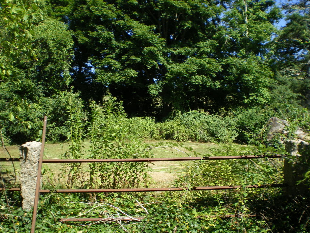
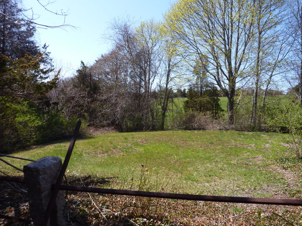
| Description | : | Following the Quaker belief that tombstones were an unnecessary show of worldly grandeur, there are no tombstones in this ancient cemetery. To quote an article (thanks, Caryn!) by Paul Babin, found in the Sandwich Broadsider Posted May 12, 2008 @ 03:53 PM Sandwich — Sandwich's oldest Quaker burial ground is tucked away on a tiny fenced-in patch of land off of Spring Hill Road. The graves are unmarked and the surrounding trees and vegetation have partially hidden the rusty iron fence from view. According to research published by local historian John Cullity, the early Quakers kept their graves unmarked as "an... Read More |
frequently asked questions (FAQ):
-
Where is Old Quaker Meeting House Cemetery at Spring Hill?
Old Quaker Meeting House Cemetery at Spring Hill is located at Sandwich, Barnstable County ,Massachusetts ,USA.
-
Old Quaker Meeting House Cemetery at Spring Hill cemetery's updated grave count on graveviews.com?
1 memorials
-
Where are the coordinates of the Old Quaker Meeting House Cemetery at Spring Hill?
Latitude: 41.7463100
Longitude: -70.4613060
Nearby Cemetories:
1. Quaker Meeting House Cemetery
East Sandwich, Barnstable County, USA
Coordinate: 41.7469673, -70.4591064
2. Spring Hill Cemetery
Sandwich, Barnstable County, USA
Coordinate: 41.7487984, -70.4775009
3. Cedarville Cemetery
East Sandwich, Barnstable County, USA
Coordinate: 41.7397804, -70.4428864
4. Almshouse Burial Ground
Sandwich, Barnstable County, USA
Coordinate: 41.7501000, -70.4847000
5. Mount Hope Cemetery
Sandwich, Barnstable County, USA
Coordinate: 41.7518997, -70.4850006
6. Old Town Cemetery
Sandwich, Barnstable County, USA
Coordinate: 41.7556992, -70.5011978
7. Saint Peters Cemetery
Sandwich, Barnstable County, USA
Coordinate: 41.7502480, -70.5079346
8. Freeman Cemetery
Sandwich, Barnstable County, USA
Coordinate: 41.7573013, -70.5083008
9. Bay View Cemetery
Sandwich, Barnstable County, USA
Coordinate: 41.7583008, -70.5102997
10. Sandwich Town Cemetery
Sandwich, Barnstable County, USA
Coordinate: 41.7125300, -70.4909000
11. Saddle and Pillion Cemetery
Sagamore, Barnstable County, USA
Coordinate: 41.7672005, -70.5192032
12. Tobey Cemetery
Forestdale, Barnstable County, USA
Coordinate: 41.6972008, -70.4875031
13. Percival Cemetery
Sandwich, Barnstable County, USA
Coordinate: 41.6883011, -70.4557037
14. Boardley Road Cemetery
Sandwich, Barnstable County, USA
Coordinate: 41.6870003, -70.4559021
15. Sagamore Cemetery
Bourne, Barnstable County, USA
Coordinate: 41.7714005, -70.5339966
16. Forestdale Cemetery
Forestdale, Barnstable County, USA
Coordinate: 41.6903000, -70.5024033
17. Francis Family Cemetery
Mashpee, Barnstable County, USA
Coordinate: 41.6807900, -70.4816600
18. Wakeby Cemetery
Sandwich, Barnstable County, USA
Coordinate: 41.6725500, -70.4723100
19. West Parish Burial Ground
West Barnstable, Barnstable County, USA
Coordinate: 41.6984200, -70.3842920
20. West Barnstable Cemetery
West Barnstable, Barnstable County, USA
Coordinate: 41.7080994, -70.3728027
21. Animal Inn Pet Cemetery
Forestdale, Barnstable County, USA
Coordinate: 41.6754200, -70.5070100
22. Bournedale Burying Hill
Bourne, Barnstable County, USA
Coordinate: 41.7741520, -70.5611730
23. Crocker Park Cemetery
Barnstable, Barnstable County, USA
Coordinate: 41.6959000, -70.3780975
24. Bournedale Herring Pond Indian Cemetery
Bourne, Barnstable County, USA
Coordinate: 41.7861900, -70.5658722