
| Memorials | : | 0 |
| Location | : | Edenhall, Eden District, England |
| Coordinate | : | 54.6816000, -2.6700000 |
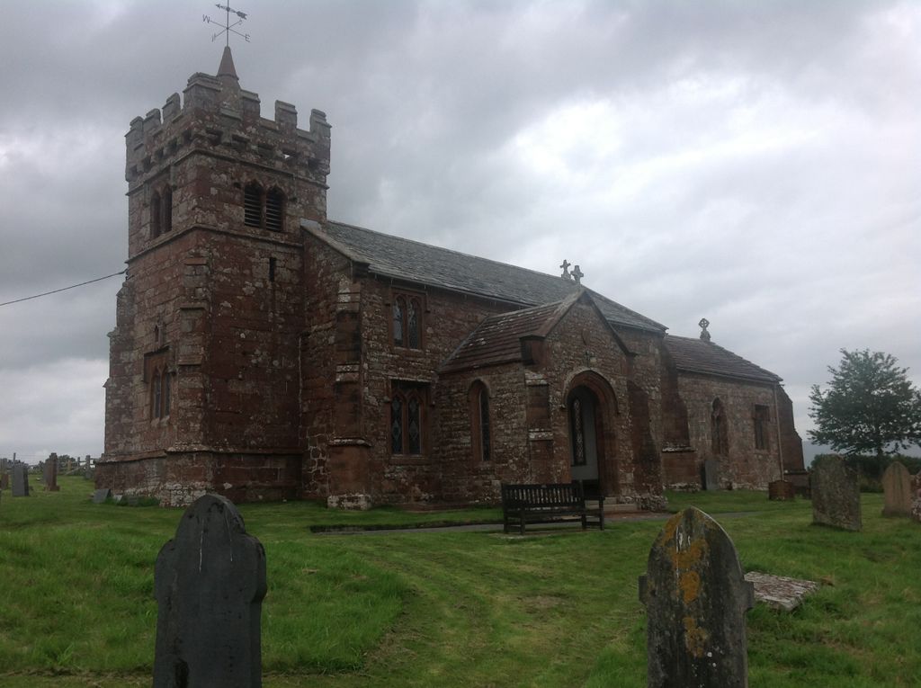
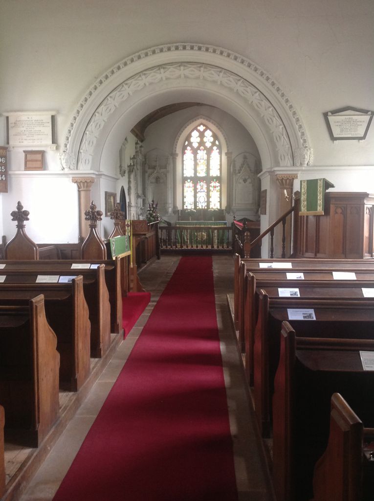
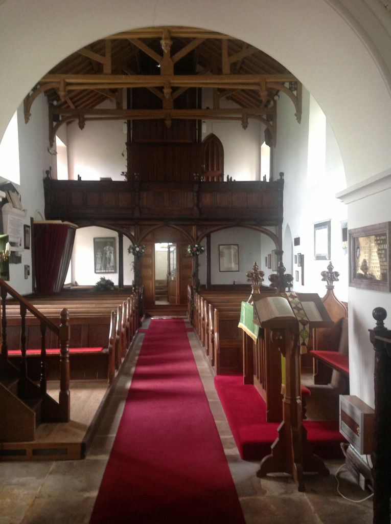
| Description | : | Saint Cuthbert's Church in Edenhall, about a mile south of Langwathby, was founded as a Roman Catholic Church in the 12th century. In the 16th century, however, it was confiscated by Henry VIII when he broke with Rome and has been in use by the Anglican community since that time. The parish church is part of the Diocese of Carlisle. In the 19th century, significant renovation was carried Rev. Sir Christopher John Musgrave, Bt. (9th Baronet Musgrave of Edenhall). In 1967, English Heritage declared the church a Grade 1 listed building. In 2000, Saint Cuthbert's... Read More |
frequently asked questions (FAQ):
-
Where is Saint Cuthbert's Churchyard?
Saint Cuthbert's Churchyard is located at Edenhall, Eden District ,Cumbria ,England.
-
Saint Cuthbert's Churchyard cemetery's updated grave count on graveviews.com?
0 memorials
-
Where are the coordinates of the Saint Cuthbert's Churchyard?
Latitude: 54.6816000
Longitude: -2.6700000
Nearby Cemetories:
1. St. Peter's Churchyard
Langwathby, Eden District, England
Coordinate: 54.6968220, -2.6701190
2. Langwathby Cemetery
Langwathby, Eden District, England
Coordinate: 54.7043400, -2.6750620
3. All Saints Churchyard
Culgaith, Eden District, England
Coordinate: 54.6606090, -2.6059000
4. St John the Evangelist Churchyard
Skirwith, Eden District, England
Coordinate: 54.6869000, -2.5944870
5. Eden Valley Crematorium
Temple Sowerby, Eden District, England
Coordinate: 54.6451850, -2.6237780
6. Saint Cuthbert Churchyard
Great Salkeld, Eden District, England
Coordinate: 54.7239460, -2.6978280
7. Brougham Castle
Brougham, Eden District, England
Coordinate: 54.6493200, -2.7285300
8. Beacon Edge Cemetery
Penrith, Eden District, England
Coordinate: 54.6728020, -2.7503650
9. Penrith Quaker Meeting House
Penrith, Eden District, England
Coordinate: 54.6664360, -2.7513030
10. Brougham Hall and St Wilfrids Chapel Grounds
Brougham, Eden District, England
Coordinate: 54.6482400, -2.7334200
11. St. Andrew's Churchyard
Penrith, Eden District, England
Coordinate: 54.6640750, -2.7513390
12. Christ Church
Penrith, Eden District, England
Coordinate: 54.6678290, -2.7548970
13. Saint Cuthbert's Churchyard
Clifton, Eden District, England
Coordinate: 54.6361620, -2.7266804
14. Saint Michael Churchyard
Glassonby, Eden District, England
Coordinate: 54.7382400, -2.6620900
15. Saint James Churchyard
Temple Sowerby, Eden District, England
Coordinate: 54.6378210, -2.6033040
16. St John the Baptist Churchyard
Melmerby, Eden District, England
Coordinate: 54.7304650, -2.6051700
17. St. Lawrence Churchyard
Kirkland, Eden District, England
Coordinate: 54.6864180, -2.5505640
18. St Cuthbert Churchyard
Cliburn, Eden District, England
Coordinate: 54.6138700, -2.6399030
19. St. Nicholas Churchyard
Lazonby, Eden District, England
Coordinate: 54.7506180, -2.7019380
20. St John the Evangelist Churchyard
Hesket, Eden District, England
Coordinate: 54.7268660, -2.7821200
21. Saint Cuthbert’s Churchyard
Milburn, Eden District, England
Coordinate: 54.6554800, -2.5404800
22. St. John Churchyard
Newton Reigny, Eden District, England
Coordinate: 54.6767560, -2.8088380
23. St. Oswald Churchyard
Kirkoswald, Eden District, England
Coordinate: 54.7612000, -2.6930770
24. St Barnabas Cemetery
Great Strickland, Eden District, England
Coordinate: 54.6002670, -2.6794060