
| Memorials | : | 0 |
| Location | : | Brougham, Eden District, England |
| Coordinate | : | 54.6482400, -2.7334200 |
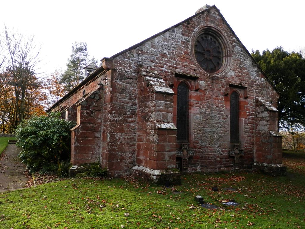
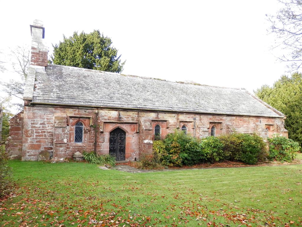
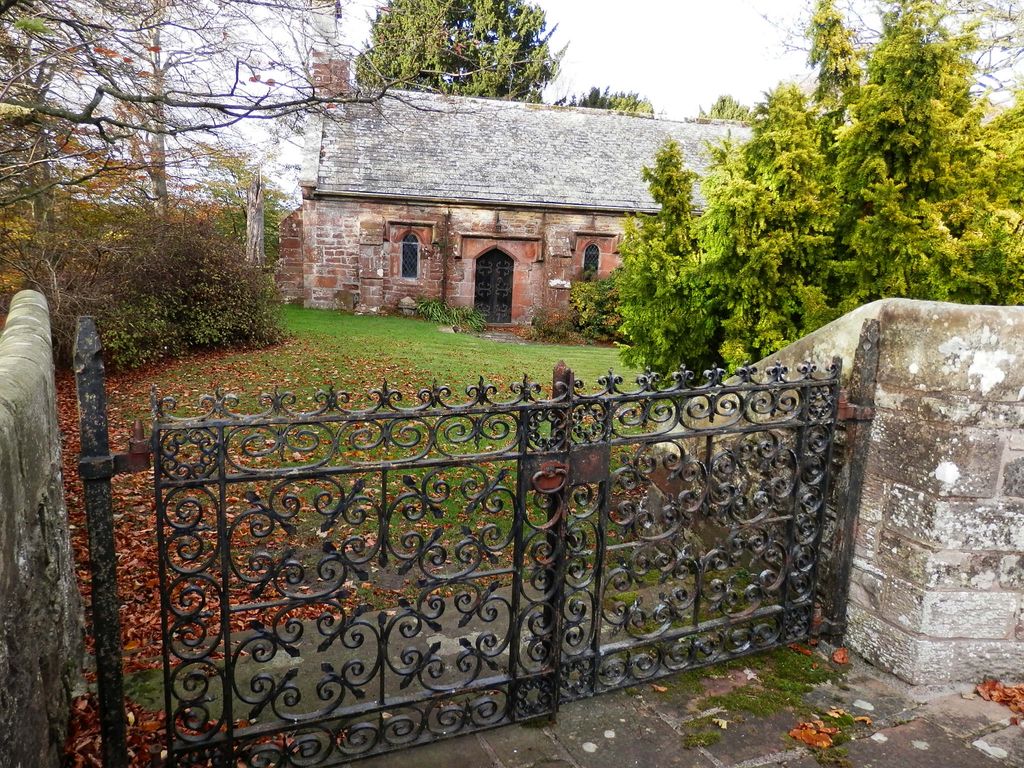
| Description | : | Located in the village of Brougham just outside Penrith, Cumbria, England. There has been a place of worship opposite Brougham Hall since at least 1310AD. The present chapel was rebuilt on the site of an earlier church in 1659 by Lady Anne Clifford, when she inherited the Brougham Estate. It is a simple low building, with buttresses, a nave and a chancel with a bell-cote. The inside was refurbished by the Brougham family of Brougham Hall in the early 19th Century. The Brougham Estate was owned by de Burgham family since before the Norman Conquest. The Tudor Hall, which dates back to... Read More |
frequently asked questions (FAQ):
-
Where is Brougham Hall and St Wilfrids Chapel Grounds?
Brougham Hall and St Wilfrids Chapel Grounds is located at Brougham, Eden District ,Cumbria ,England.
-
Brougham Hall and St Wilfrids Chapel Grounds cemetery's updated grave count on graveviews.com?
0 memorials
-
Where are the coordinates of the Brougham Hall and St Wilfrids Chapel Grounds?
Latitude: 54.6482400
Longitude: -2.7334200
Nearby Cemetories:
1. Brougham Castle
Brougham, Eden District, England
Coordinate: 54.6493200, -2.7285300
2. Saint Cuthbert's Churchyard
Clifton, Eden District, England
Coordinate: 54.6361620, -2.7266804
3. St. Andrew's Churchyard
Penrith, Eden District, England
Coordinate: 54.6640750, -2.7513390
4. Penrith Quaker Meeting House
Penrith, Eden District, England
Coordinate: 54.6664360, -2.7513030
5. Christ Church
Penrith, Eden District, England
Coordinate: 54.6678290, -2.7548970
6. Beacon Edge Cemetery
Penrith, Eden District, England
Coordinate: 54.6728020, -2.7503650
7. St. Michael Churchyard
Lowther, Eden District, England
Coordinate: 54.6129190, -2.7462760
8. St. Michael's Churchyard
Barton, Eden District, England
Coordinate: 54.6297980, -2.7949154
9. Saint Peter's Churchyard
Askham, Eden District, England
Coordinate: 54.6077420, -2.7476530
10. Saint Cuthbert's Churchyard
Edenhall, Eden District, England
Coordinate: 54.6816000, -2.6700000
11. St. John Churchyard
Newton Reigny, Eden District, England
Coordinate: 54.6767560, -2.8088380
12. St Barnabas Cemetery
Great Strickland, Eden District, England
Coordinate: 54.6002670, -2.6794060
13. St. Peter's Churchyard
Langwathby, Eden District, England
Coordinate: 54.6968220, -2.6701190
14. St Andrew's Churchyard
Dacre, Eden District, England
Coordinate: 54.6319910, -2.8380460
15. Eden Valley Crematorium
Temple Sowerby, Eden District, England
Coordinate: 54.6451850, -2.6237780
16. St Cuthbert Churchyard
Cliburn, Eden District, England
Coordinate: 54.6138700, -2.6399030
17. Langwathby Cemetery
Langwathby, Eden District, England
Coordinate: 54.7043400, -2.6750620
18. All Saints Churchyard
Culgaith, Eden District, England
Coordinate: 54.6606090, -2.6059000
19. Saint James Churchyard
Temple Sowerby, Eden District, England
Coordinate: 54.6378210, -2.6033040
20. Saint Cuthbert Churchyard
Great Salkeld, Eden District, England
Coordinate: 54.7239460, -2.6978280
21. St. Andrew Churchyard
Greystoke, Eden District, England
Coordinate: 54.6690130, -2.8645240
22. St. Lawrence Churchyard
Morland, Eden District, England
Coordinate: 54.5964730, -2.6235880
23. St John the Evangelist Churchyard
Hesket, Eden District, England
Coordinate: 54.7268660, -2.7821200
24. St Mary Churchyard
Thrimby, Eden District, England
Coordinate: 54.5708750, -2.6782120