
| Memorials | : | 0 |
| Location | : | Werrington, Peterborough Unitary Authority, England |
| Coordinate | : | 52.6134500, -0.2734500 |
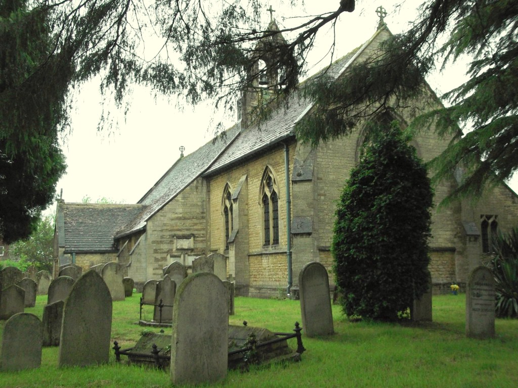
| Description | : | The present building is the result of eight centuries of development, repairs and restoration. It retains both its historical qualities (it is a Grade 1 listed building) as well as trying to meet the needs of a worshipping Christian community in the early 21st century. In the late 19th century the churchyard was extended on land given by Edward Peach. The Eastern end was marked by line of elm trees. Until this time churchyard did not extend North of the building. Cottages to the West of the church were demolished at about this time and the land taken into the churchyard.... Read More |
frequently asked questions (FAQ):
-
Where is Saint John the Baptist Churchyard?
Saint John the Baptist Churchyard is located at Church Street Werrington, Peterborough Unitary Authority ,Cambridgeshire , PE4 6QEEngland.
-
Saint John the Baptist Churchyard cemetery's updated grave count on graveviews.com?
0 memorials
-
Where are the coordinates of the Saint John the Baptist Churchyard?
Latitude: 52.6134500
Longitude: -0.2734500
Nearby Cemetories:
1. All Saints Churchyard
Paston, Peterborough Unitary Authority, England
Coordinate: 52.6053690, -0.2576130
2. Peterborough Crematorium
Bretton, Peterborough Unitary Authority, England
Coordinate: 52.6047280, -0.2915090
3. St Mary The Virgin Churchyard
Marholm, Peterborough Unitary Authority, England
Coordinate: 52.6029760, -0.3089570
4. Glinton Cemetery
Glinton, Peterborough Unitary Authority, England
Coordinate: 52.6374399, -0.2947420
5. Saint Benedict Churchyard
Glinton, Peterborough Unitary Authority, England
Coordinate: 52.6392160, -0.2959420
6. Saint Pegas Churchyard
Peakirk, Peterborough Unitary Authority, England
Coordinate: 52.6454940, -0.2744530
7. Eastfield Cemetery
Peterborough, Peterborough Unitary Authority, England
Coordinate: 52.5890690, -0.2225360
8. St Bartholomew Churchyard
Newborough, Peterborough Unitary Authority, England
Coordinate: 52.6385360, -0.2223780
9. Broadway Cemetery
Peterborough, Peterborough Unitary Authority, England
Coordinate: 52.5796750, -0.2350260
10. St. John the Baptist Church
Peterborough, Peterborough Unitary Authority, England
Coordinate: 52.5727200, -0.2438210
11. Peterborough Cathedral
Peterborough, Peterborough Unitary Authority, England
Coordinate: 52.5725280, -0.2392390
12. St. Andrew's Churchyard
Northborough, Peterborough Unitary Authority, England
Coordinate: 52.6571000, -0.2974630
13. St. Botolph Helpston Churchyard
Helpston, Peterborough Unitary Authority, England
Coordinate: 52.6359090, -0.3435870
14. Helpston Cemetery
Helpston, Peterborough Unitary Authority, England
Coordinate: 52.6374890, -0.3433900
15. All Saints at Botolphbridge (Not Extant)
Orton Longueville, Peterborough Unitary Authority, England
Coordinate: 52.5615344, -0.2731584
16. Saint Matthew's Churchyard
Eye, Peterborough Unitary Authority, England
Coordinate: 52.6094813, -0.1866602
17. Eye Cemetery
Eye, Peterborough Unitary Authority, England
Coordinate: 52.6110938, -0.1859580
18. Woodston Cemetery
Woodston, Peterborough Unitary Authority, England
Coordinate: 52.5607090, -0.2529700
19. Fletton Cemetery
Fletton, Peterborough Unitary Authority, England
Coordinate: 52.5611534, -0.2350550
20. St Kyneburgha Churchyard
Castor, Peterborough Unitary Authority, England
Coordinate: 52.5729580, -0.3417630
21. St. James Cemetery
Deeping St James, South Kesteven District, England
Coordinate: 52.6716340, -0.2899500
22. St. James Churchyard
Deeping St James, South Kesteven District, England
Coordinate: 52.6716980, -0.2896360
23. St. Margaret's churchyard
Fletton, Peterborough Unitary Authority, England
Coordinate: 52.5584400, -0.2350100
24. St. Peter's Churchyard
Maxey, Peterborough Unitary Authority, England
Coordinate: 52.6575500, -0.3455940