
| Memorials | : | 0 |
| Location | : | Fletton, Peterborough Unitary Authority, England |
| Coordinate | : | 52.5584400, -0.2350100 |
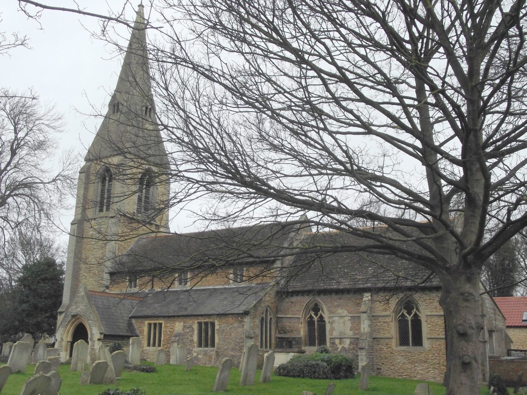
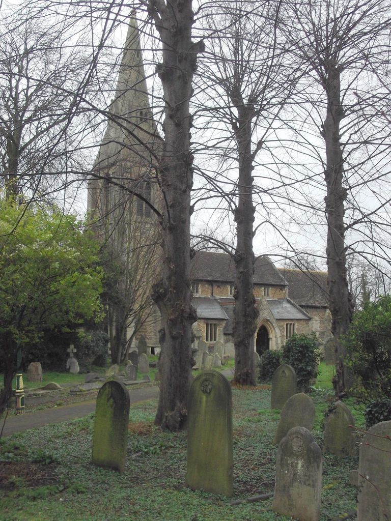
| Description | : | The church was mentioned in the Domesday Book of AD1086 and some of the fabric undoubtedly dates from this time. There are Norman features from the 12th century with additions in the 14th century. St. Margaret's has several 9th Century Saxon carvings. The parish church is dedicated to Saint Margaret of Antioch and, although in the Diocese of Ely, it has now been placed under the pastoral care of the Bishop of Peterborough, acting as Assistant Bishop in the Diocese of Ely. Fletton, or Old Fletton, is a defined area of Peterborough and it is surprising that (unlike nearby Stanground) Find... Read More |
frequently asked questions (FAQ):
-
Where is St. Margaret's churchyard?
St. Margaret's churchyard is located at At the corner of Fletton Ave and Fletton High Street Fletton, Peterborough Unitary Authority ,Cambridgeshire , PE2 8DFEngland.
-
St. Margaret's churchyard cemetery's updated grave count on graveviews.com?
0 memorials
-
Where are the coordinates of the St. Margaret's churchyard?
Latitude: 52.5584400
Longitude: -0.2350100
Nearby Cemetories:
1. Fletton Cemetery
Fletton, Peterborough Unitary Authority, England
Coordinate: 52.5611534, -0.2350550
2. Stanground Cemetery
Stanground, Peterborough Unitary Authority, England
Coordinate: 52.5516860, -0.2273100
3. Woodston Cemetery
Woodston, Peterborough Unitary Authority, England
Coordinate: 52.5607090, -0.2529700
4. Peterborough Cathedral
Peterborough, Peterborough Unitary Authority, England
Coordinate: 52.5725280, -0.2392390
5. St. John the Baptist Church
Peterborough, Peterborough Unitary Authority, England
Coordinate: 52.5727200, -0.2438210
6. Broadway Cemetery
Peterborough, Peterborough Unitary Authority, England
Coordinate: 52.5796750, -0.2350260
7. All Saints at Botolphbridge (Not Extant)
Orton Longueville, Peterborough Unitary Authority, England
Coordinate: 52.5615344, -0.2731584
8. Eastfield Cemetery
Peterborough, Peterborough Unitary Authority, England
Coordinate: 52.5890690, -0.2225360
9. All Saints Churchyard
Paston, Peterborough Unitary Authority, England
Coordinate: 52.6053690, -0.2576130
10. Yaxley Cemetery
Peterborough, Peterborough Unitary Authority, England
Coordinate: 52.5137400, -0.2700500
11. Saint Peter's Churchyard
Yaxley, Huntingdonshire District, England
Coordinate: 52.5117400, -0.2672200
12. Peterborough Crematorium
Bretton, Peterborough Unitary Authority, England
Coordinate: 52.6047280, -0.2915090
13. Alwalton Cemetery
Alwalton, Huntingdonshire District, England
Coordinate: 52.5501113, -0.3288831
14. St. Andrew's Church
Alwalton, Huntingdonshire District, England
Coordinate: 52.5495800, -0.3297610
15. Saint Matthew's Churchyard
Eye, Peterborough Unitary Authority, England
Coordinate: 52.6094813, -0.1866602
16. Saint John the Baptist Churchyard
Werrington, Peterborough Unitary Authority, England
Coordinate: 52.6134500, -0.2734500
17. Eye Cemetery
Eye, Peterborough Unitary Authority, England
Coordinate: 52.6110938, -0.1859580
18. St. Andrew's Churchyard
Whittlesey, Fenland District, England
Coordinate: 52.5558673, -0.1330800
19. St Mary The Virgin Churchyard
Marholm, Peterborough Unitary Authority, England
Coordinate: 52.6029760, -0.3089570
20. St. Michael's Churchyard
Chesterton, Huntingdonshire District, England
Coordinate: 52.5451434, -0.3400366
21. Saint Mary's Churchyard
Whittlesey, Fenland District, England
Coordinate: 52.5556600, -0.1278000
22. St Kyneburgha Churchyard
Castor, Peterborough Unitary Authority, England
Coordinate: 52.5729580, -0.3417630
23. Whittlesey Cemetery
Whittlesey, Fenland District, England
Coordinate: 52.5583700, -0.1232450
24. St. Mary's Churchyard
Peterborough, Peterborough Unitary Authority, England
Coordinate: 52.5184227, -0.3295881