
| Memorials | : | 0 |
| Location | : | Orton Longueville, Peterborough Unitary Authority, England |
| Coordinate | : | 52.5615344, -0.2731584 |
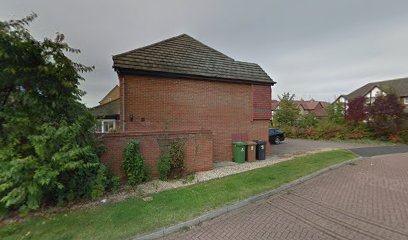
| Description | : | All Saints Church of the now extinct Botolphbridge parish was mentioned in the Domesday survey of 1086. It sat to the north of Botolphbridge manor. The site is sometimes indicated as "Bottle Bridge" or "Battle Bridge." All Saints was pulled down in 1695, and the materials were used to repair and enlarge the church at Orton Longueville. According to *A History of the County of Huntingdon* (1936), " [J]udging by the south aisle of Orton Longueville, which was enlarged with its stones, it [All Saints] must have been partly rebuilt in the 14th century. The bells are referred to in... Read More |
frequently asked questions (FAQ):
-
Where is All Saints at Botolphbridge (Not Extant)?
All Saints at Botolphbridge (Not Extant) is located at Orton Longueville, Peterborough Unitary Authority ,Cambridgeshire ,England.
-
All Saints at Botolphbridge (Not Extant) cemetery's updated grave count on graveviews.com?
0 memorials
-
Where are the coordinates of the All Saints at Botolphbridge (Not Extant)?
Latitude: 52.5615344
Longitude: -0.2731584
Nearby Cemetories:
1. Woodston Cemetery
Woodston, Peterborough Unitary Authority, England
Coordinate: 52.5607090, -0.2529700
2. St. John the Baptist Church
Peterborough, Peterborough Unitary Authority, England
Coordinate: 52.5727200, -0.2438210
3. Fletton Cemetery
Fletton, Peterborough Unitary Authority, England
Coordinate: 52.5611534, -0.2350550
4. Peterborough Cathedral
Peterborough, Peterborough Unitary Authority, England
Coordinate: 52.5725280, -0.2392390
5. St. Margaret's churchyard
Fletton, Peterborough Unitary Authority, England
Coordinate: 52.5584400, -0.2350100
6. Broadway Cemetery
Peterborough, Peterborough Unitary Authority, England
Coordinate: 52.5796750, -0.2350260
7. Stanground Cemetery
Stanground, Peterborough Unitary Authority, England
Coordinate: 52.5516860, -0.2273100
8. Alwalton Cemetery
Alwalton, Huntingdonshire District, England
Coordinate: 52.5501113, -0.3288831
9. St. Andrew's Church
Alwalton, Huntingdonshire District, England
Coordinate: 52.5495800, -0.3297610
10. Eastfield Cemetery
Peterborough, Peterborough Unitary Authority, England
Coordinate: 52.5890690, -0.2225360
11. St Kyneburgha Churchyard
Castor, Peterborough Unitary Authority, England
Coordinate: 52.5729580, -0.3417630
12. St. Michael's Churchyard
Chesterton, Huntingdonshire District, England
Coordinate: 52.5451434, -0.3400366
13. Peterborough Crematorium
Bretton, Peterborough Unitary Authority, England
Coordinate: 52.6047280, -0.2915090
14. All Saints Churchyard
Paston, Peterborough Unitary Authority, England
Coordinate: 52.6053690, -0.2576130
15. St Mary The Virgin Churchyard
Marholm, Peterborough Unitary Authority, England
Coordinate: 52.6029760, -0.3089570
16. Yaxley Cemetery
Peterborough, Peterborough Unitary Authority, England
Coordinate: 52.5137400, -0.2700500
17. Saint Peter's Churchyard
Yaxley, Huntingdonshire District, England
Coordinate: 52.5117400, -0.2672200
18. Saint John the Baptist Churchyard
Werrington, Peterborough Unitary Authority, England
Coordinate: 52.6134500, -0.2734500
19. St. Mary's Churchyard
Peterborough, Peterborough Unitary Authority, England
Coordinate: 52.5184227, -0.3295881
20. St Remigius Churchyard
Water Newton, Huntingdonshire District, England
Coordinate: 52.5624550, -0.3656390
21. All Saints
Morborne, Huntingdonshire District, England
Coordinate: 52.5094990, -0.3228910
22. St. Michael & All Angels
Sutton, Peterborough Unitary Authority, England
Coordinate: 52.5754356, -0.3853515
23. Saint Matthew's Churchyard
Eye, Peterborough Unitary Authority, England
Coordinate: 52.6094813, -0.1866602
24. Eye Cemetery
Eye, Peterborough Unitary Authority, England
Coordinate: 52.6110938, -0.1859580