
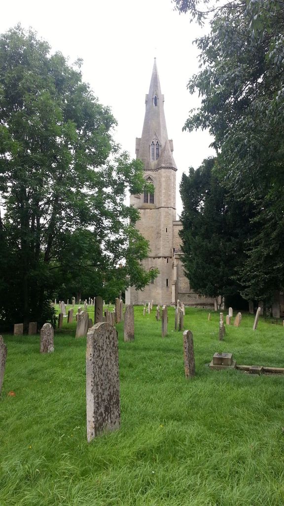
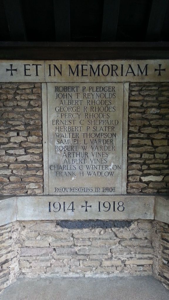
| Memorials | : | 1 |
| Location | : | Paston, Peterborough Unitary Authority, England |
| Coordinate | : | 52.6053690, -0.2576130 |
frequently asked questions (FAQ):
-
Where is All Saints Churchyard?
All Saints Churchyard is located at Fulbridge Road, Paston, Peterborough Unitary Authority ,Cambridgeshire , PE4 6SNEngland.
-
All Saints Churchyard cemetery's updated grave count on graveviews.com?
1 memorials
-
Where are the coordinates of the All Saints Churchyard?
Latitude: 52.6053690
Longitude: -0.2576130
Nearby Cemetories:
1. Saint John the Baptist Churchyard
Werrington, Peterborough Unitary Authority, England
Coordinate: 52.6134500, -0.2734500
2. Peterborough Crematorium
Bretton, Peterborough Unitary Authority, England
Coordinate: 52.6047280, -0.2915090
3. Eastfield Cemetery
Peterborough, Peterborough Unitary Authority, England
Coordinate: 52.5890690, -0.2225360
4. Broadway Cemetery
Peterborough, Peterborough Unitary Authority, England
Coordinate: 52.5796750, -0.2350260
5. St Mary The Virgin Churchyard
Marholm, Peterborough Unitary Authority, England
Coordinate: 52.6029760, -0.3089570
6. St. John the Baptist Church
Peterborough, Peterborough Unitary Authority, England
Coordinate: 52.5727200, -0.2438210
7. Peterborough Cathedral
Peterborough, Peterborough Unitary Authority, England
Coordinate: 52.5725280, -0.2392390
8. Glinton Cemetery
Glinton, Peterborough Unitary Authority, England
Coordinate: 52.6374399, -0.2947420
9. St Bartholomew Churchyard
Newborough, Peterborough Unitary Authority, England
Coordinate: 52.6385360, -0.2223780
10. Saint Benedict Churchyard
Glinton, Peterborough Unitary Authority, England
Coordinate: 52.6392160, -0.2959420
11. Saint Pegas Churchyard
Peakirk, Peterborough Unitary Authority, England
Coordinate: 52.6454940, -0.2744530
12. Saint Matthew's Churchyard
Eye, Peterborough Unitary Authority, England
Coordinate: 52.6094813, -0.1866602
13. Eye Cemetery
Eye, Peterborough Unitary Authority, England
Coordinate: 52.6110938, -0.1859580
14. Woodston Cemetery
Woodston, Peterborough Unitary Authority, England
Coordinate: 52.5607090, -0.2529700
15. All Saints at Botolphbridge (Not Extant)
Orton Longueville, Peterborough Unitary Authority, England
Coordinate: 52.5615344, -0.2731584
16. Fletton Cemetery
Fletton, Peterborough Unitary Authority, England
Coordinate: 52.5611534, -0.2350550
17. St. Margaret's churchyard
Fletton, Peterborough Unitary Authority, England
Coordinate: 52.5584400, -0.2350100
18. Stanground Cemetery
Stanground, Peterborough Unitary Authority, England
Coordinate: 52.5516860, -0.2273100
19. St. Andrew's Churchyard
Northborough, Peterborough Unitary Authority, England
Coordinate: 52.6571000, -0.2974630
20. St. Botolph Helpston Churchyard
Helpston, Peterborough Unitary Authority, England
Coordinate: 52.6359090, -0.3435870
21. St Kyneburgha Churchyard
Castor, Peterborough Unitary Authority, England
Coordinate: 52.5729580, -0.3417630
22. Helpston Cemetery
Helpston, Peterborough Unitary Authority, England
Coordinate: 52.6374890, -0.3433900
23. St. James Cemetery
Deeping St James, South Kesteven District, England
Coordinate: 52.6716340, -0.2899500
24. St. James Churchyard
Deeping St James, South Kesteven District, England
Coordinate: 52.6716980, -0.2896360