
| Memorials | : | 0 |
| Location | : | Lower Shuckburgh, Stratford-on-Avon District, England |
| Coordinate | : | 52.2598580, -1.2845210 |
frequently asked questions (FAQ):
-
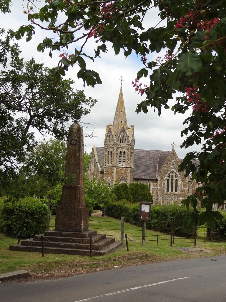
Where is Saint John the Baptist Churchyard?
Saint John the Baptist Churchyard is located at Lower Shuckburgh, Stratford-on-Avon District ,Warwickshire ,England.
-
Saint John the Baptist Churchyard cemetery's updated grave count on graveviews.com?
0 memorials
-
Where are the coordinates of the Saint John the Baptist Churchyard?
Latitude: 52.2598580
Longitude: -1.2845210
Nearby Cemetories:
1. St John the Baptist Church
Upper Shuckburgh, Stratford-on-Avon District, England
Coordinate: 52.2517680, -1.2732630
2. St Lawrence Churchyard
Napton-on-the-Hill, Stratford-on-Avon District, England
Coordinate: 52.2477560, -1.3230470
3. St Peter's Churchyard
Grandborough, Rugby Borough, England
Coordinate: 52.2988800, -1.2791400
4. St. Leonard's Churchyard
Priors Marston, Stratford-on-Avon District, England
Coordinate: 52.2144950, -1.2852860
5. St. John the Baptist Churchyard
Hellidon, Daventry District, England
Coordinate: 52.2195780, -1.2464920
6. St Michael's Church
Stockton, Stratford-on-Avon District, England
Coordinate: 52.2688770, -1.3600030
7. St. Mary the Virgin Churchyard
Staverton, Daventry District, England
Coordinate: 52.2457070, -1.2090230
8. St. Nicholas Parish Churchyard
Willoughby, Rugby Borough, England
Coordinate: 52.3027580, -1.2446380
9. All Saints Churchyard
Braunston, Daventry District, England
Coordinate: 52.2908200, -1.2140100
10. All Saints Churchyard
Leamington Hastings, Rugby Borough, England
Coordinate: 52.3045700, -1.3491900
11. St Mary's Churchyard
Priors Hardwick, Stratford-on-Avon District, England
Coordinate: 52.2019860, -1.3110330
12. St James Churchyard
Southam, Stratford-on-Avon District, England
Coordinate: 52.2525240, -1.3893000
13. St. Mary the Virgin
Badby, Daventry District, England
Coordinate: 52.2240200, -1.1820100
14. Holy Trinity Churchyard
Long Itchington, Stratford-on-Avon District, England
Coordinate: 52.2828775, -1.3971052
15. Long Itchington Cemetery
Long Itchington, Stratford-on-Avon District, England
Coordinate: 52.2840190, -1.3980140
16. St Leonard's Churchyard
Birdingbury, Rugby Borough, England
Coordinate: 52.3141340, -1.3675630
17. All Saints Churchyard
Ladbroke, Stratford-on-Avon District, England
Coordinate: 52.2267360, -1.3960660
18. Welton Road Daventry
Daventry, Daventry District, England
Coordinate: 52.2643510, -1.1590460
19. St Peter Churchyard
Dunchurch, Rugby Borough, England
Coordinate: 52.3372340, -1.2879220
20. Dunchurch Baptist Churchyard
Dunchurch, Rugby Borough, England
Coordinate: 52.3393410, -1.2980990
21. Holy Trinity Churchyard
Charwelton, Daventry District, England
Coordinate: 52.1952913, -1.2044410
22. St Peters Churchyard
Bourton on Dunsmore, Rugby Borough, England
Coordinate: 52.3285270, -1.3612930
23. St Mary's Parish Church
Barby, Daventry District, England
Coordinate: 52.3279870, -1.2041410
24. Welton Cemetery
Welton, Daventry District, England
Coordinate: 52.2932126, -1.1567336