
| Memorials | : | 0 |
| Location | : | Grandborough, Rugby Borough, England |
| Coordinate | : | 52.2988800, -1.2791400 |
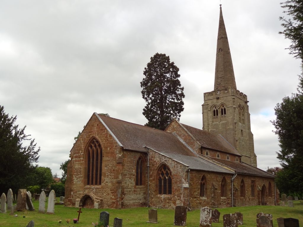
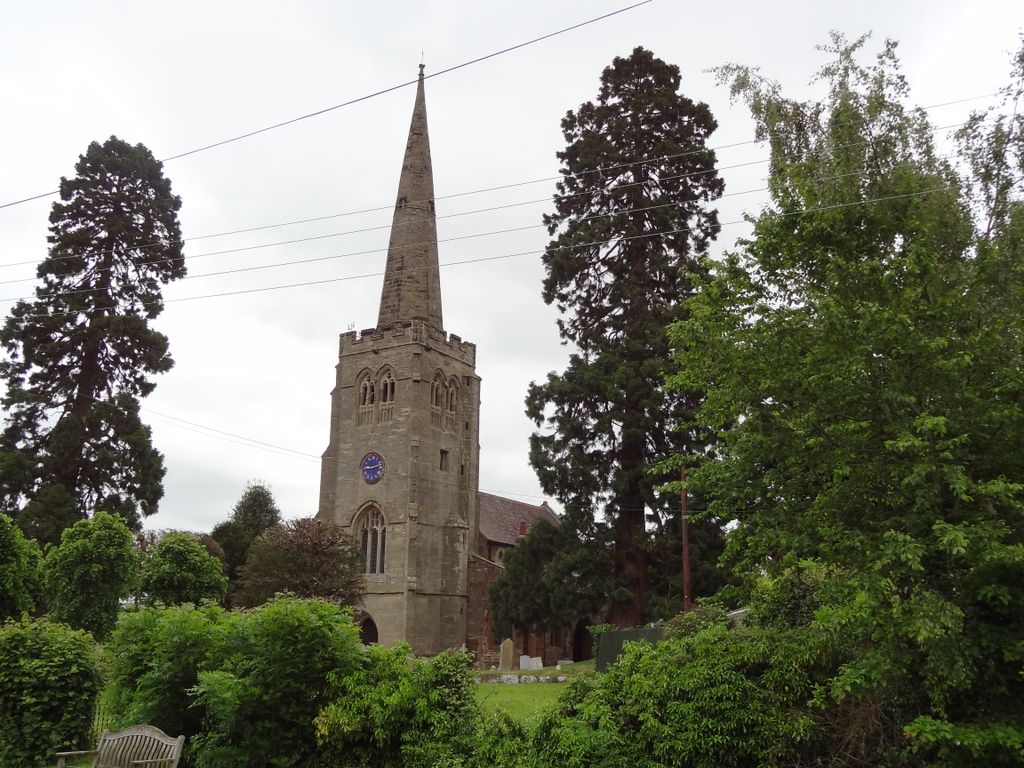
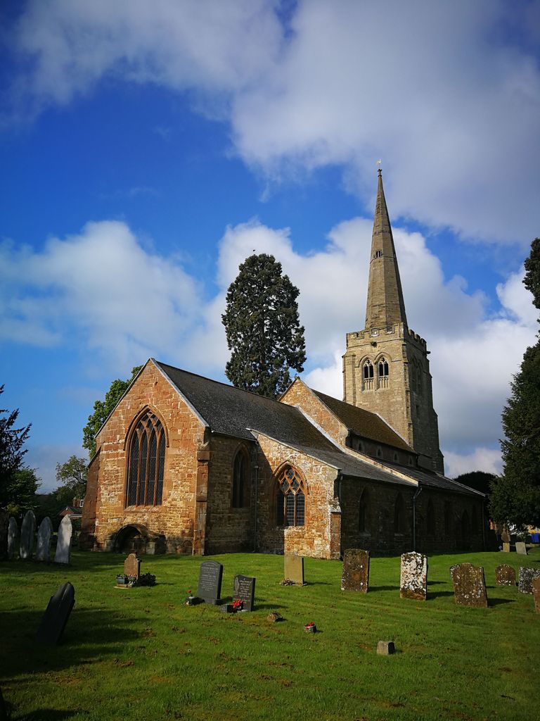
| Description | : | St Peter’s Church is situated in the picturesque village of Grandborough. Two Wellingtonia trees which were planted on either side of the tower and spire, some 100 years ago, can be seen for miles around Grandborough and make an impressive picture from some distance away. |
frequently asked questions (FAQ):
-
Where is St Peter's Churchyard?
St Peter's Churchyard is located at Church Road Grandborough, Rugby Borough ,Warwickshire , CV23 8DHEngland.
-
St Peter's Churchyard cemetery's updated grave count on graveviews.com?
0 memorials
-
Where are the coordinates of the St Peter's Churchyard?
Latitude: 52.2988800
Longitude: -1.2791400
Nearby Cemetories:
1. St. Nicholas Parish Churchyard
Willoughby, Rugby Borough, England
Coordinate: 52.3027580, -1.2446380
2. St Peter Churchyard
Dunchurch, Rugby Borough, England
Coordinate: 52.3372340, -1.2879220
3. Saint John the Baptist Churchyard
Lower Shuckburgh, Stratford-on-Avon District, England
Coordinate: 52.2598580, -1.2845210
4. All Saints Churchyard
Braunston, Daventry District, England
Coordinate: 52.2908200, -1.2140100
5. Dunchurch Baptist Churchyard
Dunchurch, Rugby Borough, England
Coordinate: 52.3393410, -1.2980990
6. All Saints Churchyard
Leamington Hastings, Rugby Borough, England
Coordinate: 52.3045700, -1.3491900
7. St John the Baptist Church
Upper Shuckburgh, Stratford-on-Avon District, England
Coordinate: 52.2517680, -1.2732630
8. St Mary's Parish Church
Barby, Daventry District, England
Coordinate: 52.3279870, -1.2041410
9. St Leonard's Churchyard
Birdingbury, Rugby Borough, England
Coordinate: 52.3141340, -1.3675630
10. Rainsbrook Cemetery and Crematorium
Rugby, Rugby Borough, England
Coordinate: 52.3528167, -1.2465422
11. St Lawrence Churchyard
Napton-on-the-Hill, Stratford-on-Avon District, England
Coordinate: 52.2477560, -1.3230470
12. St Michael's Church
Stockton, Stratford-on-Avon District, England
Coordinate: 52.2688770, -1.3600030
13. St Peters Churchyard
Bourton on Dunsmore, Rugby Borough, England
Coordinate: 52.3285270, -1.3612930
14. Saint Marks Churchyard
Bilton, Rugby Borough, England
Coordinate: 52.3611920, -1.2854120
15. St. Nicholas Churchyard
Frankton, Rugby Borough, England
Coordinate: 52.3277230, -1.3796870
16. St. Mary the Virgin Churchyard
Staverton, Daventry District, England
Coordinate: 52.2457070, -1.2090230
17. St. Marie's Roman Catholic Church
Rugby, Rugby Borough, England
Coordinate: 52.3666391, -1.2642307
18. Croop Hill Cemetery
Rugby, Rugby Borough, England
Coordinate: 52.3701510, -1.2829420
19. Rugby School Chapel
Rugby, Rugby Borough, England
Coordinate: 52.3703890, -1.2639150
20. Watts Lane Cemetery
Rugby, Rugby Borough, England
Coordinate: 52.3592560, -1.2133530
21. Blessed Virgin Mary and St Leodegarius Churchyard
Ashby St Ledgers, Daventry District, England
Coordinate: 52.3090000, -1.1606000
22. St. Faith's Churchyard
Kilsby, Daventry District, England
Coordinate: 52.3356260, -1.1748520
23. Holy Trinity Churchyard
Long Itchington, Stratford-on-Avon District, England
Coordinate: 52.2828775, -1.3971052
24. Long Itchington Cemetery
Long Itchington, Stratford-on-Avon District, England
Coordinate: 52.2840190, -1.3980140