
| Memorials | : | 0 |
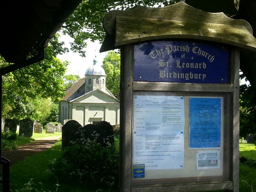
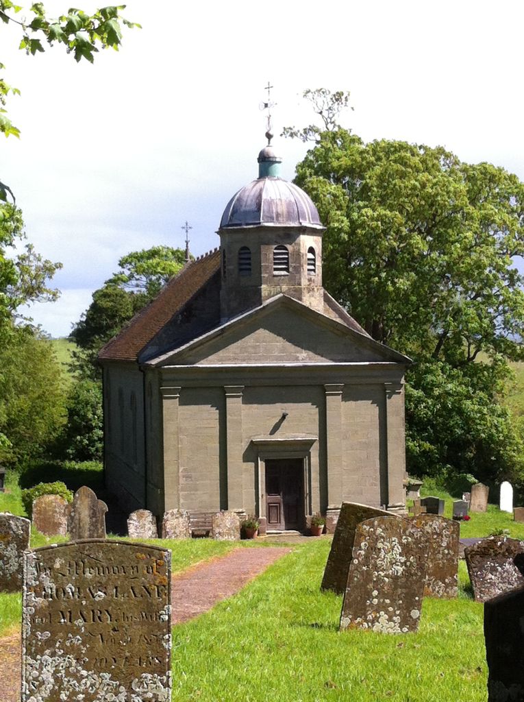
| Location | : | Birdingbury, Rugby Borough, England |
| Coordinate | : | 52.3141340, -1.3675630 |
frequently asked questions (FAQ):
-
Where is St Leonard's Churchyard?
St Leonard's Churchyard is located at Main St Birdingbury, Rugby Borough ,Warwickshire , CV23 8EWEngland.
-
St Leonard's Churchyard cemetery's updated grave count on graveviews.com?
0 memorials
-
Where are the coordinates of the St Leonard's Churchyard?
Latitude: 52.3141340
Longitude: -1.3675630
Nearby Cemetories:
1. All Saints Churchyard
Leamington Hastings, Rugby Borough, England
Coordinate: 52.3045700, -1.3491900
2. St Peters Churchyard
Bourton on Dunsmore, Rugby Borough, England
Coordinate: 52.3285270, -1.3612930
3. St. Nicholas Churchyard
Frankton, Rugby Borough, England
Coordinate: 52.3277230, -1.3796870
4. St Esprit Churchyard
Marton, Rugby Borough, England
Coordinate: 52.3167730, -1.4043900
5. Long Itchington Cemetery
Long Itchington, Stratford-on-Avon District, England
Coordinate: 52.2840190, -1.3980140
6. Holy Trinity Churchyard
Long Itchington, Stratford-on-Avon District, England
Coordinate: 52.2828775, -1.3971052
7. Princethorpe Cemetery
Princethorpe, Rugby Borough, England
Coordinate: 52.3340670, -1.4232840
8. Princethorpe Priory Nun's Cemetery
Princethorpe, Rugby Borough, England
Coordinate: 52.3360620, -1.4216400
9. All Saints Churchyard
Stretton-on-Dunsmore, Rugby Borough, England
Coordinate: 52.3495500, -1.4042900
10. St Michael's Church
Stockton, Stratford-on-Avon District, England
Coordinate: 52.2688770, -1.3600030
11. Saint Anne Churchyard
Wappenbury, Warwick District, England
Coordinate: 52.3200340, -1.4458580
12. St John the Baptist Churchyard
Wappenbury, Warwick District, England
Coordinate: 52.3204330, -1.4467410
13. Dunchurch Baptist Churchyard
Dunchurch, Rugby Borough, England
Coordinate: 52.3393410, -1.2980990
14. Saint Margaret's Churchyard
Hunningham, Warwick District, England
Coordinate: 52.3098800, -1.4551000
15. St Peter Churchyard
Dunchurch, Rugby Borough, England
Coordinate: 52.3372340, -1.2879220
16. St Peter's Churchyard
Grandborough, Rugby Borough, England
Coordinate: 52.2988800, -1.2791400
17. Dyers Lane Cemetery
Wolston, Rugby Borough, England
Coordinate: 52.3742591, -1.3921321
18. St James Churchyard
Southam, Stratford-on-Avon District, England
Coordinate: 52.2525240, -1.3893000
19. St. Michael's Churchyard
Weston under Wetherley, Warwick District, England
Coordinate: 52.3201580, -1.4728890
20. St Leonard's Churchyard
Ryton-on-Dunsmore, Rugby Borough, England
Coordinate: 52.3674940, -1.4338580
21. St Margaret's Churchyard
Wolston, Rugby Borough, England
Coordinate: 52.3783460, -1.3996960
22. Saint Marks Churchyard
Bilton, Rugby Borough, England
Coordinate: 52.3611920, -1.2854120
23. St. Gregory's Churchyard
Leamington Spa, Warwick District, England
Coordinate: 52.2878560, -1.4763950
24. St Lawrence Churchyard
Napton-on-the-Hill, Stratford-on-Avon District, England
Coordinate: 52.2477560, -1.3230470