
| Memorials | : | 0 |
| Location | : | Mountain View, Howell County, USA |
| Coordinate | : | 37.0037498, -91.7072525 |
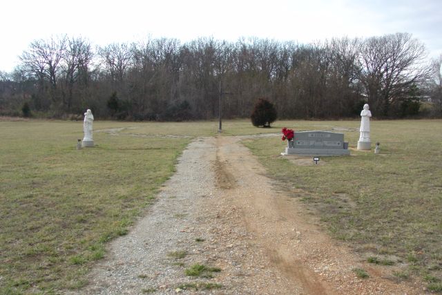
| Description | : | Located 0.1 miles North off of Hwy. 60, on Hwy. Y, turn left at the Catholic Church into the parking area. Cemetery is behind Church. |
frequently asked questions (FAQ):
-
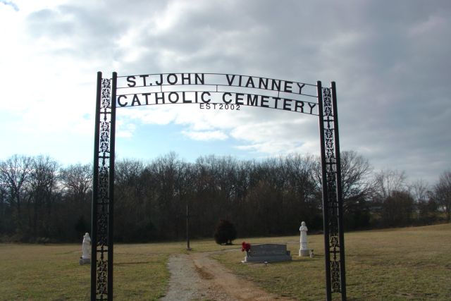
Where is Saint John Vianney Catholic Cemetery?
Saint John Vianney Catholic Cemetery is located at Mountain View, Howell County ,Missouri ,USA.
-
Saint John Vianney Catholic Cemetery cemetery's updated grave count on graveviews.com?
0 memorials
-
Where are the coordinates of the Saint John Vianney Catholic Cemetery?
Latitude: 37.0037498
Longitude: -91.7072525

Nearby Cemetories:
1. Mountain View Cemetery
Mountain View, Howell County, USA
Coordinate: 36.9972992, -91.6904984
2. Greenlawn Cemetery
Mountain View, Howell County, USA
Coordinate: 36.9975014, -91.6892014
3. Veterans Memorial Cemetery
Mountain View, Howell County, USA
Coordinate: 36.9975014, -91.6869965
4. Padgett Cemetery
Mountain View, Howell County, USA
Coordinate: 36.9727173, -91.7155533
5. Gill Cemetery
Mountain View, Howell County, USA
Coordinate: 37.0224991, -91.7500000
6. Pilgrim Rest Cemetery
Teresita, Shannon County, USA
Coordinate: 37.0189018, -91.6485977
7. New Salem Cemetery
Mountain View, Howell County, USA
Coordinate: 37.0278015, -91.7727966
8. Grace Cemetery
Mountain View, Howell County, USA
Coordinate: 37.0075684, -91.7871323
9. Chapel Hill Cemetery
Chapel, Howell County, USA
Coordinate: 36.9358290, -91.6826140
10. Pleasant Grove Cemetery
Teresita, Shannon County, USA
Coordinate: 36.9742012, -91.6206970
11. Center Hill Cemetery
Chapel, Howell County, USA
Coordinate: 36.9415016, -91.7610016
12. Forest Dell Ebenezer Cemetery
Mountain View, Howell County, USA
Coordinate: 36.9328003, -91.7403030
13. Walker Chapel Cemetery
Mountain View, Howell County, USA
Coordinate: 36.9647408, -91.7969513
14. Turkey Oak Cemetery
Montier, Shannon County, USA
Coordinate: 37.0203018, -91.5768967
15. Montier Cemetery
Montier, Shannon County, USA
Coordinate: 36.9847984, -91.5754013
16. Rowe Cemetery
Willow Springs, Howell County, USA
Coordinate: 36.9791985, -91.8396988
17. Oakside Cemetery
Summersville, Shannon County, USA
Coordinate: 37.1053505, -91.6523285
18. Cantrell Cemetery
Hutton Valley, Howell County, USA
Coordinate: 36.9270300, -91.8112900
19. New Salem Cemetery
Teresita, Shannon County, USA
Coordinate: 36.9239006, -91.6027985
20. Dunkard Cemetery
Montier, Shannon County, USA
Coordinate: 37.0208015, -91.5580978
21. Bolin Cemetery
Hutton Valley, Howell County, USA
Coordinate: 36.9443100, -91.8530200
22. Corinth Cemetery
Birch Tree, Shannon County, USA
Coordinate: 36.9169998, -91.5661011
23. Hutton Valley Cemetery
Willow Springs, Howell County, USA
Coordinate: 36.9637985, -91.8796997
24. Lost Camp Cemetery
Pomona, Howell County, USA
Coordinate: 36.9105988, -91.8566971