
| Memorials | : | 0 |
| Location | : | Frosterley, Durham Unitary Authority, England |
| Coordinate | : | 54.7270600, -1.9597500 |
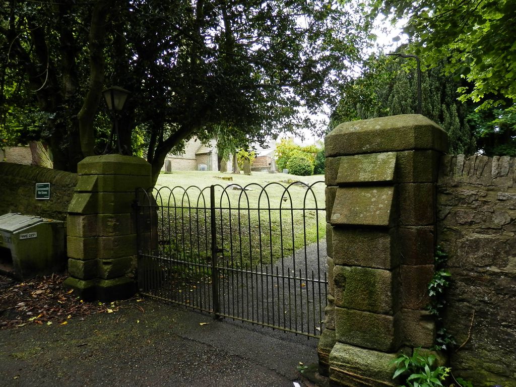
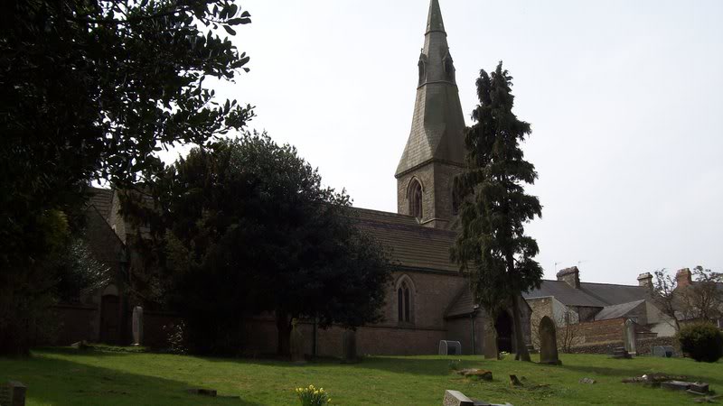
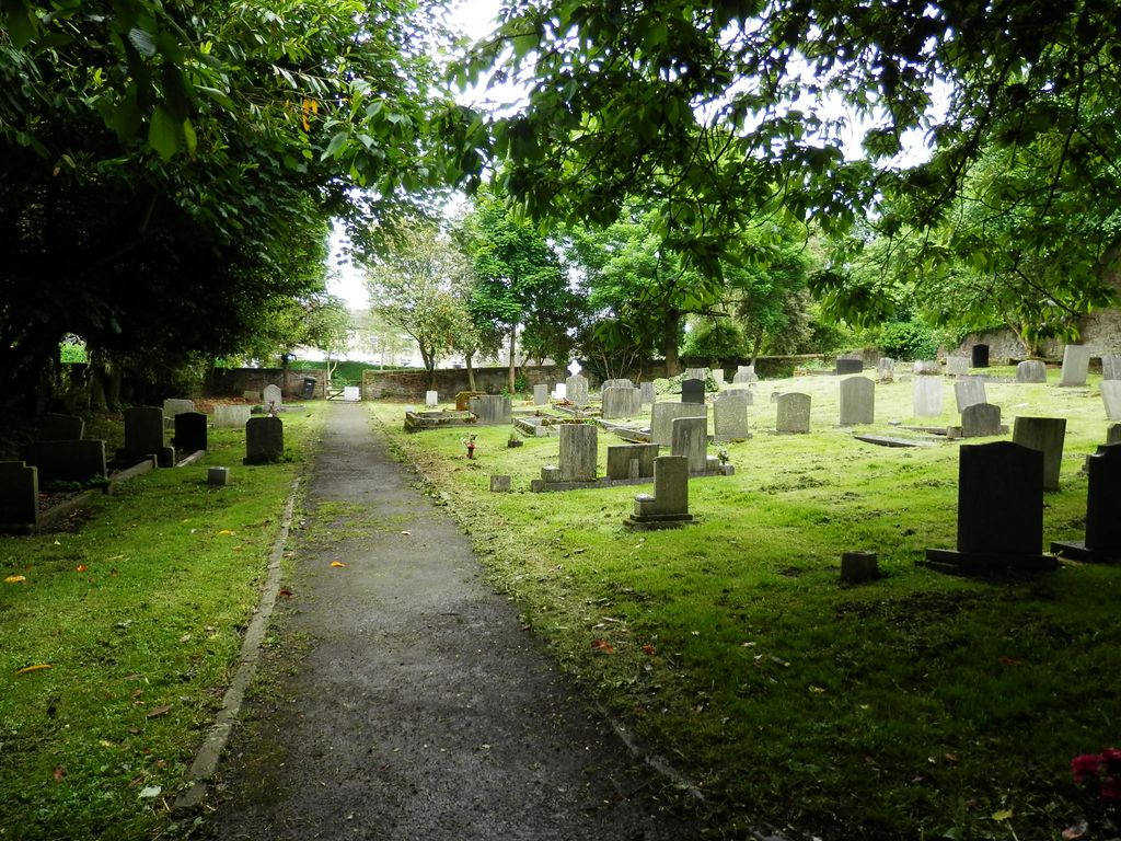
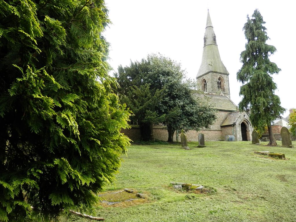
| Description | : | Frosterley is a village in County Durham, in England. It is situated in Weardale, on the River Wear close to its confluence with Bollihope Burn; halfway between Wolsingham and Stanhope. The church is located on an elevated position on a north facing slope on the southern side of the village. It is set within an attractive churchyard with mature trees and shrubs which are well maintained by the Local Authority, and lies adjacent to the former vicarage which stands to the east of the church within its own grounds again with mature planting and shrubbery. Access to the former vicarage and... Read More |
frequently asked questions (FAQ):
-
Where is Saint Michael's Churchyard?
Saint Michael's Churchyard is located at Parish Church of Saint Michael and All Angels, Church Lane Frosterley, Durham Unitary Authority ,County Durham , DL13 2RPEngland.
-
Saint Michael's Churchyard cemetery's updated grave count on graveviews.com?
0 memorials
-
Where are the coordinates of the Saint Michael's Churchyard?
Latitude: 54.7270600
Longitude: -1.9597500
Nearby Cemetories:
1. All Saints Churchyard
Eastgate, Durham Unitary Authority, England
Coordinate: 54.7445590, -2.0745270
2. St Matthew Churchyard
Consett, Durham Unitary Authority, England
Coordinate: 54.8040630, -1.9239040
3. Rookhope Cemetery
Eastgate, Durham Unitary Authority, England
Coordinate: 54.7744000, -2.0916800
4. Old Churchyard
Eastgate, Durham Unitary Authority, England
Coordinate: 54.7751710, -2.0933400
5. Hamsterley Baptist Church Cemetery
Hamsterley, Durham Unitary Authority, England
Coordinate: 54.6745490, -1.8176480
6. St Cuthbert's Churchyard
Satley, Durham Unitary Authority, England
Coordinate: 54.7840240, -1.8194680
7. Hamsterley Cemetery
Hamsterley, Durham Unitary Authority, England
Coordinate: 54.6733200, -1.8047700
8. St James Churchyard
Hamsterley, Durham Unitary Authority, England
Coordinate: 54.6729590, -1.8041290
9. Castleside Cemetery
Consett, Durham Unitary Authority, England
Coordinate: 54.8300800, -1.8834900
10. Lynesack Cemetery
Lynesack, Durham Unitary Authority, England
Coordinate: 54.6301930, -1.8601710
11. St. John the Evangelist Churchyard
Lynesack, Durham Unitary Authority, England
Coordinate: 54.6299000, -1.8607870
12. Rowley Burial Ground
Consett, Durham Unitary Authority, England
Coordinate: 54.8262177, -1.8656499
13. St. Edmunds Churchyard
Edmundbyers, Durham Unitary Authority, England
Coordinate: 54.8440300, -1.9790400
14. All Saints Churchyard
Muggleswick, Durham Unitary Authority, England
Coordinate: 54.8442600, -1.9326700
15. St. Thomas Churchyard
Crook, Durham Unitary Authority, England
Coordinate: 54.7364000, -1.7541000
16. Holy Trinity Churchyard
Eggleston, Durham Unitary Authority, England
Coordinate: 54.6082390, -2.0037610
17. Middleton On Teesdale Churchyard
Middleton-in-Teesdale, Durham Unitary Authority, England
Coordinate: 54.6257980, -2.0825420
18. Chapel of Ease
Eggleston, Durham Unitary Authority, England
Coordinate: 54.6058000, -2.0050000
19. Moorside Cemetery
Consett, Durham Unitary Authority, England
Coordinate: 54.8409330, -1.8709330
20. St Mary the Virgin
Howden-le-Wear, Durham Unitary Authority, England
Coordinate: 54.6947300, -1.7506400
21. St Catherine's Churchyard
Crook, Durham Unitary Authority, England
Coordinate: 54.7153620, -1.7438540
22. Howden-le-Wear Cemetery
Howden-le-Wear, Durham Unitary Authority, England
Coordinate: 54.6977300, -1.7484900
23. Our Lady Immaculate and St Cuthbert Roman Catholic Churchyard
Crook, Durham Unitary Authority, England
Coordinate: 54.7169050, -1.7410380
24. St James Churchyard
Hunstanworth, Durham Unitary Authority, England
Coordinate: 54.8358650, -2.0807750