
| Memorials | : | 0 |
| Location | : | Consett, Durham Unitary Authority, England |
| Website | : | www.rowleybaptist.co.uk/ |
| Coordinate | : | 54.8262177, -1.8656499 |
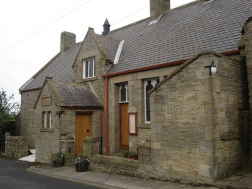
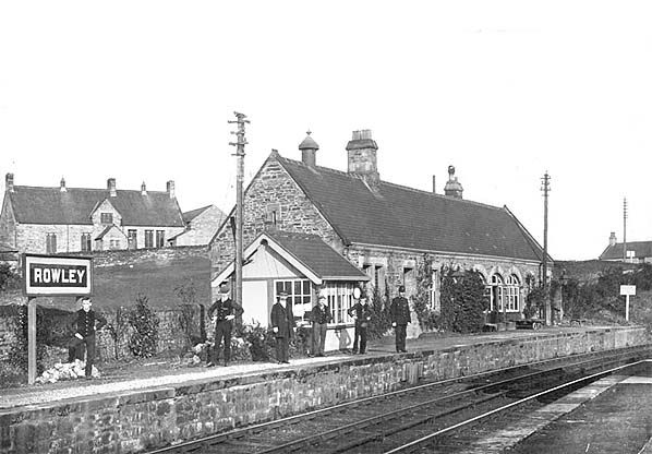
| Description | : | Small burial ground to the rear of the Rowley Baptist Chapel overlooking the site of the old Rowley Railway Station (now C2C cycle route) |
frequently asked questions (FAQ):
-
Where is Rowley Burial Ground?
Rowley Burial Ground is located at Rowley Bank Consett, Durham Unitary Authority ,County Durham ,England.
-
Rowley Burial Ground cemetery's updated grave count on graveviews.com?
0 memorials
-
Where are the coordinates of the Rowley Burial Ground?
Latitude: 54.8262177
Longitude: -1.8656499
Nearby Cemetories:
1. Castleside Cemetery
Consett, Durham Unitary Authority, England
Coordinate: 54.8300800, -1.8834900
2. Moorside Cemetery
Consett, Durham Unitary Authority, England
Coordinate: 54.8409330, -1.8709330
3. Blackhill Cemetery
Consett, Durham Unitary Authority, England
Coordinate: 54.8609100, -1.8451580
4. St Matthew Churchyard
Consett, Durham Unitary Authority, England
Coordinate: 54.8040630, -1.9239040
5. All Saints Churchyard
Muggleswick, Durham Unitary Authority, England
Coordinate: 54.8442600, -1.9326700
6. St Cuthbert's Churchyard
Satley, Durham Unitary Authority, England
Coordinate: 54.7840240, -1.8194680
7. St Ives Churchyard
Iveston, Durham Unitary Authority, England
Coordinate: 54.8609250, -1.7985710
8. St. Ives Churchyard
Leadgate, Durham Unitary Authority, England
Coordinate: 54.8610940, -1.7987850
9. Our Blessed Lady and St Joseph Churchyard
Leadgate, Durham Unitary Authority, England
Coordinate: 54.8642660, -1.7891290
10. St. Mary Magdalene Churchyard
Medomsley, Durham Unitary Authority, England
Coordinate: 54.8839400, -1.8161700
11. Lanchester Cemetery
Lanchester, Durham Unitary Authority, England
Coordinate: 54.8268000, -1.7524600
12. St. Edmunds Churchyard
Edmundbyers, Durham Unitary Authority, England
Coordinate: 54.8440300, -1.9790400
13. St Ebba’s Churchyard
Ebchester, Durham Unitary Authority, England
Coordinate: 54.8938660, -1.8401650
14. All Saints Churchyard
Lanchester, Durham Unitary Authority, England
Coordinate: 54.8208930, -1.7406720
15. Saint Andrew’s Churchyard
Kiln Pit Hill, Northumberland Unitary Authority, England
Coordinate: 54.8916000, -1.9307000
16. St John The Evangelist Churchyard
Dipton, Durham Unitary Authority, England
Coordinate: 54.8756390, -1.7657080
17. Harelaw Cemetery
Harelaw, Durham Unitary Authority, England
Coordinate: 54.8687900, -1.7554770
18. St. John the Evangelist Graveyard
Dipton, Durham Unitary Authority, England
Coordinate: 54.8731067, -1.7607181
19. Old Harelaw Cemetery
Harelaw, Durham Unitary Authority, England
Coordinate: 54.8691560, -1.7524030
20. Low Westwood Cemetery
Low Westwood, Durham Unitary Authority, England
Coordinate: 54.9008900, -1.8257700
21. Sacred Heart Roman Catholic Cemetery
Low Westwood, Durham Unitary Authority, England
Coordinate: 54.9009080, -1.8258350
22. St. Thomas Churchyard
Harelaw, Durham Unitary Authority, England
Coordinate: 54.8679000, -1.7495000
23. Low Westwood Christ Churchyard
Low Westwood, Durham Unitary Authority, England
Coordinate: 54.9030390, -1.8246450
24. Saint Patrick’s Roman Catholic Cemetery
Dipton, Durham Unitary Authority, England
Coordinate: 54.8768300, -1.7516900